

<< Our Photo Pages >> Meini Herion Stone - Standing Stone (Menhir) in Wales in Gwynedd
Submitted by TheCaptain on Tuesday, 10 December 2019 Page Views: 1027
Neolithic and Bronze AgeSite Name: Meini Herion StoneCountry: Wales County: Gwynedd Type: Standing Stone (Menhir)
Nearest Town: Porthmadog
Map Ref: SH54914276
Latitude: 52.962522N Longitude: 4.161615W
Condition:
| 5 | Perfect |
| 4 | Almost Perfect |
| 3 | Reasonable but with some damage |
| 2 | Ruined but still recognisable as an ancient site |
| 1 | Pretty much destroyed, possibly visible as crop marks |
| 0 | No data. |
| -1 | Completely destroyed |
| 5 | Superb |
| 4 | Good |
| 3 | Ordinary |
| 2 | Not Good |
| 1 | Awful |
| 0 | No data. |
| 5 | Can be driven to, probably with disabled access |
| 4 | Short walk on a footpath |
| 3 | Requiring a bit more of a walk |
| 2 | A long walk |
| 1 | In the middle of nowhere, a nightmare to find |
| 0 | No data. |
| 5 | co-ordinates taken by GPS or official recorded co-ordinates |
| 4 | co-ordinates scaled from a detailed map |
| 3 | co-ordinates scaled from a bad map |
| 2 | co-ordinates of the nearest village |
| 1 | co-ordinates of the nearest town |
| 0 | no data |
Be the first person to rate this site - see the 'Contribute!' box in the right hand menu.
Internal Links:
External Links:
")
You may be viewing yesterday's version of this page. To see the most up to date information please register for a free account.
")
")
")
Do not use the above information on other web sites or publications without permission of the contributor.
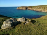
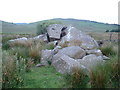
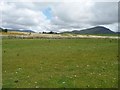
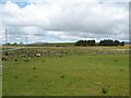
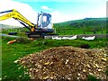
Nearby Images from Geograph Britain and Ireland:
©2006(licence)
©2015(licence)
©2015(licence)
©2015(licence)
©2024(licence)
The above images may not be of the site on this page, they are loaded from Geograph.
Please Submit an Image of this site or go out and take one for us!
Click here to see more info for this site
Nearby sites
Key: Red: member's photo, Blue: 3rd party photo, Yellow: other image, Green: no photo - please go there and take one, Grey: site destroyed
Download sites to:
KML (Google Earth)
GPX (GPS waypoints)
CSV (Garmin/Navman)
CSV (Excel)
To unlock full downloads you need to sign up as a Contributory Member. Otherwise downloads are limited to 50 sites.
Turn off the page maps and other distractions
Nearby sites listing. In the following links * = Image available
125m WSW 240° Cefn Coch (Gwynedd)* Stone Circle (SH548427)
398m SSE 168° Cae Glan Yr Afon Stone Feature* Modern Stone Circle etc (SH5498142368)
693m SE 142° Cerrig Cae-glan-yr-afon* Marker Stone (SH55324220)
1.2km ENE 64° Ynys-Wen Settlement* Ancient Village or Settlement (SH56054327)
1.4km S 179° Cwm Mawr Hut Group Ancient Village or Settlement (SH54904135)
1.4km SSE 162° Cwm Mawr Stone Circle (SH553414)
1.5km ENE 70° Beudy Caeau Gwynion Stones* Standing Stones (SH5630043208)
1.5km S 179° Hut Group West of Cwm Mawr Ancient Village or Settlement (SH549413)
1.5km S 186° Hut Circle near Graig Y Gesail* Ancient Village or Settlement (SH547413)
1.6km E 89° Cae'r Eithin Tew Hut Circle* Ancient Village or Settlement (SH5649042750)
1.6km N 357° Cairn North East of Traian* Cairn (SH5486344387)
1.6km N 358° Settlement North East of Traian* Ancient Village or Settlement (SH549444)
1.7km E 94° Llyn Du Hut Circle 1* Ancient Village or Settlement (SH5656842599)
1.7km S 182° Cairns east of Graig Y Gesail* Cairn (SH548411)
1.7km E 94° Llyn Du Hut Circle 2* Ancient Village or Settlement (SH5657342584)
1.8km ENE 63° Ynys Wen Hut Circle 3* Ancient Village or Settlement (SH5650543497)
1.8km ENE 67° Ynys Wen Hut Circle 2* Ancient Village or Settlement (SH5655243395)
1.8km N 8° Hut Circles South of Braich Y Gornel* Ancient Village or Settlement (SH552445)
1.8km ENE 67° Ynys Wen Hut Circle 1* Ancient Village or Settlement (SH5656243391)
1.8km NNE 13° Cwm Ystradllyn Standing Stones* Standing Stones (SH5538344508)
1.8km N 8° Cwm Ystradllyn Ring Cairn* Ring Cairn (SH5522944572)
1.9km N 352° Hut Circle near Cae Bach* Ancient Village or Settlement (SH547446)
1.9km E 87° Pant Engan Hut Circle* Ancient Village or Settlement (SH5677642807)
1.9km N 8° Cwm Ystradllyn Hut Circle Settlement* Ancient Village or Settlement (SH5524044595)
1.9km NNE 13° Single Hut Circle East of Braich Y Gornel* Ancient Village or Settlement (SH554446)
View more nearby sites and additional images


 We would like to know more about this location. Please feel free to add a brief description and any relevant information in your own language.
 Wir möchten mehr über diese Stätte erfahren. Bitte zögern Sie nicht, eine kurze Beschreibung und relevante Informationen in Deutsch hinzuzufügen.
 Nous aimerions en savoir encore un peu sur les lieux. S'il vous plaît n'hesitez pas à ajouter une courte description et tous les renseignements pertinents dans votre propre langue.
 Quisieramos informarnos un poco más de las lugares. No dude en añadir una breve descripción y otros datos relevantes en su propio idioma.