


<< Our Photo Pages >> Doe Tor - Cist in England in Devon
Submitted by davep on Tuesday, 12 April 2016 Page Views: 1972
Neolithic and Bronze AgeSite Name: Doe Tor Alternative Name: Doe Tor East Cist; Grinsell Lydford 12; Dixon 17Country: England County: Devon Type: Cist
Nearest Town: Lydford
Map Ref: SX54388485
Latitude: 50.645090N Longitude: 4.060973W
Condition:
| 5 | Perfect |
| 4 | Almost Perfect |
| 3 | Reasonable but with some damage |
| 2 | Ruined but still recognisable as an ancient site |
| 1 | Pretty much destroyed, possibly visible as crop marks |
| 0 | No data. |
| -1 | Completely destroyed |
| 5 | Superb |
| 4 | Good |
| 3 | Ordinary |
| 2 | Not Good |
| 1 | Awful |
| 0 | No data. |
| 5 | Can be driven to, probably with disabled access |
| 4 | Short walk on a footpath |
| 3 | Requiring a bit more of a walk |
| 2 | A long walk |
| 1 | In the middle of nowhere, a nightmare to find |
| 0 | No data. |
| 5 | co-ordinates taken by GPS or official recorded co-ordinates |
| 4 | co-ordinates scaled from a detailed map |
| 3 | co-ordinates scaled from a bad map |
| 2 | co-ordinates of the nearest village |
| 1 | co-ordinates of the nearest town |
| 0 | no data |
Internal Links:
External Links:
")
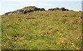
Can be found by walking from the Dartmoor Inn not far from Lydford. This cist is on the slopes of Doe Tor. It consists of 3 remaining slabs, one side stone 1.3 m long and two end stones. Butler Doe Tor E - Vol. 2. Map 32.21 (diagram Vol. 5. p.198). Grinsell LYDFORD 12.
Update September 2019: This cist is featured on the Prehistoric Dartmoor Walks website - see their entry for the Doe Tor Cist.
The cist is also recorded as Pastscape Monument No. 440667, which tells us: "The cist measures 0.76m square and the cairn is 5.8m by 5.4m and a maximum 0.6m high". The Devon and Dartmoor HER also includes more information; see: MDV3251 (Cairn with cist east of Doe Tor, Lydford).
The round cairn and cist is also scheduled as Historic England List ID 1011232, which adds: "This monument includes a round cairn situated on a gentle east-facing slope of Doe Tor overlooking the valley of the Walla Brook …. This cairn was partially excavated by the Dartmoor Exploration Committee in 1905. This work revealed that the cist had been robbed previously and the only find was a small fragment of charcoal. A possible capstone measuring 1m long by 0.7m wide lies immediately east of the cairn mound".
You may be viewing yesterday's version of this page. To see the most up to date information please register for a free account.
Do not use the above information on other web sites or publications without permission of the contributor.
Nearby Images from Geograph Britain and Ireland:
©2009(licence)
©2008(licence)
©2014(licence)
©2014(licence)
©2014(licence)
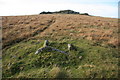
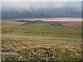
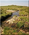
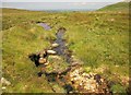
The above images may not be of the site on this page, they are loaded from Geograph.
Please Submit an Image of this site or go out and take one for us!
Click here to see more info for this site
Nearby sites
Key: Red: member's photo, Blue: 3rd party photo, Yellow: other image, Green: no photo - please go there and take one, Grey: site destroyed
Download sites to:
KML (Google Earth)
GPX (GPS waypoints)
CSV (Garmin/Navman)
CSV (Excel)
To unlock full downloads you need to sign up as a Contributory Member. Otherwise downloads are limited to 50 sites.
Turn off the page maps and other distractions
Nearby sites listing. In the following links * = Image available
937m SW 224° White Hill North East* Cairn (SX5371384190)
1.2km SW 222° White Hill North Cairn Field Ring Cairn (SX53528395)
1.5km SSE 168° Ger Tor Cairn (SX54658338)
1.7km NNE 16° Great Links Tor Cairn* Cairn (SX5491686496)
1.9km SW 229° White Hill South* Ring Cairn (SX5294283680)
2.0km S 187° Nattor Down 5 Cairn (SX54098286)
2.6km N 356° Little Links Tor* Stone Row / Alignment (SX5428587463)
2.6km NNW 347° Great Nodden* Cist (SX5387487416)
3.0km SW 227° Ring of Bells* Ring Cairn (SX5214082873)
3.5km S 173° Standon Hill Cairn Cairn (SX5473781373)
4.0km N 359° Sourton Tors Ring Cairns* Ring Cairn (SX5441888858)
4.3km N 9° Cornridge SE* Stone Circle (SX5517589119)
4.4km N 8° Corn Ridge Stone Ring Cairn Circle* Ring Cairn (SX5513889153)
4.4km N 11° Branscombe's Loaf* Ring Cairn (SX55318912)
4.4km N 9° Corn Ridge Rock* Ring Cairn (SX5521989145)
4.6km N 1° Sourton Tors Cairn* Cairn (SX5460389438)
4.7km N 2° Sourton Tors Stone Circle* Stone Circle (SX54688958)
4.8km SSE 152° Limsboro Cairn (SX5656780550)
5.1km NE 37° Fordsland Ledge Chambered cairn* Chambered Cairn (SX57588888)
5.4km NW 322° Bridestowe Holy Well Holy Well or Sacred Spring (SX512892)
5.5km WNW 298° Burley Wood Hillfort Hillfort (SX49548754)
5.5km NNW 348° Sourton Green Saxon Cross* Ancient Cross (SX534903)
5.7km NE 38° High Willhays kerb cairn* Round Cairn (SX58038922)
5.8km ESE 110° Cut Hill Cairn* Cairn (SX5982382745)
5.9km NE 37° High Willhays North Ring Cairn (SX58028944)
View more nearby sites and additional images


 We would like to know more about this location. Please feel free to add a brief description and any relevant information in your own language.
 Wir möchten mehr über diese Stätte erfahren. Bitte zögern Sie nicht, eine kurze Beschreibung und relevante Informationen in Deutsch hinzuzufügen.
 Nous aimerions en savoir encore un peu sur les lieux. S'il vous plaît n'hesitez pas à ajouter une courte description et tous les renseignements pertinents dans votre propre langue.
 Quisieramos informarnos un poco más de las lugares. No dude en añadir una breve descripción y otros datos relevantes en su propio idioma.