

<< Text Pages >> Murlaganmore Footprint (Killin) - Sculptured Stone in Scotland in Perth and Kinross
Submitted by Anne T on Wednesday, 06 December 2017 Page Views: 1277
Multi-periodSite Name: Murlaganmore Footprint (Killin) Alternative Name: Morris (CEN 16); Murlaganmore 3Country: Scotland County: Perth and Kinross Type: Sculptured Stone
Nearest Town: Killin Nearest Village: Mulaganmore Cottages
Map Ref: NN54323483
Latitude: 56.482971N Longitude: 4.367198W
Condition:
| 5 | Perfect |
| 4 | Almost Perfect |
| 3 | Reasonable but with some damage |
| 2 | Ruined but still recognisable as an ancient site |
| 1 | Pretty much destroyed, possibly visible as crop marks |
| 0 | No data. |
| -1 | Completely destroyed |
| 5 | Superb |
| 4 | Good |
| 3 | Ordinary |
| 2 | Not Good |
| 1 | Awful |
| 0 | No data. |
| 5 | Can be driven to, probably with disabled access |
| 4 | Short walk on a footpath |
| 3 | Requiring a bit more of a walk |
| 2 | A long walk |
| 1 | In the middle of nowhere, a nightmare to find |
| 0 | No data. |
| 5 | co-ordinates taken by GPS or official recorded co-ordinates |
| 4 | co-ordinates scaled from a detailed map |
| 3 | co-ordinates scaled from a bad map |
| 2 | co-ordinates of the nearest village |
| 1 | co-ordinates of the nearest town |
| 0 | no data |
Be the first person to rate this site - see the 'Contribute!' box in the right hand menu.
Internal Links:
External Links:
I have visited· I would like to visit
Uralsdaughter visited on 22nd Aug 2018 - their rating: Cond: 3 Amb: 3 Access: 3
The Northern Antiquarian (TNA) features a page for this site - see their entry for Murlaganmore Footprint, Killin, Perthshire, which gives directions for finding this site, together with a photograph and a brief description.
This boulder is recorded as Canmore ID 24226, which quotes from Cash's 1912 report: "An outcrop with a "foot-print" in it is visible 100 yds N of Morlaganmore farmhouse and 10 yds W of the farm road. It measures 13 1/2" x 6" and is 6" deep. A natural crack runs obliquely across it. There is insufficient evidence to say whether it is natural or artificial." In 1975, this was updated to read: "on top of a long ridge of natural outcrop rock. It would appear to be artificial rather than natural. No other marks were seen on the rock."
TNA adds a curious note: "The ‘footprint’ appears to have been described first of all by F.W.L. Thomas (1879) in his essay on the inaugural seat of Kings at Dunadd, where a similar footprint is found at the top of the fort. Thomas thought that this curious footprint could have had a similar function — though even folklore hereabouts seems silent on such a matter."
Note: Have you visited this site? Do you have any information, photographs or comments to add?
You may be viewing yesterday's version of this page. To see the most up to date information please register for a free account.
Do not use the above information on other web sites or publications without permission of the contributor.
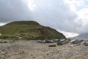
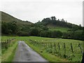
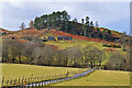
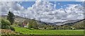
Nearby Images from Geograph Britain and Ireland:
©2020(licence)
©2008(licence)
©2013(licence)
©2020(licence)
©2012(licence)
The above images may not be of the site on this page, they are loaded from Geograph.
Please Submit an Image of this site or go out and take one for us!
Click here to see more info for this site
Nearby sites
Key: Red: member's photo, Blue: 3rd party photo, Yellow: other image, Green: no photo - please go there and take one, Grey: site destroyed
Download sites to:
KML (Google Earth)
GPX (GPS waypoints)
CSV (Garmin/Navman)
CSV (Excel)
To unlock full downloads you need to sign up as a Contributory Member. Otherwise downloads are limited to 50 sites.
Turn off the page maps and other distractions
Nearby sites listing. In the following links * = Image available
409m SW 225° Murlaganmore (Killin) Rock Art (NN54023455)
463m SW 231° Murlaganmore 2 (Killin) Rock Art (NN53953455)
1.5km NW 310° Duncroisk* Rock Art (NN53223582)
1.6km NW 308° Duncroisk 2 (Glen Lochay) Rock Art (NN53133584)
1.6km NW 307° Corrycharmaig East 4 (Glen Lochay) Rock Art (NN53103582)
1.6km NW 308° Corrycharmaig East 3 (Glen Lochay) Rock Art (NN5305635877)
1.7km WNW 291° Corrycharmaig 3 (Glen Lochay) Rock Art (NN52783549)
1.7km NW 305° Corrycharmaig East 2 (Glen Lochay) Rock Art (NN52943588)
1.9km NW 324° Duncroisk Crosses Ancient Cross (NN53253641)
2.0km NW 320° Duncroisk 1 (Glen Lochay) Rock Art (NN53113640)
2.1km NW 313° Tullich Rock Art Rock Art (NN52813634)
2.2km NW 325° Tirai* Standing Stone (Menhir) (NN53083670)
2.6km NE 51° Allt na Ceardaich Knoll Rock Art (NN564364)
2.8km NW 314° East Tullich Enclosure (Glen Lochay) Ancient Village or Settlement (NN52363685)
3.1km NE 40° Creag na Cailleach (Killin) Ancient Mine, Quarry or other Industry (NN56403715)
3.3km ESE 121° Fingal's Stone* Standing Stone (Menhir) (NN5712933021)
3.7km SE 126° Innis Bhuidhe* Stone Fort or Dun (NN57223255)
3.7km SSE 149° Acharn Standing Stone* Standing Stone (Menhir) (NN56143160)
3.8km N 352° Duncroisk (Glen Lochay) Hillfort (NN539386)
3.9km ESE 119° Kinnell* Stone Circle (NN5770032803)
4.0km NW 321° Caisteal Samhraidh (Killin) Standing Stone (Menhir) (NN519380)
4.5km E 89° Tir Artair Standing Stone (Killin) Standing Stone (Menhir) (NN5887034720)
4.6km NW 312° Allt Ghaordaidh Standing Stone (Menhir) (NN51013807)
4.7km E 88° Tir Artair 1 (Killin) Rock Art (NN5906334807)
5.0km S 169° Mid Lix (Killin) Rock Art (NN55132987)
View more nearby sites and additional images


 We would like to know more about this location. Please feel free to add a brief description and any relevant information in your own language.
 Wir möchten mehr über diese Stätte erfahren. Bitte zögern Sie nicht, eine kurze Beschreibung und relevante Informationen in Deutsch hinzuzufügen.
 Nous aimerions en savoir encore un peu sur les lieux. S'il vous plaît n'hesitez pas à ajouter une courte description et tous les renseignements pertinents dans votre propre langue.
 Quisieramos informarnos un poco más de las lugares. No dude en añadir una breve descripción y otros datos relevantes en su propio idioma.