


<< Text Pages >> Cocks Tor - Stone Row / Alignment in England in Devon
Submitted by thecaptain on Tuesday, 01 October 2002 Page Views: 5264
Neolithic and Bronze AgeSite Name: Cocks Tor Alternative Name: Cox TorCountry: England County: Devon Type: Stone Row / Alignment
Nearest Town: Tavistock Nearest Village: Peter Tavy
Map Ref: SX530760 Landranger Map Number: 191
Latitude: 50.565209N Longitude: 4.076972W
Condition:
| 5 | Perfect |
| 4 | Almost Perfect |
| 3 | Reasonable but with some damage |
| 2 | Ruined but still recognisable as an ancient site |
| 1 | Pretty much destroyed, possibly visible as crop marks |
| 0 | No data. |
| -1 | Completely destroyed |
| 5 | Superb |
| 4 | Good |
| 3 | Ordinary |
| 2 | Not Good |
| 1 | Awful |
| 0 | No data. |
| 5 | Can be driven to, probably with disabled access |
| 4 | Short walk on a footpath |
| 3 | Requiring a bit more of a walk |
| 2 | A long walk |
| 1 | In the middle of nowhere, a nightmare to find |
| 0 | No data. |
| 5 | co-ordinates taken by GPS or official recorded co-ordinates |
| 4 | co-ordinates scaled from a detailed map |
| 3 | co-ordinates scaled from a bad map |
| 2 | co-ordinates of the nearest village |
| 1 | co-ordinates of the nearest town |
| 0 | no data |
Internal Links:
External Links:
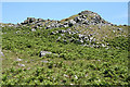
Unsure or destroyed stone row, mentioned in 1893 by Worth, although nothing at all corresponds to his descriptions these days.
You may be viewing yesterday's version of this page. To see the most up to date information please register for a free account.
Do not use the above information on other web sites or publications without permission of the contributor.
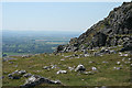
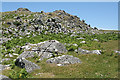
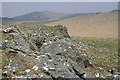
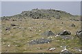
Nearby Images from Geograph Britain and Ireland:
©2011(licence)
©2011(licence)
©2006(licence)
©2006(licence)
©2011(licence)
The above images may not be of the site on this page, they are loaded from Geograph.
Please Submit an Image of this site or go out and take one for us!
Click here to see more info for this site
Nearby sites
Key: Red: member's photo, Blue: 3rd party photo, Yellow: other image, Green: no photo - please go there and take one, Grey: site destroyed
Download sites to:
KML (Google Earth)
GPX (GPS waypoints)
CSV (Garmin/Navman)
CSV (Excel)
To unlock full downloads you need to sign up as a Contributory Member. Otherwise downloads are limited to 50 sites.
Turn off the page maps and other distractions
Nearby sites listing. In the following links * = Image available
190m NNE 17° Cox Tor Summit Cairns* Cairn (SX53067618)
780m NE 49° Cox Tor north east* Ancient Village or Settlement (SX536765)
1.0km S 177° Whitchurch Common Ring Cairn (SX5301674995)
1.4km ENE 64° Roos Tor Rocks* Rock Outcrop (SX543766)
1.5km SSE 165° Barn Hill Cairn (SX53337458)
1.6km NE 38° Roos Tor north west* Ancient Village or Settlement (SX5403977254)
1.8km SSE 164° Windy Post Cross* Ancient Cross (SX53437428)
2.0km SE 141° Vixen Tor* Cist (SX5424074392)
2.2km NE 41° Wedlake Cairns* Barrow Cemetery (SX545776)
2.4km NW 313° Peter Tavy Churchyard Cross* Ancient Cross (SX51307770)
2.5km NE 47° Cairns North of Roos Tor* Cairn (SX5488477645)
2.5km NNE 22° White Tor Long Cairn* Cairn (SX5401478316)
2.6km NNE 12° Cudliptown Down Enclosed Settlement* Ancient Village or Settlement (SX536785)
2.6km ESE 115° Merrivale N circle* Stone Circle (SX5532674841)
2.6km ESE 117° Merrivale NW* Stone Circle (SX55307475)
2.6km ESE 118° Cairn south of Stone Row B (Merrivale)* Cairn (SX553747)
2.7km NE 42° Langstone Moor Cairn Circle* Ring Cairn (SX54847792)
2.7km ESE 116° Merrivale SW row 3* Stone Row / Alignment (SX5539474761)
2.7km ESE 116° Merrivale Centre S* Cairn (SX55407477)
2.7km ESE 119° Merrivale circle* Stone Circle (SX55357463)
2.7km ESE 115° Merrivale Centre N* Cairn (SX55437477)
2.7km ESE 115° Merrivale North Row* Multiple Stone Rows / Avenue (SX55457479)
2.7km NNE 27° South of White Tor Cairns* Barrow Cemetery (SX543784)
2.7km ESE 119° Merrivale 6* Stone Row / Alignment (SX5534474590)
2.7km ESE 119° Merrivale 5* Stone Row / Alignment (SX5534974592)
View more nearby sites and additional images


 We would like to know more about this location. Please feel free to add a brief description and any relevant information in your own language.
 Wir möchten mehr über diese Stätte erfahren. Bitte zögern Sie nicht, eine kurze Beschreibung und relevante Informationen in Deutsch hinzuzufügen.
 Nous aimerions en savoir encore un peu sur les lieux. S'il vous plaît n'hesitez pas à ajouter une courte description et tous les renseignements pertinents dans votre propre langue.
 Quisieramos informarnos un poco más de las lugares. No dude en añadir una breve descripción y otros datos relevantes en su propio idioma.