


<< Our Photo Pages >> The Peace Stone - Rock Art in Scotland in Stirling
Submitted by custer on Saturday, 16 February 2013 Page Views: 4990
Rock ArtSite Name: The Peace Stone Alternative Name: MallingCountry: Scotland
NOTE: This site is 8.3 km away from the location you searched for.
County: Stirling Type: Rock Art
Nearest Town: Aberfoyle
Map Ref: NS56419954
Latitude: 56.166822N Longitude: 4.314036W
Condition:
| 5 | Perfect |
| 4 | Almost Perfect |
| 3 | Reasonable but with some damage |
| 2 | Ruined but still recognisable as an ancient site |
| 1 | Pretty much destroyed, possibly visible as crop marks |
| 0 | No data. |
| -1 | Completely destroyed |
| 5 | Superb |
| 4 | Good |
| 3 | Ordinary |
| 2 | Not Good |
| 1 | Awful |
| 0 | No data. |
| 5 | Can be driven to, probably with disabled access |
| 4 | Short walk on a footpath |
| 3 | Requiring a bit more of a walk |
| 2 | A long walk |
| 1 | In the middle of nowhere, a nightmare to find |
| 0 | No data. |
| 5 | co-ordinates taken by GPS or official recorded co-ordinates |
| 4 | co-ordinates scaled from a detailed map |
| 3 | co-ordinates scaled from a bad map |
| 2 | co-ordinates of the nearest village |
| 1 | co-ordinates of the nearest town |
| 0 | no data |
Internal Links:
External Links:
I have visited· I would like to visit
custer visited on 16th Feb 2013 - their rating: Cond: 2 Amb: 4 Access: 2 Great location, shame the day I was here it was very foggy. The sites of the roman forts marked on the map were not visible, piles of rocks had also been cleared from these areas. Still a great trek.
")
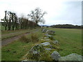
The peace stone covered in cup marks. Has obviously been moved from original location and placed at the edge of the field. Said to be protected by the Trossachs little folk with plenty of stories to be found. Canmore ID44622. Lovely setting just above the small Loch Macanrie and just over the hill you can look out over The Lake of Menteith.
For more information see Canmore ID 44622 which says this stone, "first recorded in 1899, appears to have moved slightly from its original position, probably during agricultural improvements in recent decades ... It now lies a few metres away at the field edge, in a strip of bracken-covered land between the old field wall and a modern fence. It lies next to a large boulder and several smaller stones probably cleared from the adjacent field. The 22 markings are still mostly visible though not in the detail recorded in 1899."
You may be viewing yesterday's version of this page. To see the most up to date information please register for a free account.
Do not use the above information on other web sites or publications without permission of the contributor.
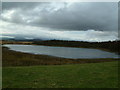
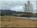
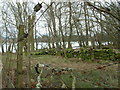
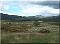
Nearby Images from Geograph Britain and Ireland:
©2007(licence)
©2007(licence)
©2007(licence)
©2007(licence)
©2007(licence)
The above images may not be of the site on this page, they are loaded from Geograph.
Please Submit an Image of this site or go out and take one for us!
Click here to see more info for this site
Nearby sites
Key: Red: member's photo, Blue: 3rd party photo, Yellow: other image, Green: no photo - please go there and take one, Grey: site destroyed
Download sites to:
KML (Google Earth)
GPX (GPS waypoints)
CSV (Garmin/Navman)
CSV (Excel)
To unlock full downloads you need to sign up as a Contributory Member. Otherwise downloads are limited to 50 sites.
Turn off the page maps and other distractions
Nearby sites listing. In the following links * = Image available
1.5km NNW 339° Ballochraggan 1 Rock Art (NN5590001005)
2.0km NNW 348° Ballochraggan 5 Rock Art (NN5604401549)
2.2km N 350° Ballochraggan 12 Rock Art (NN5610601711)
2.2km N 350° Mask Stone (Port of Menteith) Rock Art (NN5610701712)
2.3km N 351° Nether Glenny Rock Art* Rock Art (NN56140179)
2.4km N 359° Nether Glenny Cairn* Cairn (NN56460192)
2.4km NE 47° Lake of Menteith Crannogs* Crannog (NN5821901097)
2.4km N 353° Nether Glenny (28) Rock Art (NN56190197)
2.5km N 359° Nether Glenny (02) Cairn (NN56440202)
2.6km N 358° Nether Glenny (35) Rock Art (NN5642502099)
2.7km N 358° Nether Glenny (42) Rock Art (NN56430229)
3.3km N 6° Upper Glenny* Rock Art (NN56880277)
5.7km SSE 156° Buchlyvie Broch* Broch or Nuraghe (NS5856494259)
5.8km ENE 74° The Ruskie Stane* Modern Stone Circle etc (NN6203800912)
8.8km SSE 157° Carlin Stone (Balfron) Marker Stone (NS5955391277)
8.9km SSE 154° Wife with the Bratty Plaid (Balfron) Standing Stone (Menhir) (NS6002791383)
9.2km NNE 24° Samson Stone (Callendar) Ancient Village or Settlement (NN6039807821)
10.3km ENE 58° Wester Torrie Stone Circle (NN65340480)
10.5km NE 53° St Mary's Well (Callender)* Holy Well or Sacred Spring (NN65070556)
11.0km NE 55° Ballochallan* Modern Stone Circle etc (NN65580559)
11.4km NE 46° Auchenlaich Cairn* Chambered Cairn (NN64980715)
12.4km NNE 33° Druim Mor (Callander)* Standing Stone (Menhir) (NN6354209721)
12.6km SSE 157° Knockraich (Fintry)* Standing Stone (Menhir) (NS60898774)
12.6km E 94° Craighead Cairn* Cairn (NS69039822)
13.3km E 94° Coldoch Broch* Broch or Nuraghe (NS6963998128)
View more nearby sites and additional images


 We would like to know more about this location. Please feel free to add a brief description and any relevant information in your own language.
 Wir möchten mehr über diese Stätte erfahren. Bitte zögern Sie nicht, eine kurze Beschreibung und relevante Informationen in Deutsch hinzuzufügen.
 Nous aimerions en savoir encore un peu sur les lieux. S'il vous plaît n'hesitez pas à ajouter une courte description et tous les renseignements pertinents dans votre propre langue.
 Quisieramos informarnos un poco más de las lugares. No dude en añadir una breve descripción y otros datos relevantes en su propio idioma.