


<< Text Pages >> Greenland 1 - Rock Art in Scotland in West Dunbartonshire
Submitted by SolarMegalith on Saturday, 10 November 2012 Page Views: 4341
Rock ArtSite Name: Greenland 1Country: Scotland County: West Dunbartonshire Type: Rock Art
Map Ref: NS43447460
Latitude: 55.938877N Longitude: 4.508115W
Condition:
| 5 | Perfect |
| 4 | Almost Perfect |
| 3 | Reasonable but with some damage |
| 2 | Ruined but still recognisable as an ancient site |
| 1 | Pretty much destroyed, possibly visible as crop marks |
| 0 | No data. |
| -1 | Completely destroyed |
| 5 | Superb |
| 4 | Good |
| 3 | Ordinary |
| 2 | Not Good |
| 1 | Awful |
| 0 | No data. |
| 5 | Can be driven to, probably with disabled access |
| 4 | Short walk on a footpath |
| 3 | Requiring a bit more of a walk |
| 2 | A long walk |
| 1 | In the middle of nowhere, a nightmare to find |
| 0 | No data. |
| 5 | co-ordinates taken by GPS or official recorded co-ordinates |
| 4 | co-ordinates scaled from a detailed map |
| 3 | co-ordinates scaled from a bad map |
| 2 | co-ordinates of the nearest village |
| 1 | co-ordinates of the nearest town |
| 0 | no data |
Be the first person to rate this site - see the 'Contribute!' box in the right hand menu.
Internal Links:
External Links:
I have visited· I would like to visit
Spiral3 would like to visit
A gritstone outcrop with 48 sets of cup-marks and ring-marks. The largest motif has 80 cm in diameter.
Reference:
Morris, R.B.W. 1981. The Prehistoric Rock Art of Southern Scotland. Oxford: B.A.R. (p. 98-103).
You may be viewing yesterday's version of this page. To see the most up to date information please register for a free account.
Do not use the above information on other web sites or publications without permission of the contributor.
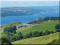
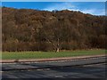
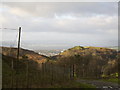
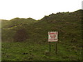
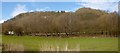
Nearby Images from Geograph Britain and Ireland:
©2017(licence)
©2005(licence)
©2007(licence)
©2007(licence)
©2013(licence)
The above images may not be of the site on this page, they are loaded from Geograph.
Please Submit an Image of this site or go out and take one for us!
Click here to see more info for this site
Nearby sites
Key: Red: member's photo, Blue: 3rd party photo, Yellow: other image, Green: no photo - please go there and take one, Grey: site destroyed
Download sites to:
KML (Google Earth)
GPX (GPS waypoints)
CSV (Garmin/Navman)
CSV (Excel)
To unlock full downloads you need to sign up as a Contributory Member. Otherwise downloads are limited to 50 sites.
Turn off the page maps and other distractions
Nearby sites listing. In the following links * = Image available
45m ENE 61° Greenland 2 Rock Art (NS43487462)
204m SSE 167° Ardconnel Hill Fort* Hillfort (NS4348074400)
1.4km E 97° Hill of Dun* Hillfort (NS44807439)
1.4km WNW 292° Dumbuie Dun* Hillfort (NS42187517)
2.0km WSW 248° Dumbuck Crannog* Crannog (NS41577392)
2.2km SSW 195° Longhaugh Point Menhir* Standing Stone (Menhir) (NS4279972498)
2.6km SE 128° Erskine Bridge Crannog Crannog (NS4548272901)
3.2km SE 136° Erskine Park* Ancient Village or Settlement (NS45607220)
3.3km WSW 242° Langbank Crannog (East)* Crannog (NS4049773171)
3.5km W 265° Dumbarton Hilllfort* Hillfort (NS399744)
4.0km SE 126° Kilpatrick Crannog Crannog (NS4658172121)
5.4km WSW 257° Langbank Crannog (West)* Crannog (NS3813073550)
6.3km SSW 205° Barochan Hillfort Hillfort (NS40566902)
6.3km ESE 105° Antonine Wall remains below Golden Hill* Stone Fort or Dun (NS49467274)
6.4km ESE 106° Golden Hill Roman Fort* Stone Fort or Dun (NS49517265)
6.6km NNE 20° Shiels of Gartlea* Chambered Cairn (NS459807)
6.7km E 96° Auchnacraig 5* Rock Art (NS501736)
6.9km E 96° Auchnacraig 1* Rock Art (NS50287365)
6.9km E 96° Auchnacraig 4* Rock Art (NS50297362)
6.9km E 94° Auchnacraig Stone Circle* Stone Circle (NS50347391)
7.0km E 94° The Cochno Stone* Rock Art (NS50457388)
7.0km E 93° Cochno Crags* Natural Stone / Erratic / Other Natural Feature (NS50487401)
7.3km NNE 17° Lang Cairn* Chambered Cairn (NS458815)
7.4km SSW 208° Sewn Dun Hillfort (NS39766816)
7.5km SW 230° Elphinstone Fort Hillfort (NS37506995)
View more nearby sites and additional images


 We would like to know more about this location. Please feel free to add a brief description and any relevant information in your own language.
 Wir möchten mehr über diese Stätte erfahren. Bitte zögern Sie nicht, eine kurze Beschreibung und relevante Informationen in Deutsch hinzuzufügen.
 Nous aimerions en savoir encore un peu sur les lieux. S'il vous plaît n'hesitez pas à ajouter une courte description et tous les renseignements pertinents dans votre propre langue.
 Quisieramos informarnos un poco más de las lugares. No dude en añadir una breve descripción y otros datos relevantes en su propio idioma.