


<< Our Photo Pages >> Bryn Dyfrydog - Standing Stone (Menhir) in Wales in Anglesey
Submitted by TimPrevett on Monday, 03 March 2003 Page Views: 7104
Neolithic and Bronze AgeSite Name: Bryn Dyfrydog Alternative Name: Llys EinionCountry: Wales County: Anglesey Type: Standing Stone (Menhir)
Map Ref: SH431859 Landranger Map Number: 114
Latitude: 53.346652N Longitude: 4.358444W
Condition:
| 5 | Perfect |
| 4 | Almost Perfect |
| 3 | Reasonable but with some damage |
| 2 | Ruined but still recognisable as an ancient site |
| 1 | Pretty much destroyed, possibly visible as crop marks |
| 0 | No data. |
| -1 | Completely destroyed |
| 5 | Superb |
| 4 | Good |
| 3 | Ordinary |
| 2 | Not Good |
| 1 | Awful |
| 0 | No data. |
| 5 | Can be driven to, probably with disabled access |
| 4 | Short walk on a footpath |
| 3 | Requiring a bit more of a walk |
| 2 | A long walk |
| 1 | In the middle of nowhere, a nightmare to find |
| 0 | No data. |
| 5 | co-ordinates taken by GPS or official recorded co-ordinates |
| 4 | co-ordinates scaled from a detailed map |
| 3 | co-ordinates scaled from a bad map |
| 2 | co-ordinates of the nearest village |
| 1 | co-ordinates of the nearest town |
| 0 | no data |
Internal Links:
External Links:
I have visited· I would like to visit
cactus_chris visited on 1st Oct 2020 - their rating: Cond: 4 Amb: 4 Access: 1 In the middle of a farmers field.
guile TimPrevett have visited here
")
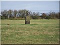
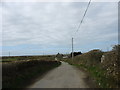
Access: Parked considerately at the end of a lane leading to a farm, not far off the B5111 Llanerchymedd to Amlwch road. Down lane, and short way down on the right hand side there is a gate; there were sheep there when I visited, so I climbed over gate instead of opening it.
The stone is in the middle of the field, just to the right. The stone: I estimated about 5'5" tall, very square; almost reminds me of a trig point stone. Covered in various lichens.
You may be viewing yesterday's version of this page. To see the most up to date information please register for a free account.
")
")
")
")
Do not use the above information on other web sites or publications without permission of the contributor.
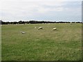
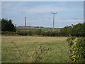
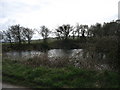
Nearby Images from Geograph Britain and Ireland:
©2006(licence)
©2006(licence)
©2008(licence)
©2009(licence)
©2009(licence)
The above images may not be of the site on this page, they are loaded from Geograph.
Please Submit an Image of this site or go out and take one for us!
Click here to see more info for this site
Nearby sites
Key: Red: member's photo, Blue: 3rd party photo, Yellow: other image, Green: no photo - please go there and take one, Grey: site destroyed
Download sites to:
KML (Google Earth)
GPX (GPS waypoints)
CSV (Garmin/Navman)
CSV (Excel)
To unlock full downloads you need to sign up as a Contributory Member. Otherwise downloads are limited to 50 sites.
Turn off the page maps and other distractions
Nearby sites listing. In the following links * = Image available
226m SE 133° Maen Chwyf* Natural Stone / Erratic / Other Natural Feature (SH43268574)
1.5km SSW 194° Bedd y Foel* Burial Chamber or Dolmen (SH42698444)
1.6km SSE 160° Llwydiarth Esgob Stone* Rock Art (SH436844)
2.2km SE 135° Carreg Leidr* Standing Stone (Menhir) (SH446843)
2.5km SE 132° Clorach Wells* Not Known (by us) (SH4487584177)
2.5km SE 132° Ffynnon Deiniol* Holy Well or Sacred Spring (SH44908416)
2.5km SE 133° Ffynnon Gybi* Holy Well or Sacred Spring (SH44908414)
3.5km SE 141° Llech Golman* Standing Stone (Menhir) (SH452831)
3.5km SE 127° Llanfihangel Tre'r Beirdd Cross* Ancient Cross (SH4588783693)
3.9km SE 128° Maen Addwyn* Standing Stone (Menhir) (SH461834)
3.9km SSW 210° Mynydd Mwyn Mawr standing stones* Standing Stones (SH41058256)
4.4km SW 227° Carmel Standing Stone* Standing Stone (Menhir) (SH39798304)
4.6km E 93° Ponc y Garreg Hir* Standing Stone (Menhir) (SH47668549)
4.8km NNE 15° Parys Mountain* Ancient Mine, Quarry or other Industry (SH445905)
5.0km NNW 328° Bodewryd* Standing Stone (Menhir) (SH406902)
5.1km NW 313° Maen y Goges* Natural Stone / Erratic / Other Natural Feature (SH39518948)
5.4km W 281° St Pabo's Church Memorial Stone* Early Christian Sculptured Stone (SH378871)
5.7km E 97° Tyddyn Isaf Burnt Mound Misc. Earthwork (SH4873185067)
5.8km E 89° Rhos Lligwy Burnt Mound Misc. Earthwork (SH4888185780)
5.8km ENE 66° Ogof Arian Cave or Rock Shelter (SH485881)
5.9km E 88° Coed Newydd Burnt Mounds Misc. Earthwork (SH4904885932)
5.9km E 96° Bwlch-Y-Dafarn Enclosed Settlement Ancient Village or Settlement (SH4900085103)
6.0km E 94° Bwlch-Y-Dafarn Settlement Enclosure Ancient Village or Settlement (SH4910585235)
6.1km ESE 109° Frigan Field System Misc. Earthwork (SH488837)
6.2km E 90° Bwlch-Y-Dafarn Ancient Village or Settlement (SH4929285663)
View more nearby sites and additional images


 We would like to know more about this location. Please feel free to add a brief description and any relevant information in your own language.
 Wir möchten mehr über diese Stätte erfahren. Bitte zögern Sie nicht, eine kurze Beschreibung und relevante Informationen in Deutsch hinzuzufügen.
 Nous aimerions en savoir encore un peu sur les lieux. S'il vous plaît n'hesitez pas à ajouter une courte description et tous les renseignements pertinents dans votre propre langue.
 Quisieramos informarnos un poco más de las lugares. No dude en añadir una breve descripción y otros datos relevantes en su propio idioma.