

<< Our Photo Pages >> Bryncennau standing stone - Standing Stone (Menhir) in Wales in Carmarthenshire
Submitted by Bladup on Tuesday, 15 December 2015 Page Views: 1560
Neolithic and Bronze AgeSite Name: Bryncennau standing stoneCountry: Wales County: Carmarthenshire Type: Standing Stone (Menhir)
Map Ref: SN42192662
Latitude: 51.915686N Longitude: 4.295922W
Condition:
| 5 | Perfect |
| 4 | Almost Perfect |
| 3 | Reasonable but with some damage |
| 2 | Ruined but still recognisable as an ancient site |
| 1 | Pretty much destroyed, possibly visible as crop marks |
| 0 | No data. |
| -1 | Completely destroyed |
| 5 | Superb |
| 4 | Good |
| 3 | Ordinary |
| 2 | Not Good |
| 1 | Awful |
| 0 | No data. |
| 5 | Can be driven to, probably with disabled access |
| 4 | Short walk on a footpath |
| 3 | Requiring a bit more of a walk |
| 2 | A long walk |
| 1 | In the middle of nowhere, a nightmare to find |
| 0 | No data. |
| 5 | co-ordinates taken by GPS or official recorded co-ordinates |
| 4 | co-ordinates scaled from a detailed map |
| 3 | co-ordinates scaled from a bad map |
| 2 | co-ordinates of the nearest village |
| 1 | co-ordinates of the nearest town |
| 0 | no data |
Internal Links:
External Links:
")
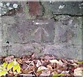
The Bryncennau standing stone is a leaning solitary monolith, 5'6" tall. The stone is set inside some sort of circular earthwork.
You may be viewing yesterday's version of this page. To see the most up to date information please register for a free account.
")
")
Do not use the above information on other web sites or publications without permission of the contributor.
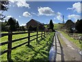
Nearby Images from Geograph Britain and Ireland:
©2006(licence)
©2020(licence)
©2020(licence)
©2019(licence)
©2020(licence)
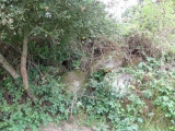
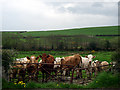
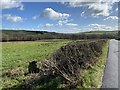
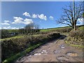
The above images may not be of the site on this page, they are loaded from Geograph.
Please Submit an Image of this site or go out and take one for us!
Click here to see more info for this site
Nearby sites
Key: Red: member's photo, Blue: 3rd party photo, Yellow: other image, Green: no photo - please go there and take one, Grey: site destroyed
Download sites to:
KML (Google Earth)
GPX (GPS waypoints)
CSV (Garmin/Navman)
CSV (Excel)
To unlock full downloads you need to sign up as a Contributory Member. Otherwise downloads are limited to 50 sites.
Turn off the page maps and other distractions
Nearby sites listing. In the following links * = Image available
1.9km NNW 333° Ffosymaen* Standing Stone (Menhir) (SN414283)
2.0km SSE 158° Cwmhawddgar Standing Stone* Standing Stone (Menhir) (SN4288124790)
2.6km SSE 162° Preswyfla Standing Stone* Standing Stone (Menhir) (SN42942412)
3.4km SSW 197° Maesgwyn Fort* Hillfort (SN411234)
3.5km SW 224° Crugiau Garn Fawr* Barrow Cemetery (SN39682419)
3.6km SW 224° Crug Tumuli* Round Barrow(s) (SN396241)
3.8km SW 220° Garn-Fawr Hillfort (SN397238)
3.8km E 96° Meini-Gwyn* Stone Row / Alignment (SN4598126102)
4.1km E 93° Bull Hall Crug Cairn (SN46272631)
4.2km E 92° Pant-y-llyn Cairn (SN46352635)
4.5km E 98° Croes Arthur Hillfort* Hillfort (SN46602585)
5.2km E 82° Crug-y-Rhyd-Hir* Cairn (SN47422714)
5.3km ESE 106° Parc-y-Gaer* Hillfort (SN47212500)
5.5km NNW 330° Crug Bach* Round Barrow(s) (SN39603147)
5.7km WSW 243° Cilcrug Hillfort (SN37002416)
5.8km NNW 337° Crug Gwyn* Cairn (SN40063204)
6.0km SSE 160° Carmarthen Museum* Museum (SN4408620973)
6.0km SSE 147° Merlin's Stone (Carmarthen)* Standing Stone (Menhir) (SN453215)
6.1km SE 145° Merlins Hill Hillfort* Hillfort (SN455215)
6.3km NNW 343° Crugiau Fach* Barrow Cemetery (SN40543270)
6.5km NNW 346° Crug Gilfach Fach Round Barrow(s) (SN40783299)
6.7km SE 142° Felin-Wen-Isaf* Round Barrow(s) (SN461212)
6.7km SE 144° Carreg Annell* Standing Stone (Menhir) (SN4595421098)
7.2km NNW 346° Gareg Hir* Standing Stone (Menhir) (SN40603367)
7.4km WSW 240° Pen-Y-Gaer (Abernant) Hillfort (SN35602316)
View more nearby sites and additional images


 We would like to know more about this location. Please feel free to add a brief description and any relevant information in your own language.
 Wir möchten mehr über diese Stätte erfahren. Bitte zögern Sie nicht, eine kurze Beschreibung und relevante Informationen in Deutsch hinzuzufügen.
 Nous aimerions en savoir encore un peu sur les lieux. S'il vous plaît n'hesitez pas à ajouter une courte description et tous les renseignements pertinents dans votre propre langue.
 Quisieramos informarnos un poco más de las lugares. No dude en añadir una breve descripción y otros datos relevantes en su propio idioma.