


<< Our Photo Pages >> Blairbuy 2 - Rock Art in Scotland in Dumfries and Galloway
Submitted by SolarMegalith on Sunday, 22 December 2002 Page Views: 4074
Rock ArtSite Name: Blairbuy 2 Alternative Name: Larroch Cup and RingsCountry: Scotland County: Dumfries and Galloway Type: Rock Art
Nearest Town: Wigtown Nearest Village: Monreith
Map Ref: NX37284117 Landranger Map Number: 83
Latitude: 54.739080N Longitude: 4.529096W
Condition:
| 5 | Perfect |
| 4 | Almost Perfect |
| 3 | Reasonable but with some damage |
| 2 | Ruined but still recognisable as an ancient site |
| 1 | Pretty much destroyed, possibly visible as crop marks |
| 0 | No data. |
| -1 | Completely destroyed |
| 5 | Superb |
| 4 | Good |
| 3 | Ordinary |
| 2 | Not Good |
| 1 | Awful |
| 0 | No data. |
| 5 | Can be driven to, probably with disabled access |
| 4 | Short walk on a footpath |
| 3 | Requiring a bit more of a walk |
| 2 | A long walk |
| 1 | In the middle of nowhere, a nightmare to find |
| 0 | No data. |
| 5 | co-ordinates taken by GPS or official recorded co-ordinates |
| 4 | co-ordinates scaled from a detailed map |
| 3 | co-ordinates scaled from a bad map |
| 2 | co-ordinates of the nearest village |
| 1 | co-ordinates of the nearest town |
| 0 | no data |
Internal Links:
External Links:
I have visited· I would like to visit
markj99 visited on 27th Aug 2011 - their rating: Cond: 3 Amb: 5 Access: 3 The cup and ring markings on the panel were faint but there were several large cup markings visible.
")
For more information see Blairbuy 2 on ScotlandsPlaces and Canmore ID 62768.
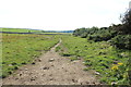
Blairbuy 2 is sited in a field on Blairbuy farm near to Monreith. The farm is mainly arable land with a dairy herd.
You may be viewing yesterday's version of this page. To see the most up to date information please register for a free account.
")
")
")
Do not use the above information on other web sites or publications without permission of the contributor.
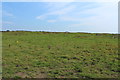
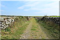
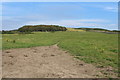
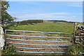
Nearby Images from Geograph Britain and Ireland:
©2015(licence)
©2015(licence)
©2015(licence)
©2015(licence)
©2015(licence)
The above images may not be of the site on this page, they are loaded from Geograph.
Please Submit an Image of this site or go out and take one for us!
Click here to see more info for this site
Nearby sites
Key: Red: member's photo, Blue: 3rd party photo, Yellow: other image, Green: no photo - please go there and take one, Grey: site destroyed
Download sites to:
KML (Google Earth)
GPX (GPS waypoints)
CSV (Garmin/Navman)
CSV (Excel)
To unlock full downloads you need to sign up as a Contributory Member. Otherwise downloads are limited to 50 sites.
Turn off the page maps and other distractions
Nearby sites listing. In the following links * = Image available
221m NW 304° Blairbuy 1* Rock Art (NX371413)
657m NNE 26° Blairbuy 5* Rock Art (NX37594175)
729m NNE 11° Fell of Barhullion* Hillfort (NX37454188)
957m NNW 328° Blairbuy 4 Rock Art (NX368420)
1.0km SW 227° Knock Rock Art (4)* Rock Art (NX365405)
1.2km N 7° Blairbuy 3* Rock Art (NX37464233)
1.2km WNW 289° Milton Hill* Standing Stones (NX36174159)
1.3km SSW 195° Knock 5* Carving (NX36903995)
1.3km SW 216° Knock Rock Art (1)* Rock Art (NX36454012)
1.4km NNW 334° Blairbuy 6* Rock Art (NX36714243)
1.4km SW 214° St Medana's Well* Holy Well or Sacred Spring (NX36454005)
1.4km SSW 209° Kirkmaiden Old Church* Ancient Cross (NX3655739968)
1.4km WNW 303° Wren's Egg* Standing Stones (NX36104199)
1.8km SSW 195° Boden Walls Well Holy Well or Sacred Spring (NX36773947)
2.0km NW 323° Black Loch of Myrton Settlement* Crannog (NX3610442835)
2.2km NNW 332° Lady Well (Monreith Mains) Holy Well or Sacred Spring (NX36314315)
2.5km NW 324° White Loch of Myrton* Crannog (NX35854328)
2.6km W 269° Barsalloch* Promontory Fort / Cliff Castle (NX3472041210)
3.2km NNW 343° Drumtroddan Stone Row* Stone Row / Alignment (NX36454430)
3.7km NNW 342° Drumtroddan Cup and Ring Markings* Rock Art (NX36264474)
4.1km NE 43° White Loch. Crannog (NX40174404)
4.6km SE 146° Laggan Camp* Hillfort (NX3976437252)
5.0km SE 137° Glasserton Mains* Rock Art (NX40613737)
5.8km E 100° Rispain Camp* Ancient Village or Settlement (NX4293039930)
6.5km NNE 28° Dowalton Crannogs* Crannog (NX40614681)
View more nearby sites and additional images


 We would like to know more about this location. Please feel free to add a brief description and any relevant information in your own language.
 Wir möchten mehr über diese Stätte erfahren. Bitte zögern Sie nicht, eine kurze Beschreibung und relevante Informationen in Deutsch hinzuzufügen.
 Nous aimerions en savoir encore un peu sur les lieux. S'il vous plaît n'hesitez pas à ajouter une courte description et tous les renseignements pertinents dans votre propre langue.
 Quisieramos informarnos un poco más de las lugares. No dude en añadir una breve descripción y otros datos relevantes en su propio idioma.