


<< Our Photo Pages >> Castlewitch Henge - Henge in England in Cornwall
Submitted by SolarMegalith on Thursday, 13 October 2011 Page Views: 8005
Neolithic and Bronze AgeSite Name: Castlewitch HengeCountry: England County: Cornwall Type: Henge
Nearest Village: Pengelly
Map Ref: SX37086854
Latitude: 50.493951N Longitude: 4.298315W
Condition:
| 5 | Perfect |
| 4 | Almost Perfect |
| 3 | Reasonable but with some damage |
| 2 | Ruined but still recognisable as an ancient site |
| 1 | Pretty much destroyed, possibly visible as crop marks |
| 0 | No data. |
| -1 | Completely destroyed |
| 5 | Superb |
| 4 | Good |
| 3 | Ordinary |
| 2 | Not Good |
| 1 | Awful |
| 0 | No data. |
| 5 | Can be driven to, probably with disabled access |
| 4 | Short walk on a footpath |
| 3 | Requiring a bit more of a walk |
| 2 | A long walk |
| 1 | In the middle of nowhere, a nightmare to find |
| 0 | No data. |
| 5 | co-ordinates taken by GPS or official recorded co-ordinates |
| 4 | co-ordinates scaled from a detailed map |
| 3 | co-ordinates scaled from a bad map |
| 2 | co-ordinates of the nearest village |
| 1 | co-ordinates of the nearest town |
| 0 | no data |
Internal Links:
External Links:
")
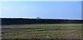
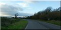
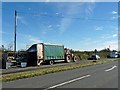
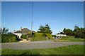
Remains of a possible class 1 henge of 96m diameter are preserved as strongly ploughed earthworks. No remains of a causeway are visible.
Read More at Pastscape.
You may be viewing yesterday's version of this page. To see the most up to date information please register for a free account.
")
")
")
")
Do not use the above information on other web sites or publications without permission of the contributor.
Nearby Images from Geograph Britain and Ireland:
©2018(licence)
©2022(licence)
©2012(licence)
©2006(licence)
©2006(licence)
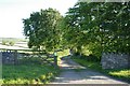
The above images may not be of the site on this page, they are loaded from Geograph.
Please Submit an Image of this site or go out and take one for us!
Click here to see more info for this site
Nearby sites
Key: Red: member's photo, Blue: 3rd party photo, Yellow: other image, Green: no photo - please go there and take one, Grey: site destroyed
Download sites to:
KML (Google Earth)
GPX (GPS waypoints)
CSV (Garmin/Navman)
CSV (Excel)
To unlock full downloads you need to sign up as a Contributory Member. Otherwise downloads are limited to 50 sites.
Turn off the page maps and other distractions
Nearby sites listing. In the following links * = Image available
824m NNE 21° Dupath Well* Holy Well or Sacred Spring (SX374693)
1.6km NW 310° Lady's Well (Callington)* Holy Well or Sacred Spring (SX359696)
2.4km W 270° Frogwell* Holy Well or Sacred Spring (SX347686)
2.8km N 6° Kit Hill Long Barrow (SX37487135)
3.1km WSW 248° Cadson Bury* Hillfort (SX342675)
3.7km SW 234° Collects Well* Holy Well or Sacred Spring (SX3399466483)
4.8km NW 315° Lower Manaton Holy Well or Sacred Spring (SX3377072033)
5.3km ESE 118° St Indract's Well* Holy Well or Sacred Spring (SX417659)
6.9km SW 235° Quethiock Cross* Ancient Cross (SX31296471)
7.0km NW 310° St Melor's Well* Holy Well or Sacred Spring (SX319732)
7.3km NW 314° Linkinhorne Round* Misc. Earthwork (SX31927376)
8.0km SSE 153° St Mary the Virgin (Cornwall)* Holy Well or Sacred Spring (SX4055461327)
8.1km SSE 157° Holy Well near Saltash Holy Well or Sacred Spring (SX400610)
8.5km WNW 288° St John's Well (Caradon)* Holy Well or Sacred Spring (SX291714)
8.7km WNW 282° Roundabury* Hillfort (SX28627056)
9.1km N 352° Rezare Holy Well* Holy Well or Sacred Spring (SX3607977615)
9.4km SW 215° Padderbury Top Ancient Village or Settlement (SX3139661023)
10.1km W 281° Caradon Hill cairns* Barrow Cemetery (SX272707)
10.4km W 277° Caradon Hill stone row Stone Row / Alignment (SX26797016)
10.8km S 187° Venton Gwavas* Holy Well or Sacred Spring (SX355579)
11.0km SSE 160° Trehan Cross* Ancient Cross (SX405581)
11.1km W 270° Trethevy Quoit* Burial Chamber or Dolmen (SX2593668813)
11.1km NNW 341° St Michael's Well (Lezant)* Holy Well or Sacred Spring
11.2km WNW 296° Notter Tor Ancient Village or Settlement (SX27157377)
11.2km NNW 348° St Brigid's Well Holy Well or Sacred Spring (SX350796)
View more nearby sites and additional images


 We would like to know more about this location. Please feel free to add a brief description and any relevant information in your own language.
 Wir möchten mehr über diese Stätte erfahren. Bitte zögern Sie nicht, eine kurze Beschreibung und relevante Informationen in Deutsch hinzuzufügen.
 Nous aimerions en savoir encore un peu sur les lieux. S'il vous plaît n'hesitez pas à ajouter une courte description et tous les renseignements pertinents dans votre propre langue.
 Quisieramos informarnos un poco más de las lugares. No dude en añadir una breve descripción y otros datos relevantes en su propio idioma.