


<< Our Photo Pages >> Spittal Croft cairn - Cairn in Scotland in Dumfries and Galloway
Submitted by vicky on Sunday, 22 December 2002 Page Views: 6793
Neolithic and Bronze AgeSite Name: Spittal Croft cairn Alternative Name: Boreland CairnCountry: Scotland County: Dumfries and Galloway Type: Cairn
Nearest Town: Wigtown Nearest Village: Causeway End
Map Ref: NX35645800 Landranger Map Number: 83
Latitude: 54.889637N Longitude: 4.564101W
Condition:
| 5 | Perfect |
| 4 | Almost Perfect |
| 3 | Reasonable but with some damage |
| 2 | Ruined but still recognisable as an ancient site |
| 1 | Pretty much destroyed, possibly visible as crop marks |
| 0 | No data. |
| -1 | Completely destroyed |
| 5 | Superb |
| 4 | Good |
| 3 | Ordinary |
| 2 | Not Good |
| 1 | Awful |
| 0 | No data. |
| 5 | Can be driven to, probably with disabled access |
| 4 | Short walk on a footpath |
| 3 | Requiring a bit more of a walk |
| 2 | A long walk |
| 1 | In the middle of nowhere, a nightmare to find |
| 0 | No data. |
| 5 | co-ordinates taken by GPS or official recorded co-ordinates |
| 4 | co-ordinates scaled from a detailed map |
| 3 | co-ordinates scaled from a bad map |
| 2 | co-ordinates of the nearest village |
| 1 | co-ordinates of the nearest town |
| 0 | no data |
Internal Links:
External Links:
I have visited· I would like to visit
Anne T visited on 17th Jun 2019 - their rating: Cond: 2 Amb: 3 Access: 4 Boreland Cairn: By this time of the afternoon (early evening) I was getting more than a little ‘cairned-out’ having seen, and still trying to make sense of, all those cairns at Torhousekie. But this was a lovely little cairn, complete with sheep warming themselves by the small piles of stones on top of the cairn.
With rain threatening and the dark clouds feeling as if they were virtually overhead, we walked some way up and down both sides of the road, both the B733 and the minor road running between the B733 and the B7052, but could find no gate into the field, so photographed the cairn as best I could from the dry stone wall.
We did go further up the road to find the standing stones and cairn at NX 3522 5808 and NX 3528 5819 (Canmore 62860 and 62849 respectively), but the field was jam-packed full of cattle.
markj99 visited on 15th Sep 2018 - their rating: Cond: 2 Amb: 3 Access: 4 It is easy to park at a road junction just beyond Spittal Croft Cairn. The low circle in the flat pasture is not spectacular but it was obviously more impressive before its near destruction. Sometimes it is better to to have a footprint of a cairn than an over-reconstructed monument.
Average ratings for this site from all visit loggers: Condition: 2 Ambience: 3 Access: 4
")
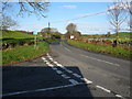
This stoney cairn can be seen at NX35645800 just NE of a property called Spittal Croft (the cairn maybe called something different locally). It is located at a road junction. It is one of a cluster of monuments in the area including another cairn (White Cairn) a fort and a stone pair.
For more information see Canmore ID 62870 which simply describes this cairns as "The grass-covered remains of a cairn measuring 25.0m in diameter and 0.7m high. There is no sign of a trench on the S side, the surrounding land having been ploughed right up to the edge of the cairn."
You may be viewing yesterday's version of this page. To see the most up to date information please register for a free account.
")
")
")
")
Do not use the above information on other web sites or publications without permission of the contributor.
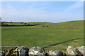
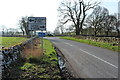
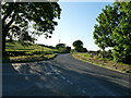
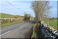
Nearby Images from Geograph Britain and Ireland:
©2014(licence)
©2014(licence)
©2012(licence)
©2014(licence)
©2010(licence)
The above images may not be of the site on this page, they are loaded from Geograph.
Please Submit an Image of this site or go out and take one for us!
Click here to see more info for this site
Nearby sites
Key: Red: member's photo, Blue: 3rd party photo, Yellow: other image, Green: no photo - please go there and take one, Grey: site destroyed
Download sites to:
KML (Google Earth)
GPX (GPS waypoints)
CSV (Garmin/Navman)
CSV (Excel)
To unlock full downloads you need to sign up as a Contributory Member. Otherwise downloads are limited to 50 sites.
Turn off the page maps and other distractions
Nearby sites listing. In the following links * = Image available
406m WNW 296° Whitecairn (Boreland)* Cairn (NX35285819)
426m W 279° Knocknocher stone pair* Standing Stones (NX35225808)
2.4km SSE 155° White Cairn (Crouse)* Cairn (NX36585577)
2.5km SSE 155° Crow Stone (Wigtown)* Standing Stone (Menhir) (NX3658555732)
2.6km ESE 117° Torhousekie Farm Cairn* Cairn (NX37895676)
2.9km ESE 116° Torhouse North Side Cairn* Cairn (NX3817456665)
2.9km ESE 117° Torhousekie N* Cairn (NX38195660)
2.9km ESE 115° Torhouse North Cairn* Cairn (NX3828156679)
3.0km ESE 119° Torhouseskie South West Standing Stones* Standing Stones (NX38205644)
3.0km ESE 118° Torhousekie stone circle* Stone Circle (NX3825556493)
3.0km ESE 118° Torhousekie Stones East* Standing Stones (NX3827156468)
3.1km ESE 116° Torhousekie East* Stone Row / Alignment (NX38385651)
3.4km ESE 122° Torhousekie Standing Stone* Standing Stone (Menhir) (NX3843456097)
4.3km NE 34° Cairn Hill (Barraer)* Cairn (NX38226149)
4.8km NNW 335° Barhoise* Cairn (NX33776245)
5.1km NNW 337° Shennanton SE* Cairn (NX33816280)
5.5km SSE 159° Culmalzie (Whauphill) Holy Well or Sacred Spring (NX37405281)
5.5km NNW 336° Shennanton NW* Cairn (NX33546310)
5.5km E 88° Cairnhouse W* Cairn (NX41205798)
5.9km N 4° Cairn Wood (Barskeoch)* Cairn (NX36266391)
6.1km E 87° Cairnhouse E* Cairn (NX41765813)
6.4km SSE 147° Barvernochan Standing Stone* Standing Stone (Menhir) (NX38975255)
6.8km NE 55° High Baltersan* Cairn (NX41346168)
6.8km ESE 114° Neilson's Hill* Rock Art (NX4176655018)
7.6km ESE 117° Bladnoch* Standing Stone (Menhir) (NX4229254238)
View more nearby sites and additional images


 We would like to know more about this location. Please feel free to add a brief description and any relevant information in your own language.
 Wir möchten mehr über diese Stätte erfahren. Bitte zögern Sie nicht, eine kurze Beschreibung und relevante Informationen in Deutsch hinzuzufügen.
 Nous aimerions en savoir encore un peu sur les lieux. S'il vous plaît n'hesitez pas à ajouter une courte description et tous les renseignements pertinents dans votre propre langue.
 Quisieramos informarnos un poco más de las lugares. No dude en añadir una breve descripción y otros datos relevantes en su propio idioma.