


<< Our Photo Pages >> Llanon Defended Enclosure - Ancient Village or Settlement in Wales in Ceredigion
Submitted by Hayden on Friday, 22 April 2022 Page Views: 351
Multi-periodSite Name: Llanon Defended Enclosure Alternative Name: Morfa UchafCountry: Wales
NOTE: This site is 21.3 km away from the location you searched for.
County: Ceredigion Type: Ancient Village or Settlement
Nearest Town: Aberaeron Nearest Village: Llannon
Map Ref: SN5051066250
Latitude: 52.274019N Longitude: 4.192443W
Condition:
| 5 | Perfect |
| 4 | Almost Perfect |
| 3 | Reasonable but with some damage |
| 2 | Ruined but still recognisable as an ancient site |
| 1 | Pretty much destroyed, possibly visible as crop marks |
| 0 | No data. |
| -1 | Completely destroyed |
| 5 | Superb |
| 4 | Good |
| 3 | Ordinary |
| 2 | Not Good |
| 1 | Awful |
| 0 | No data. |
| 5 | Can be driven to, probably with disabled access |
| 4 | Short walk on a footpath |
| 3 | Requiring a bit more of a walk |
| 2 | A long walk |
| 1 | In the middle of nowhere, a nightmare to find |
| 0 | No data. |
| 5 | co-ordinates taken by GPS or official recorded co-ordinates |
| 4 | co-ordinates scaled from a detailed map |
| 3 | co-ordinates scaled from a bad map |
| 2 | co-ordinates of the nearest village |
| 1 | co-ordinates of the nearest town |
| 0 | no data |
Internal Links:
External Links:
")
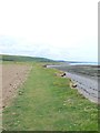
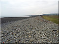
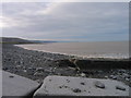
This site is now completely destroyed and only visible as crop-marks. It lays below agricultural land.
Royal Commission aerial reconnaissance on 4th July 2018 discovered cropmarks of a rectangular defended enclosure measuring approx. 60m x 70m sited on the coastal plain south of Llanon, west of Tanrallt farm. The enclosure is characteristic of later Iron Age and Romano-British defended settlements normally found in the south of Ceredigion. No diagnostic internal features are visible. The enclosure currently lies some 260m inland of the coast.
Credit T. Driver - https://coflein.gov.uk/en/site/423425
You may be viewing yesterday's version of this page. To see the most up to date information please register for a free account.
Do not use the above information on other web sites or publications without permission of the contributor.
Nearby Images from Geograph Britain and Ireland:
©2012(licence)
©2023(licence)
©2016(licence)
©2007(licence)
©2013(licence)
The above images may not be of the site on this page, they are loaded from Geograph.
Please Submit an Image of this site or go out and take one for us!
Click here to see more info for this site
Nearby sites
Key: Red: member's photo, Blue: 3rd party photo, Yellow: other image, Green: no photo - please go there and take one, Grey: site destroyed
Download sites to:
KML (Google Earth)
GPX (GPS waypoints)
CSV (Garmin/Navman)
CSV (Excel)
To unlock full downloads you need to sign up as a Contributory Member. Otherwise downloads are limited to 50 sites.
Turn off the page maps and other distractions
Nearby sites listing. In the following links * = Image available
4.0km ESE 109° Llech Gron* Standing Stone (Menhir) (SN5424664851)
4.0km SSW 193° Castell Dinerth* Promontory Fort / Cliff Castle (SN4949062370)
4.0km NE 51° Castell Mawr (Llanrhystud) Hillfort (SN5373068660)
4.1km SW 223° St David's Church Hillfort* Hillfort (SN4761063370)
4.3km NE 50° Castell Bach (Llanrhystud)* Hillfort (SN5388068870)
4.3km NE 48° Pentre-isaf Misc. Earthwork (SN5377069010)
4.5km NE 37° Pengarreg Defended Enclosure Hillfort (SN5333069710)
4.8km NE 48° Y Foel Promontory Fort * Promontory Fort / Cliff Castle (SN5418069310)
5.6km SW 227° Tyn-y-coed the Second Well* Holy Well or Sacred Spring (SN4626462558)
5.6km SW 227° Tyn-y-coed Well* Holy Well or Sacred Spring (SN4626062559)
5.7km NE 53° Gaer Penrhôs* Ancient Village or Settlement (SN5520569555)
5.9km SW 230° Aberaeron Chalybeate Well* Holy Well or Sacred Spring (SN458626)
6.5km SW 231° Pant-teg Enclosure* Hillfort (SN4533062300)
6.6km NE 53° Gaer (Gilfachafael)* Ancient Village or Settlement (SN55907005)
7.3km SSE 148° Trichrug cairns Round Cairn (SN542599)
7.7km SSE 161° Castell Perthi-mawr* Hillfort (SN528589)
8.8km NNE 32° Pen Glog* Cairn (SN554736)
9.8km S 172° Pen-Y-Gaer (Ceredigion) Hillfort (SN51545648)
10.1km ENE 63° The Dominicus Stone Early Christian Sculptured Stone (SN597705)
10.1km SSE 153° Castell Trefilan* Artificial Mound (SN5489557101)
10.7km SE 136° Pen-Y-Gaer (Nantcwnlle)* Hillfort (SN57735833)
11.4km SSW 197° Cwm Castell Hillfort (SN4694055440)
11.8km SW 222° Cross of Gurhirt (Llanarth)* Early Christian Sculptured Stone (SN42295775)
12.0km SSE 154° Pen-Clawdd-Mawr Hillfort (SN55455535)
12.7km ENE 78° Ty n-yr-eithin* Cairn (SN630685)
View more nearby sites and additional images


 We would like to know more about this location. Please feel free to add a brief description and any relevant information in your own language.
 Wir möchten mehr über diese Stätte erfahren. Bitte zögern Sie nicht, eine kurze Beschreibung und relevante Informationen in Deutsch hinzuzufügen.
 Nous aimerions en savoir encore un peu sur les lieux. S'il vous plaît n'hesitez pas à ajouter une courte description et tous les renseignements pertinents dans votre propre langue.
 Quisieramos informarnos un poco más de las lugares. No dude en añadir una breve descripción y otros datos relevantes en su propio idioma.