


<< Our Photo Pages >> St Denis Well, Holy Well, Sacred Spring - Holy Well or Sacred Spring in England in Cornwall
Submitted by dooclay on Wednesday, 29 December 2021 Page Views: 1136
Springs and Holy WellsSite Name: St Denis Well, Holy Well, Sacred SpringCountry: England
NOTE: This site is 0.5 km away from the location you searched for.
County: Cornwall Type: Holy Well or Sacred Spring
Nearest Town: Holsworthy Nearest Village: North Tamerton
Map Ref: SX3109797178
Latitude: 50.749568N Longitude: 4.395637W
Condition:
| 5 | Perfect |
| 4 | Almost Perfect |
| 3 | Reasonable but with some damage |
| 2 | Ruined but still recognisable as an ancient site |
| 1 | Pretty much destroyed, possibly visible as crop marks |
| 0 | No data. |
| -1 | Completely destroyed |
| 5 | Superb |
| 4 | Good |
| 3 | Ordinary |
| 2 | Not Good |
| 1 | Awful |
| 0 | No data. |
| 5 | Can be driven to, probably with disabled access |
| 4 | Short walk on a footpath |
| 3 | Requiring a bit more of a walk |
| 2 | A long walk |
| 1 | In the middle of nowhere, a nightmare to find |
| 0 | No data. |
| 5 | co-ordinates taken by GPS or official recorded co-ordinates |
| 4 | co-ordinates scaled from a detailed map |
| 3 | co-ordinates scaled from a bad map |
| 2 | co-ordinates of the nearest village |
| 1 | co-ordinates of the nearest town |
| 0 | no data |
Internal Links:
External Links:
You may be viewing yesterday's version of this page. To see the most up to date information please register for a free account.
")
Do not use the above information on other web sites or publications without permission of the contributor.
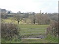
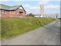
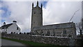
Nearby Images from Geograph Britain and Ireland:

©2013(licence)
©2013(licence)
©2013(licence)
©2009(licence)

©2007(licence)
The above images may not be of the site on this page, they are loaded from Geograph.
Please Submit an Image of this site or go out and take one for us!
Click here to see more info for this site
Nearby sites
Key: Red: member's photo, Blue: 3rd party photo, Yellow: other image, Green: no photo - please go there and take one, Grey: site destroyed
Download sites to:
KML (Google Earth)
GPX (GPS waypoints)
CSV (Garmin/Navman)
CSV (Excel)
To unlock full downloads you need to sign up as a Contributory Member. Otherwise downloads are limited to 50 sites.
Turn off the page maps and other distractions
Nearby sites listing. In the following links * = Image available
2.4km WSW 259° Mount Pleasant Barrows* Barrow Cemetery (SX28769679)
3.1km NNE 14° Affaland Moor Bowl Barrow* Round Barrow(s) (SS3196200184)
3.7km WSW 255° Kiddy Barrow* Barrow Cemetery (SX27499637)
4.0km W 263° Dilland Barrow* Round Barrow(s) (SX27109679)
4.1km WSW 252° Wilsworthy Cross Barrows* Barrow Cemetery (SX2716496017)
4.8km WSW 236° Chelsfield Barrows* Barrow Cemetery (SX27049467)
5.0km WNW 284° St Anne's Well (Whitstone)* Holy Well or Sacred Spring (SX263985)
5.8km SSE 158° Northcott Wood Camp* Ancient Village or Settlement (SX33059173)
6.2km W 277° Swannacott Round Ancient Village or Settlement (SX24989817)
6.2km WNW 292° Froxton Wood Castle* Hillfort (SX2543099705)
6.4km WNW 291° Hilton Wood Castle* Hillfort (SX25229969)
7.4km NNE 25° Holsworthy St Peter’s Well Holy Well or Sacred Spring (SS345038)
7.6km ENE 73° Sandymoor Cross Tumuli* Barrow Cemetery (SX3849499147)
7.9km SSW 200° St Paternus's Well* Holy Well or Sacred Spring (SX2813889895)
8.3km W 270° Ashbury hillfort* Hillfort (SX228975)
8.8km NE 47° Hollacombe Cross* Ancient Cross (SS3774603038)
9.6km NNW 328° Red Post Barrows* Barrow Cemetery (SS26330547)
10.3km N 4° Ugworthy Beacon Barrows* Round Barrow(s) (SS3217607440)
10.6km S 170° Werrington Park Round Ancient Village or Settlement (SX32668665)
10.8km NW 320° St Swithin's Well (Launcells)* Holy Well or Sacred Spring (SS244057)
10.9km NW 305° Marhamchurch Medieval cross* Ancient Cross (SS22300369)
11.1km SSE 165° Smallacoombe Wood Round Ancient Village or Settlement (SX33628636)
11.3km WNW 284° St Neot's Well (Poundstock)* Holy Well or Sacred Spring (SS2018800184)
11.4km SSW 198° Egloskerry* Holy Well or Sacred Spring (SX272865)
11.5km S 174° St Stephen's Well* Holy Well or Sacred Spring (SX320857)
View more nearby sites and additional images


 We would like to know more about this location. Please feel free to add a brief description and any relevant information in your own language.
 Wir möchten mehr über diese Stätte erfahren. Bitte zögern Sie nicht, eine kurze Beschreibung und relevante Informationen in Deutsch hinzuzufügen.
 Nous aimerions en savoir encore un peu sur les lieux. S'il vous plaît n'hesitez pas à ajouter une courte description et tous les renseignements pertinents dans votre propre langue.
 Quisieramos informarnos un poco más de las lugares. No dude en añadir una breve descripción y otros datos relevantes en su propio idioma.