Featured: Ark of Secrets - Neolithic spirit alive in the Middle Ages

Ark of Secrets - Neolithic spirit alive in the Middle Ages

Iron Age Britain, Barry Cunliffe

Iron Age Britain, Barry Cunliffe

Who's Online

There are currently, 178 guests and 4 members online.

You are a guest. To join in, please register for free by clicking here

Sponsors

<< Our Photo Pages >> St Swithin's Well (Launcells) - Holy Well or Sacred Spring in England in Cornwall

Submitted by Thorgrim on Wednesday, 13 October 2004  Page Views: 14588

Springs and Holy WellsSite Name: St Swithin's Well (Launcells)
Country: England
NOTE: This site is 3.5 km away from the location you searched for.

County: Cornwall Type: Holy Well or Sacred Spring
Nearest Town: Bude  Nearest Village: Launcells
Map Ref: SS244057  Landranger Map Number: 190
Latitude: 50.824142N  Longitude: 4.494549W
Condition:
5Perfect
4Almost Perfect
3Reasonable but with some damage
2Ruined but still recognisable as an ancient site
1Pretty much destroyed, possibly visible as crop marks
0No data.
-1Completely destroyed
5 Ambience:
5Superb
4Good
3Ordinary
2Not Good
1Awful
0No data.
5 Access:
5Can be driven to, probably with disabled access
4Short walk on a footpath
3Requiring a bit more of a walk
2A long walk
1In the middle of nowhere, a nightmare to find
0No data.
4 Accuracy:
5co-ordinates taken by GPS or official recorded co-ordinates
4co-ordinates scaled from a detailed map
3co-ordinates scaled from a bad map
2co-ordinates of the nearest village
1co-ordinates of the nearest town
0no data
3

Internal Links:
External Links:

I have visited· I would like to visit

BodMoor would like to visit

lucasn visited on 5th Apr 2017 - their rating: Cond: 4 Amb: 4 Access: 5

Theenchantednomads visited - their rating: Cond: 5 Amb: 5 Access: 5 An enchanted little place where we left the gift of sound and song.

AngieLake cazzyjane have visited here

Average ratings for this site from all visit loggers: Condition: 4.5 Ambience: 4.5 Access: 5

St Swithin's Well (Launcells)
St Swithin's Well (Launcells) submitted by AngieLake : St Swithin's Well, which reputedly never runs dry, tucked away close to the lane leading to Launcells Church. It's water, by tradition, was a salve for eye ailments (Vote or comment on this photo)
Holy Well / Spring in Cornwall

Have you visited this site? Please add a comment below.
You may be viewing yesterday's version of this page. To see the most up to date information please register for a free account.


St Swithin's Well (Launcells)
St Swithin's Well (Launcells) submitted by Theenchantednomads : Midsummer pilgrimage to St Swithins at Launcells (Vote or comment on this photo)

St Swithin's Well (Launcells)
St Swithin's Well (Launcells) submitted by AngieLake : Close-up of the metal bars across the well-opening. Presumably they would stop a small child falling in, but allow an adult to stretch over and scoop out some water in a cup or other container. I expect it was much fuller, and easier to reach, the next day, as that night - of the Harvest Festival in the church - we had a terrific storm! Boscastle sprung to mind! Maybe they were calling on the ... (Vote or comment on this photo)

St Swithin's Well (Launcells)
St Swithin's Well (Launcells) submitted by cazzyjane : St Swithin's Well. Being very easy to find in a wonderful setting next to a stream and with lovely clear water too! (3 comments - Vote or comment on this photo)

St Swithin's Well (Launcells)
St Swithin's Well (Launcells) submitted by cazzyjane : St Swithin's Well. Showing its position at the side of the lane leading to Launcells Church. (Vote or comment on this photo)

Do not use the above information on other web sites or publications without permission of the contributor.

Nearby Images from Geograph Britain and Ireland:
SS2405 : Launcells, St. Swithin's Church: The memorial to Sir John Chamond and his children 1 by Michael Garlick
by Michael Garlick
©2018(licence)
SS2405 : Launcells, St. Swithin's Church: The memorial to Sir John Chamond and his children 2 by Michael Garlick
by Michael Garlick
©2018(licence)
SS2405 : Launcells, St. Swithin's Church: The memorial to Sir John Chamond and his children 3 by Michael Garlick
by Michael Garlick
©2018(licence)
SS2405 : Launcells, St. Swithin's Church: The memorial to Sir John Chamond and his children 4 by Michael Garlick
by Michael Garlick
©2018(licence)
SS2405 : Launcells, St. Swithin's Church: c15th Barnstaple Encaustic Tiles in the chancel 6 by Michael Garlick
by Michael Garlick
©2018(licence)

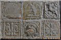
The above images may not be of the site on this page, they are loaded from Geograph.
Please Submit an Image of this site or go out and take one for us!


Click here to see more info for this site

Nearby sites

Click here to view sites on an interactive OS map

Key: Red: member's photo, Blue: 3rd party photo, Yellow: other image, Green: no photo - please go there and take one, Grey: site destroyed

Download sites to:
KML (Google Earth)
GPX (GPS waypoints)
CSV (Garmin/Navman)
CSV (Excel)

To unlock full downloads you need to sign up as a Contributory Member. Otherwise downloads are limited to 50 sites.


Turn off the page maps and other distractions

Nearby sites listing. In the following links * = Image available
 2.1km NW 307° Stamford Hill settlement* Ancient Village or Settlement (SS22750705)
 2.9km SW 224° Marhamchurch Medieval cross* Ancient Cross (SS22300369)
 3.0km NW 311° Earthquake Cist* Cist (SS22250773)
 3.2km WSW 251° Neet Valley stone, Bude Standing Stone (Menhir) (SS21320474)
 4.2km SW 232° Whalesborough Barrows* Round Barrow(s) (SS21020323)
 4.4km W 277° Compass Point Barrow* Round Barrow(s) (SS20040635)
 4.7km WNW 298° Northcott Mouth Tumuli* Barrow Cemetery (SS203081)
 4.8km WSW 246° Higher Longbeak Barrow* Round Barrow(s) (SS19950389)
 5.1km WSW 239° Widemouth Bay tumulus* Round Barrow(s) (SS19870323)
 6.1km S 170° Hilton Wood Castle* Hillfort (SX25229969)
 6.1km SSE 168° Froxton Wood Castle Hillfort (SX2543099705)
 6.9km SW 215° St Neot's Well (Poundstock)* Holy Well or Sacred Spring (SS2018800184)
 7.2km NNE 17° Taylors Cross Tumuli* Round Barrow(s) (SS2669012535)
 7.4km SSE 163° St Anne's Well (Whitstone)* Holy Well or Sacred Spring (SX263985)
 7.9km ENE 75° Ugworthy Beacon Barrows* Round Barrow(s) (SS3217607440)
 8.4km S 189° Ashbury hillfort* Hillfort (SX228975)
 8.5km N 4° Wrasford Moor Barrow Cemetary* Barrow Cemetery (SS2529114170)
 9.3km SE 124° Affaland Moor Bowl Barrow* Round Barrow(s) (SS3196200184)
 9.8km SSE 160° Kiddy Barrow* Barrow Cemetery (SX27499637)
 9.9km SSE 152° Mount Pleasant Barrows* Barrow Cemetery (SX28769679)
 10.1km SSE 162° Wilsworthy Cross Barrows* Barrow Cemetery (SX2716496017)
 10.2km E 99° Holsworthy St Peter’s Well Holy Well or Sacred Spring (SS345038)
 10.3km NNW 337° St John's Well (Morwenstow)* Holy Well or Sacred Spring (SS2064815298)
 10.3km NNW 336° Morwenstow Churchyard Cross* Ancient Cross (SS20551527)
 10.4km ENE 66° High Barrow* Round Barrow(s) (SS3410209563)
View more nearby sites and additional images

<< Trowlesworthy

Kildalton Cross >>

Please add your thoughts on this site

Cornwall in Prehistory

Cornwall in Prehistory

Sponsors

Auto-Translation (Google)

Translate from English into:

"St Swithin's Well (Launcells)" | Login/Create an Account | 2 News and Comments
  
Go back to top of page    Comments are owned by the poster. We aren't responsible for their content.
Re: St Swithin's Well by leethetree on Wednesday, 29 September 2010
(User Info | Send a Message)
these are great, I have been searching out Holy wells near to my home in North Cornwall, you have really found some great ones. Here is a link to my blog, that shows my journey.
I am really pleased this portal has so much information, it's really helping with my travels
This is a link

>

  • [ Reply to This ]

    Re: St Swithin's Well by AngieLake on Wednesday, 13 October 2004
    (User Info | Send a Message)
    This well is described in the leaflets available at the church:
    "The Holy Well of St Swithins reputedly never runs dry and its water, by tradition, was a salve for eye ailments. There is also a Holy Water stoup, built into the east wall in the Porch by the main door."
    We found it, tucked away near a bridge, nestling in a hedge beside a narrow lane leading into the car park at St Swithin's Church, Launcells. It is fenced off and there is a short path, about 2.5 metres, which takes you to the oblong well-opening (no door to this one). The well faces the south side of the church, and the main gate to the churchyard, across the carpark.

    Unlike other churches, this one is isolated from the village (which we never saw!), and accessed by a long, narrow lane leading from a series of country roads which we took from Stratton, a larger village to the west-north-west of Launcells. I navigated by instinct I guess, as I didn't have an ordnance survey map, taking what I assumed to be the eastern road out of Stratton. Eventually we saw a signpost in the hedge on the left side of the road, where we turned right down the long narrow lane to the church.

    The Church itself is really charming, and when we visited it was beautifully decorated for the evening's Harvest Festival service. (3rd October 2004). The Vicar had even left a 'Welcome Stranger' offering of salt, coal, milk and grain in four dishes on the floor of the Chancel, underneath the Bible stand. That was the first time I'd ever encountered this ancient custom, and together with the offerings of the Summer's harvest, and the nearby holy well, which had probably been revered by ancient pagans, it served to make the visit really special. (You could imagine the ancestors nodding their approval of all this bounty!)

    In the guide book we read:
    "Any stranger coming to look at Launcells Church cannot fail to notice the charming setting; in a little valley; no village near at hand and with fine trees all about it. There is the picturesque bridge, with stream gurgling beneath, at the entrance to the car park, and the Holy Well beside. Quiet and sequestered, it would be hard to find a more peaceful spot.
    There was probably a Norman Church here, for Launcells Manor is mentioned in the Domesday Book, the record of lands in England drawn up in 1086 at the order of William the Conqueror. During the reign of King John (1199-1216), Matilda, widow of William of Launcells, granted woodland known as 'Dub Wood', which today is still part of Launcells Barton (Manor), to Hugo, the Abbot of Hartland, for the sum of ten shillings. Also the Norman font helps to date the origins of the church.
    The date of the first recorded vicar, Hugo de Moltone, is 1261. At that time the Church was a cell of the Austin Canons, and dependent upon the Augustinian Abbey of Hartland. Originally dedicated to St Andrew, it was later re-dedicated to St Swithin in 1321.
    The Church was reconstructed in the 15th century. The pillars of the South Aisle are of polyphant stone and are earlier than those of the North Aisle in granite. Outside the Church is solid, compact and typical of so many in Cornwall. The Tower is of four stages and stands sixty-four feet to the battlements, the surmounting pinnacles adding a further twelve feet. (Here comes the description of the holy well, and the water stoup, as shown above, in first para.)
    Inside, the Church gives a wonderful impression of light from its fine perpendicular windows of clear glass. Many of the panes are very old, having escaped the Victorian obsession for substituting with stained glass. Crumbling granite window stanchions of the South Aisle have been replaced, but as many as possible of the original leaded panes were re-used."

    It seems, then, that the Holy Well was probably not always known as St Swithin's Well. Perhaps it, too, was once known as 'St. Andrew's' Well??

    There is much more of interest in the leaflet, such as the fac

    Read the rest of this post...
    [ Reply to This ]

    Your Name: Anonymous [ Register Now ]
    Subject:


    Add your comment or contribution to this page. Spam or offensive posts are deleted immediately, don't even bother

    <<< What is five plus one as a number? (Please type the answer to this question in the little box on the left)
    You can also embed videos and other things. For Youtube please copy and paste the 'embed code'.
    For Google Street View please include Street View in the text.
    Create a web link like this: <a href="https://www.megalithic.co.uk">This is a link</a>  

    Allowed HTML is:
    <p> <b> <i> <a> <img> <em> <br> <strong> <blockquote> <tt> <li> <ol> <ul> <object> <param> <embed> <iframe>

    We would like to know more about this location. Please feel free to add a brief description and any relevant information in your own language.
    Wir möchten mehr über diese Stätte erfahren. Bitte zögern Sie nicht, eine kurze Beschreibung und relevante Informationen in Deutsch hinzuzufügen.
    Nous aimerions en savoir encore un peu sur les lieux. S'il vous plaît n'hesitez pas à ajouter une courte description et tous les renseignements pertinents dans votre propre langue.
    Quisieramos informarnos un poco más de las lugares. No dude en añadir una breve descripción y otros datos relevantes en su propio idioma.