


<< Our Photo Pages >> Altnacealgach - Chambered Cairn in Scotland in Highlands
Submitted by markj99 on Saturday, 12 December 2020 Page Views: 1110
Neolithic and Bronze AgeSite Name: Altnacealgach Alternative Name: Altnacealgach HotelCountry: Scotland
NOTE: This site is 0.3 km away from the location you searched for.
County: Highlands Type: Chambered Cairn
Nearest Town: Ullapool Nearest Village: Ledmore
Map Ref: NC2652811033
Latitude: 58.054359N Longitude: 4.941391W
Condition:
| 5 | Perfect |
| 4 | Almost Perfect |
| 3 | Reasonable but with some damage |
| 2 | Ruined but still recognisable as an ancient site |
| 1 | Pretty much destroyed, possibly visible as crop marks |
| 0 | No data. |
| -1 | Completely destroyed |
| 5 | Superb |
| 4 | Good |
| 3 | Ordinary |
| 2 | Not Good |
| 1 | Awful |
| 0 | No data. |
| 5 | Can be driven to, probably with disabled access |
| 4 | Short walk on a footpath |
| 3 | Requiring a bit more of a walk |
| 2 | A long walk |
| 1 | In the middle of nowhere, a nightmare to find |
| 0 | No data. |
| 5 | co-ordinates taken by GPS or official recorded co-ordinates |
| 4 | co-ordinates scaled from a detailed map |
| 3 | co-ordinates scaled from a bad map |
| 2 | co-ordinates of the nearest village |
| 1 | co-ordinates of the nearest town |
| 0 | no data |
Internal Links:
External Links:
I have visited· I would like to visit
markj99 visited on 31st Jul 2015 - their rating: Cond: 3 Amb: 5 Access: 3 Altnacealgach Cairn is accessible from Altnacealgach Motel if you have walking boots or wellies as it situated on a rough moorland slope. The c. 0.5 mile return trip is more than compensated by a heather clad cairn with a 45 degree arc of exposed stones in the SE.
")
Altnacealgach Cairn is a well preserved cairn situated c. 400 yards north of the Altnacealgach Motel on the hillside. It measures c. 50 feet in diameter by 6 feet in height. The perimeter is covered in heather but the centre has exposed stones probably due to an excavation. A patina of moss on the stones indicates that this was an ancient excavation.
‘The cairn consists of a stone pile within which a central chamber made up of sub-angular stones (ave. 30-40cm long) is visible.’
The above quote is an extract from a Field Visit in 2009 contained in Canmore ID 4627.
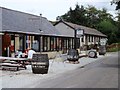
Directions: From Ullapool head north for c. 18 miles on the A835 until you reach the A837. Turn right for c. 1.75 miles and the Altnacealgach Motel is on the loch side. Parking is available adjacent to the hotel. Walk about 400 yards north uphill through rough moorland from the west side of the hotel to reach the cairn.
You may be viewing yesterday's version of this page. To see the most up to date information please register for a free account.
")
")
")
Do not use the above information on other web sites or publications without permission of the contributor.
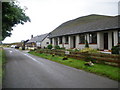
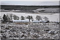
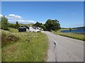
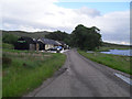
Nearby Images from Geograph Britain and Ireland:
©2009(licence)
©2012(licence)
©2018(licence)
©2010(licence)
©2012(licence)
The above images may not be of the site on this page, they are loaded from Geograph.
Please Submit an Image of this site or go out and take one for us!
Click here to see more info for this site
Nearby sites
Key: Red: member's photo, Blue: 3rd party photo, Yellow: other image, Green: no photo - please go there and take one, Grey: site destroyed
Download sites to:
KML (Google Earth)
GPX (GPS waypoints)
CSV (Garmin/Navman)
CSV (Excel)
To unlock full downloads you need to sign up as a Contributory Member. Otherwise downloads are limited to 50 sites.
Turn off the page maps and other distractions
Nearby sites listing. In the following links * = Image available
322m WNW 295° Loch Borralan East* Chambered Cairn (NC26241118)
500m W 280° Loch Borralan West* Chambered Cairn (NC2603811142)
858m WNW 291° Loch Borralan Crannog* Crannog (NC25741138)
2.9km WNW 290° Ledmore* Chambered Cairn (NC23821215)
3.5km NNW 330° Ledbeg River* Chambered Cairn (NC24891411)
3.7km WNW 302° Cam Loch A Cairn (NC23501312)
3.7km WNW 302° Cam Loch B Chambered Cairn (NC23431314)
4.3km SE 126° Cnoc Chaornaidh North West* Chambered Cairn (NC299084)
4.3km W 281° Glacbain* Cairn (NC2231112011)
4.6km SE 126° Cnoc Chaornaidh Central* Cairn (NC30170818)
4.9km SE 127° Cnoc Chaornaidh South-east* Chambered Cairn (NC30320793)
6.0km N 0° Allt nan Uamh Bone Caves* Cave or Rock Shelter (NC268170)
10.7km N 355° Carrachan Dubh Chambered Cairn (NC26102176)
12.9km NNW 347° Ardvreck* Chambered Cairn (NC24142371)
13.5km SW 225° An Dun, Strath Canaird Stone Fort or Dun (NC16530196)
14.6km E 87° Dail Langwell Broch or Nuraghe (NC41161121)
14.8km NNW 345° Allt Sgiathaig* Chambered Cairn (NC23412552)
17.4km NW 321° Loch Assynt Crannog (NC1603225018)
17.8km ESE 122° Torr Chorcain Vitrified Fort (NC412009)
18.0km ESE 121° Langwell Farm Cairn (NC416011)
18.4km SW 234° Dun Canna* Stone Fort or Dun (NC11160080)
20.3km W 280° Inverpolly Stone Fort or Dun (NC06611551)
20.8km SW 232° Isle Martin Cross Stone* Ancient Cross (NH096989)
23.0km SSW 202° Allt Raon A'Chroisg Broch or Nuraghe (NH16959008)
23.2km SSW 209° Dun Lagaidh* Stone Fort or Dun (NH14239135)
View more nearby sites and additional images


 We would like to know more about this location. Please feel free to add a brief description and any relevant information in your own language.
 Wir möchten mehr über diese Stätte erfahren. Bitte zögern Sie nicht, eine kurze Beschreibung und relevante Informationen in Deutsch hinzuzufügen.
 Nous aimerions en savoir encore un peu sur les lieux. S'il vous plaît n'hesitez pas à ajouter une courte description et tous les renseignements pertinents dans votre propre langue.
 Quisieramos informarnos un poco más de las lugares. No dude en añadir una breve descripción y otros datos relevantes en su propio idioma.