


<< Our Photo Pages >> Fox Tor stone setting - Standing Stones in England in Cornwall
Submitted by thecaptain on Sunday, 19 October 2008 Page Views: 8608
Neolithic and Bronze AgeSite Name: Fox Tor stone settingCountry: England County: Cornwall Type: Standing Stones
Nearest Town: Launceston Nearest Village: Fivelanes
Map Ref: SX23027863
Latitude: 50.580523N Longitude: 4.501143W
Condition:
| 5 | Perfect |
| 4 | Almost Perfect |
| 3 | Reasonable but with some damage |
| 2 | Ruined but still recognisable as an ancient site |
| 1 | Pretty much destroyed, possibly visible as crop marks |
| 0 | No data. |
| -1 | Completely destroyed |
| 5 | Superb |
| 4 | Good |
| 3 | Ordinary |
| 2 | Not Good |
| 1 | Awful |
| 0 | No data. |
| 5 | Can be driven to, probably with disabled access |
| 4 | Short walk on a footpath |
| 3 | Requiring a bit more of a walk |
| 2 | A long walk |
| 1 | In the middle of nowhere, a nightmare to find |
| 0 | No data. |
| 5 | co-ordinates taken by GPS or official recorded co-ordinates |
| 4 | co-ordinates scaled from a detailed map |
| 3 | co-ordinates scaled from a bad map |
| 2 | co-ordinates of the nearest village |
| 1 | co-ordinates of the nearest town |
| 0 | no data |
Internal Links:
External Links:
I have visited· I would like to visit
TheCaptain has visited here
")
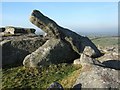
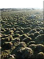
I am not sure what to make of this, a couple of large side set slabs about 1.5 metres tall, with perhaps many other smaller ones around them. It is possible that it all makes a rectangle around a boulder as I have seen in the Bodmin Moor survey book, but most of the stones are small and under the turf. Whatever, it is hard to make out the shape of the diagram in the book.
You may be viewing yesterday's version of this page. To see the most up to date information please register for a free account.
")
")
")
")
Do not use the above information on other web sites or publications without permission of the contributor.
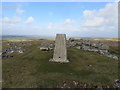
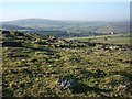
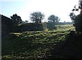
Nearby Images from Geograph Britain and Ireland:
©2015(licence)
©2007(licence)
©2007(licence)
©2007(licence)
©2007(licence)
The above images may not be of the site on this page, they are loaded from Geograph.
Please Submit an Image of this site or go out and take one for us!
Click here to see more info for this site
Nearby sites
Key: Red: member's photo, Blue: 3rd party photo, Yellow: other image, Green: no photo - please go there and take one, Grey: site destroyed
Download sites to:
KML (Google Earth)
GPX (GPS waypoints)
CSV (Garmin/Navman)
CSV (Excel)
To unlock full downloads you need to sign up as a Contributory Member. Otherwise downloads are limited to 50 sites.
Turn off the page maps and other distractions
Nearby sites listing. In the following links * = Image available
490m NNW 339° Tregune Menhir* Standing Stone (Menhir) (SX2286379095)
765m SE 128° Nine Stones (Altarnun)* Stone Circle (SX23617814)
813m SW 221° East Moor stone row* Stone Row / Alignment (SX22477803)
1.1km SW 219° East Moor Enclosure Ancient Village or Settlement (SX223778)
1.1km SW 216° East Moor Row blocking stone* Standing Stone (Menhir) (SX22327773)
1.1km SSW 213° East Moor ring cairn* Ring Cairn (SX22367769)
1.2km SSW 209° East Moor cairn* Round Cairn (SX22417762)
1.2km ESE 109° Clitters Cairn* Cairn (SX24157821)
1.2km SSW 207° East Moor stone C* Standing Stone (Menhir) (SX22447757)
1.2km SSW 211° East Moor stone B* Standing Stone (Menhir) (SX22357760)
1.2km SSE 164° Redmoor Marsh* Misc. Earthwork (SX23327742)
1.3km SSW 213° East Moor Stone D* Standing Stone (Menhir) (SX2230077606)
1.4km SSW 213° East Moor menhir* Standing Stone (Menhir) (SX22227747)
1.5km SSW 198° Greymare Rock* Natural Stone / Erratic / Other Natural Feature (SX225772)
1.5km ESE 119° The Ridge Cairn* Cairn (SX24337785)
1.6km ENE 76° Upton Castle* Artificial Mound (SX2454178961)
1.9km S 189° Colquite Menhir* Standing Stone (Menhir) (SX22657675)
1.9km WNW 295° Spettigue Menhir* Standing Stone (Menhir) (SX21307952)
2.0km ESE 120° Bowda Stone Circle* Stone Circle (SX24757757)
2.8km NNW 343° Altarnun Cross* Ancient Cross (SX223813)
3.0km NNW 347° St Nonna's Well* Holy Well or Sacred Spring (SX2243981533)
3.1km WSW 241° Carneglos Barrow* Ring Cairn (SX20287725)
3.1km SSE 159° King Arthur's Bed* Natural Stone / Erratic / Other Natural Feature (SX24057568)
3.1km NNW 345° Altarnun Cross B* Ancient Cross (SX22318170)
3.2km ESE 121° Allabury Hillfort (SX257769)
View more nearby sites and additional images


 We would like to know more about this location. Please feel free to add a brief description and any relevant information in your own language.
 Wir möchten mehr über diese Stätte erfahren. Bitte zögern Sie nicht, eine kurze Beschreibung und relevante Informationen in Deutsch hinzuzufügen.
 Nous aimerions en savoir encore un peu sur les lieux. S'il vous plaît n'hesitez pas à ajouter une courte description et tous les renseignements pertinents dans votre propre langue.
 Quisieramos informarnos un poco más de las lugares. No dude en añadir una breve descripción y otros datos relevantes en su propio idioma.