 with our Megalithic Portal iPhone app")

<< Our Photo Pages >> Earthquake Cist - Cist in England in Cornwall
Submitted by dooclay on Monday, 07 August 2023 Page Views: 147
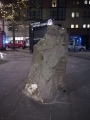
Neolithic and Bronze AgeSite Name: Earthquake CistCountry: England County: Cornwall Type: Cist
Nearest Town: Bude Nearest Village: Poughill
Map Ref: SS22250773
Latitude: 50.841723N Longitude: 4.526029W
Condition:
| 5 | Perfect |
| 4 | Almost Perfect |
| 3 | Reasonable but with some damage |
| 2 | Ruined but still recognisable as an ancient site |
| 1 | Pretty much destroyed, possibly visible as crop marks |
| 0 | No data. |
| -1 | Completely destroyed |
| 5 | Superb |
| 4 | Good |
| 3 | Ordinary |
| 2 | Not Good |
| 1 | Awful |
| 0 | No data. |
| 5 | Can be driven to, probably with disabled access |
| 4 | Short walk on a footpath |
| 3 | Requiring a bit more of a walk |
| 2 | A long walk |
| 1 | In the middle of nowhere, a nightmare to find |
| 0 | No data. |
| 5 | co-ordinates taken by GPS or official recorded co-ordinates |
| 4 | co-ordinates scaled from a detailed map |
| 3 | co-ordinates scaled from a bad map |
| 2 | co-ordinates of the nearest village |
| 1 | co-ordinates of the nearest town |
| 0 | no data |
Internal Links:
External Links:
")
https://cornishbirdblog.com/the-earthquake-at-poughill
Gives the history of this Cist
0 for Condition as it has been moved and 'reconstructed'
You may be viewing yesterday's version of this page. To see the most up to date information please register for a free account.
Do not use the above information on other web sites or publications without permission of the contributor.
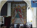
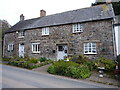
Nearby Images from Geograph Britain and Ireland:
©2016(licence)
©2016(licence)
©2016(licence)
©2016(licence)
©2017(licence)
The above images may not be of the site on this page, they are loaded from Geograph.
Please Submit an Image of this site or go out and take one for us!
Click here to see more info for this site
Nearby sites
Key: Red: member's photo, Blue: 3rd party photo, Yellow: other image, Green: no photo - please go there and take one, Grey: site destroyed
Download sites to:
KML (Google Earth)
GPX (GPS waypoints)
CSV (Garmin/Navman)
CSV (Excel)
To unlock full downloads you need to sign up as a Contributory Member. Otherwise downloads are limited to 50 sites.
Turn off the page maps and other distractions
Nearby sites listing. In the following links * = Image available
843m SE 142° Stamford Hill settlement* Ancient Village or Settlement (SS22750705)
2.0km W 279° Northcott Mouth Tumuli* Barrow Cemetery (SS203081)
2.6km SW 236° Compass Point Barrow* Round Barrow(s) (SS20040635)
3.0km SE 131° St Swithin's Well (Launcells)* Holy Well or Sacred Spring (SS244057)
3.1km SSW 195° Neet Valley stone, Bude Standing Stone (Menhir) (SS21320474)
4.0km S 177° Marhamchurch Medieval cross* Ancient Cross (SS22300369)
4.5km SSW 209° Higher Longbeak Barrow* Round Barrow(s) (SS19950389)
4.7km SSW 193° Whalesborough Barrows* Round Barrow(s) (SS21020323)
5.1km SSW 206° Widemouth Bay tumulus* Round Barrow(s) (SS19870323)
6.5km NE 41° Taylors Cross Tumuli* Round Barrow(s) (SS2669012535)
7.1km NNE 23° Wrasford Moor Barrow Cemetary* Barrow Cemetery (SS2529114170)
7.7km NNW 345° Morwenstow Churchyard Cross* Ancient Cross (SS20551527)
7.7km NNW 346° St John's Well (Morwenstow)* Holy Well or Sacred Spring (SS2064815298)
7.8km SSW 193° St Neot's Well (Poundstock)* Holy Well or Sacred Spring (SS2018800184)
8.1km NNW 341° St Morwenna's Well* Holy Well or Sacred Spring (SS1980215483)
8.6km SSE 158° Hilton Wood Castle* Hillfort (SX25229969)
8.6km SSE 156° Froxton Wood Castle Hillfort (SX2543099705)
9.7km NNE 22° Woolley Long Barrow* Long Barrow (SS2627516605)
9.9km E 90° Ugworthy Beacon Barrows* Round Barrow(s) (SS3217607440)
10.1km SSE 154° St Anne's Well (Whitstone)* Holy Well or Sacred Spring (SX263985)
10.2km S 175° Ashbury hillfort* Hillfort (SX228975)
10.6km N 1° St Nectan's Well (Welcombe)* Holy Well or Sacred Spring (SS228183)
11.9km ENE 57° St Peter's Well (Bradworthy)* Holy Well or Sacred Spring (SS325139)
11.9km SSW 193° St James's Well (Jacobstow)* Holy Well or Sacred Spring (SX19149619)
12.0km E 79° High Barrow* Round Barrow(s) (SS3410209563)
View more nearby sites and additional images


 We would like to know more about this location. Please feel free to add a brief description and any relevant information in your own language.
 Wir möchten mehr über diese Stätte erfahren. Bitte zögern Sie nicht, eine kurze Beschreibung und relevante Informationen in Deutsch hinzuzufügen.
 Nous aimerions en savoir encore un peu sur les lieux. S'il vous plaît n'hesitez pas à ajouter une courte description et tous les renseignements pertinents dans votre propre langue.
 Quisieramos informarnos un poco más de las lugares. No dude en añadir una breve descripción y otros datos relevantes en su propio idioma.