


<< Text Pages >> Neet Valley stone, Bude - Standing Stone (Menhir) in England in Cornwall
Submitted by richbaber on Saturday, 04 April 2015 Page Views: 3142
Neolithic and Bronze AgeSite Name: Neet Valley stone, BudeCountry: England
NOTE: This site is 0.813 km away from the location you searched for.
County: Cornwall Type: Standing Stone (Menhir)
Nearest Town: Bude Nearest Village: Helebridge
Map Ref: SS21320474
Latitude: 50.814575N Longitude: 4.537766W
Condition:
| 5 | Perfect |
| 4 | Almost Perfect |
| 3 | Reasonable but with some damage |
| 2 | Ruined but still recognisable as an ancient site |
| 1 | Pretty much destroyed, possibly visible as crop marks |
| 0 | No data. |
| -1 | Completely destroyed |
| 5 | Superb |
| 4 | Good |
| 3 | Ordinary |
| 2 | Not Good |
| 1 | Awful |
| 0 | No data. |
| 5 | Can be driven to, probably with disabled access |
| 4 | Short walk on a footpath |
| 3 | Requiring a bit more of a walk |
| 2 | A long walk |
| 1 | In the middle of nowhere, a nightmare to find |
| 0 | No data. |
| 5 | co-ordinates taken by GPS or official recorded co-ordinates |
| 4 | co-ordinates scaled from a detailed map |
| 3 | co-ordinates scaled from a bad map |
| 2 | co-ordinates of the nearest village |
| 1 | co-ordinates of the nearest town |
| 0 | no data |
Internal Links:
External Links:
I have visited· I would like to visit
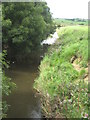
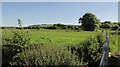
BodMoor visited on 1st Nov 2015 - their rating: Amb: 3 Access: 3 In the middle of a field on private property. Can be seen from the cycle path but best viewed with binoculars. It's ambiance isn't immediately apparent but if you imagine it in its ancient landscape without any modern influences, then its location and aspect become more like other well known minor sites. The area itself is quite beautiful and there are plenty of well maintained walking and cycling routes along the nearby river and canal. Wheelchair users should have any problems with the river and canal routes.
Seen in field alongside the Neet Valley part of The Cornish Way walk. Approach from A39 at Helebridge and follow small road from crossing island on A39 to Neet Valley. After about 1 kilometre, stone can be seen in a field to the left as you walk towards Bude. Unable to access field from this location for a closer look as it is fenced with barbed wire thereon!
Can also be approached on a circular walking route from Bude via the tourist information centre.
You may be viewing yesterday's version of this page. To see the most up to date information please register for a free account.
Do not use the above information on other web sites or publications without permission of the contributor.
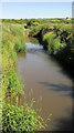
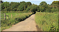
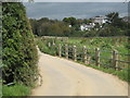
Nearby Images from Geograph Britain and Ireland:
©2020(licence)
©2020(licence)
©2009(licence)
©2009(licence)
©2020(licence)
The above images may not be of the site on this page, they are loaded from Geograph.
Please Submit an Image of this site or go out and take one for us!
Click here to see more info for this site
Nearby sites
Key: Red: member's photo, Blue: 3rd party photo, Yellow: other image, Green: no photo - please go there and take one, Grey: site destroyed
Download sites to:
KML (Google Earth)
GPX (GPS waypoints)
CSV (Garmin/Navman)
CSV (Excel)
To unlock full downloads you need to sign up as a Contributory Member. Otherwise downloads are limited to 50 sites.
Turn off the page maps and other distractions
Nearby sites listing. In the following links * = Image available
1.4km SE 135° Marhamchurch Medieval cross* Ancient Cross (SS22300369)
1.5km S 189° Whalesborough Barrows* Round Barrow(s) (SS21020323)
1.6km SW 236° Higher Longbeak Barrow* Round Barrow(s) (SS19950389)
2.1km NW 320° Compass Point Barrow* Round Barrow(s) (SS20040635)
2.1km SW 222° Widemouth Bay tumulus* Round Barrow(s) (SS19870323)
2.7km NNE 30° Stamford Hill settlement* Ancient Village or Settlement (SS22750705)
3.1km NNE 15° Earthquake Cist* Cist (SS22250773)
3.2km ENE 71° St Swithin's Well (Launcells)* Holy Well or Sacred Spring (SS244057)
3.5km NNW 341° Northcott Mouth Tumuli* Barrow Cemetery (SS203081)
4.7km SSW 192° St Neot's Well (Poundstock)* Holy Well or Sacred Spring (SS2018800184)
6.4km SE 140° Hilton Wood Castle* Hillfort (SX25229969)
6.5km SE 139° Froxton Wood Castle Hillfort (SX2543099705)
7.4km SSE 167° Ashbury hillfort* Hillfort (SX228975)
8.0km SE 140° St Anne's Well (Whitstone)* Holy Well or Sacred Spring (SX263985)
8.8km SSW 192° St James's Well (Jacobstow)* Holy Well or Sacred Spring (SX19149619)
9.5km NNE 33° Taylors Cross Tumuli* Round Barrow(s) (SS2669012535)
10.0km SW 218° St Genny's Well* Holy Well or Sacred Spring (SX149971)
10.2km NNE 21° Wrasford Moor Barrow Cemetary* Barrow Cemetery (SS2529114170)
10.2km SSW 198° Wainhouse Corner Barrows* Round Barrow(s) (SX17889510)
10.4km SE 142° Kiddy Barrow* Barrow Cemetery (SX27499637)
10.5km SE 144° Wilsworthy Cross Barrows* Barrow Cemetery (SX2716496017)
10.6km N 354° Morwenstow Churchyard Cross* Ancient Cross (SS20551527)
10.6km N 354° St John's Well (Morwenstow)* Holy Well or Sacred Spring (SS2064815298)
10.8km N 350° St Morwenna's Well* Holy Well or Sacred Spring (SS1980215483)
10.9km SE 135° Mount Pleasant Barrows* Barrow Cemetery (SX28769679)
View more nearby sites and additional images


 We would like to know more about this location. Please feel free to add a brief description and any relevant information in your own language.
 Wir möchten mehr über diese Stätte erfahren. Bitte zögern Sie nicht, eine kurze Beschreibung und relevante Informationen in Deutsch hinzuzufügen.
 Nous aimerions en savoir encore un peu sur les lieux. S'il vous plaît n'hesitez pas à ajouter une courte description et tous les renseignements pertinents dans votre propre langue.
 Quisieramos informarnos un poco más de las lugares. No dude en añadir una breve descripción y otros datos relevantes en su propio idioma.