


<< Our Photo Pages >> Barrhill White Cairn - Cairn in Scotland in South Ayrshire
Submitted by markj99 on Tuesday, 31 March 2020 Page Views: 853
Neolithic and Bronze AgeSite Name: Barrhill White CairnCountry: Scotland County: South Ayrshire Type: Cairn
Nearest Town: Girvan Nearest Village: Barrhill
Map Ref: NX21898244
Latitude: 55.104288N Longitude: 4.79342W
Condition:
| 5 | Perfect |
| 4 | Almost Perfect |
| 3 | Reasonable but with some damage |
| 2 | Ruined but still recognisable as an ancient site |
| 1 | Pretty much destroyed, possibly visible as crop marks |
| 0 | No data. |
| -1 | Completely destroyed |
| 5 | Superb |
| 4 | Good |
| 3 | Ordinary |
| 2 | Not Good |
| 1 | Awful |
| 0 | No data. |
| 5 | Can be driven to, probably with disabled access |
| 4 | Short walk on a footpath |
| 3 | Requiring a bit more of a walk |
| 2 | A long walk |
| 1 | In the middle of nowhere, a nightmare to find |
| 0 | No data. |
| 5 | co-ordinates taken by GPS or official recorded co-ordinates |
| 4 | co-ordinates scaled from a detailed map |
| 3 | co-ordinates scaled from a bad map |
| 2 | co-ordinates of the nearest village |
| 1 | co-ordinates of the nearest town |
| 0 | no data |
Internal Links:
External Links:
")
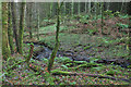
The grassed-over cairn has been extensively robbed with few scattered stones remaining but the underlying structure is intact. A modern cairn, 10 feet high has been constructed at the summit of the cairn and a sheepfold built nearby. This would account for the missing stones.
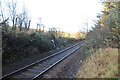
Park at the railway station and cross the tracks following a farm road N. Walk past Cairnlea farm following the farm road until you reach a sheepfold, about 200 yards on the R. Turn R into the field adjacent to the sheepfold and follow the fence NW across fields for 600 yards until you reach the edge of a forest. Walk NW along the edge of the forest for about 500 yards until you reach a sheepfold. Go through the gate ahead into a large field, the cairn is in the R corner beside the forest.
You may be viewing yesterday's version of this page. To see the most up to date information please register for a free account.
")
")
Do not use the above information on other web sites or publications without permission of the contributor.
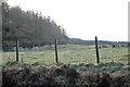
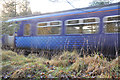
Nearby Images from Geograph Britain and Ireland:
©2012(licence)
©2012(licence)
©2012(licence)
©2012(licence)
©2012(licence)
The above images may not be of the site on this page, they are loaded from Geograph.
Please Submit an Image of this site or go out and take one for us!
Click here to see more info for this site
Nearby sites
Key: Red: member's photo, Blue: 3rd party photo, Yellow: other image, Green: no photo - please go there and take one, Grey: site destroyed
Download sites to:
KML (Google Earth)
GPX (GPS waypoints)
CSV (Garmin/Navman)
CSV (Excel)
To unlock full downloads you need to sign up as a Contributory Member. Otherwise downloads are limited to 50 sites.
Turn off the page maps and other distractions
Nearby sites listing. In the following links * = Image available
3.5km E 79° Laggan Cairn (Barrhill)* Cairn (NX25358297)
4.0km SSE 162° Laggish White Cairn* Cairn (NX22987860)
4.1km W 264° Arecleoch Standing Stone* Standing Stone (Menhir) (NX178822)
4.8km SW 226° Cave Cairn (Chirmorrie)* Chambered Cairn (NX18317924)
4.9km ENE 63° Balmalloch Chambered Cairn* Chambered Cairn (NX2638784532)
5.0km ENE 65° Balmalloch Cairnfield* Barrow Cemetery (NX26488439)
5.5km N 355° Glake Stone* Standing Stone (Menhir) (NX21678790)
6.0km SW 224° Arecleoch Chambered Cairn Chambered Cairn (NX175783)
7.8km SE 131° Arnsheen N* Cairn (NX2753877059)
7.8km SE 132° Arnsheen S* Cairn (NX2752777027)
8.4km SSW 209° Cairn Kenny* Passage Grave (NX17467525)
8.6km SSW 206° Markdhu White Cairn* Cairn (NX17807486)
8.8km SSW 195° Miltonise North Cairn* Cairn (NX19257405)
8.8km SSW 195° Miltonish Stone Circle (NX192740)
10.0km ESE 102° Cairnderry* Chambered Cairn (NX31597993)
10.2km S 172° Wells of the Rees* Holy Well or Sacred Spring (NX22977232)
10.8km S 176° Laggangarn* Standing Stones (NX22237166)
10.8km W 280° Knockdolian* Cairn (NX1132784805)
10.9km NNW 348° Dinvin Earthworks* Misc. Earthwork (NX2002993173)
11.9km E 81° Sheuchan's Cairn* Chambered Cairn (NX33798387)
12.7km ESE 103° Bargrennan Burn White Cairn* Cairn (NX34227910)
13.1km SW 220° Laganbeastie East* Cairn (NX13057271)
13.1km W 265° Garleffin* Stone Row / Alignment (NX08738172)
13.2km SW 220° Laganabeastie West* Cairn (NX13007271)
13.5km SW 217° Grey Hill (Shennas)* Cairn (NX13307198)
View more nearby sites and additional images


 We would like to know more about this location. Please feel free to add a brief description and any relevant information in your own language.
 Wir möchten mehr über diese Stätte erfahren. Bitte zögern Sie nicht, eine kurze Beschreibung und relevante Informationen in Deutsch hinzuzufügen.
 Nous aimerions en savoir encore un peu sur les lieux. S'il vous plaît n'hesitez pas à ajouter une courte description et tous les renseignements pertinents dans votre propre langue.
 Quisieramos informarnos un poco más de las lugares. No dude en añadir una breve descripción y otros datos relevantes en su propio idioma.