
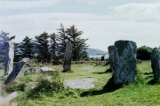

<< Our Photo Pages >> Middle Taphouse Round Barrow (B) - Round Barrow(s) in England in Cornwall
Submitted by mikeaitch on Sunday, 01 May 2011 Page Views: 4228
Neolithic and Bronze AgeSite Name: Middle Taphouse Round Barrow (B)Country: England
NOTE: This site is 1.8 km away from the location you searched for.
County: Cornwall Type: Round Barrow(s)
Nearest Village: Middle Taphouse
Map Ref: SX175624
Latitude: 50.433014N Longitude: 4.571092W
Condition:
| 5 | Perfect |
| 4 | Almost Perfect |
| 3 | Reasonable but with some damage |
| 2 | Ruined but still recognisable as an ancient site |
| 1 | Pretty much destroyed, possibly visible as crop marks |
| 0 | No data. |
| -1 | Completely destroyed |
| 5 | Superb |
| 4 | Good |
| 3 | Ordinary |
| 2 | Not Good |
| 1 | Awful |
| 0 | No data. |
| 5 | Can be driven to, probably with disabled access |
| 4 | Short walk on a footpath |
| 3 | Requiring a bit more of a walk |
| 2 | A long walk |
| 1 | In the middle of nowhere, a nightmare to find |
| 0 | No data. |
| 5 | co-ordinates taken by GPS or official recorded co-ordinates |
| 4 | co-ordinates scaled from a detailed map |
| 3 | co-ordinates scaled from a bad map |
| 2 | co-ordinates of the nearest village |
| 1 | co-ordinates of the nearest town |
| 0 | no data |
Internal Links:
External Links:
 (PID:76513)")
One of the better preserved barrows in the Mid Taphouse area. Situated south of the A390 next to the B3359.
You may be viewing yesterday's version of this page. To see the most up to date information please register for a free account.
Do not use the above information on other web sites or publications without permission of the contributor.
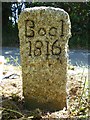
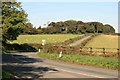
Nearby Images from Geograph Britain and Ireland:
©2023(licence)
©2009(licence)
©2022(licence)
©2019(licence)
©2009(licence)
The above images may not be of the site on this page, they are loaded from Geograph.
Please Submit an Image of this site or go out and take one for us!
Click here to see more info for this site
Nearby sites
Key: Red: member's photo, Blue: 3rd party photo, Yellow: other image, Green: no photo - please go there and take one, Grey: site destroyed
Download sites to:
KML (Google Earth)
GPX (GPS waypoints)
CSV (Garmin/Navman)
CSV (Excel)
To unlock full downloads you need to sign up as a Contributory Member. Otherwise downloads are limited to 50 sites.
Turn off the page maps and other distractions
Nearby sites listing. In the following links * = Image available
761m NNW 335° Middle Taphouse Round Barrow (A)* Round Barrow(s) (SX172631)
2.2km NNW 342° Largin Castle Hillfort (SX16896454)
3.3km SSE 155° Bury Camp (Cornwall)* Hillfort (SX188594)
3.3km WNW 282° West Taphouse Ridge Barrow Cemetery (A)* Barrow Cemetery (SX143632)
3.6km WNW 282° West Taphouse Barrow Cemetery (B)* Barrow Cemetery (SX140633)
5.3km WSW 240° St Nectan Church Cross* Ancient Cross (SX128599)
5.3km N 357° Crowpound Menhir* Standing Stone (Menhir) (SX17446773)
5.5km N 9° St Neot Crosses* Ancient Cross (SX1859567843)
5.7km W 279° Bofarnel down* Barrow Cemetery (SX119635)
5.8km N 6° St Neot's Well (St Neot)* Holy Well or Sacred Spring (SX183681)
6.7km NW 322° Welltown Stones* Early Christian Sculptured Stone (SX136678)
6.9km NNE 17° Berry Castle (St Neot)* Ancient Village or Settlement (SX197689)
7.3km ESE 122° Duloe* Stone Circle (SX23585831)
7.4km SE 124° St Cuby's Church Iron Age Fort* Hillfort (SX23485809)
7.5km NNE 17° Berry Down menhir Standing Stone (Menhir) (SX199695)
7.5km N 2° Trebinnick menhir* Standing Stone (Menhir) (SX180699)
7.6km ESE 104° St Keyne's Well* Holy Well or Sacred Spring (SX248603)
7.6km S 169° Bake rings* Ancient Village or Settlement (SX187549)
7.6km NNE 15° Mutton Downs Menhir* Standing Stone (Menhir) (SX198697)
7.7km SE 139° St Non's Well (Cornwall)* Holy Well or Sacred Spring (SX224564)
7.8km NW 324° Treslea Cross* Ancient Cross (SX131689)
7.9km SSE 149° Hall Rings Hillfort (SX214555)
7.9km ESE 122° St Cuby's Well (Duloe)* Holy Well or Sacred Spring (SX24085796)
7.9km ENE 73° Pipe Well* Holy Well or Sacred Spring (SX252644)
7.9km SSE 157° Holy Well in Pelynt Holy Well or Sacred Spring (SX204550)
View more nearby sites and additional images


 We would like to know more about this location. Please feel free to add a brief description and any relevant information in your own language.
 Wir möchten mehr über diese Stätte erfahren. Bitte zögern Sie nicht, eine kurze Beschreibung und relevante Informationen in Deutsch hinzuzufügen.
 Nous aimerions en savoir encore un peu sur les lieux. S'il vous plaît n'hesitez pas à ajouter une courte description et tous les renseignements pertinents dans votre propre langue.
 Quisieramos informarnos un poco más de las lugares. No dude en añadir una breve descripción y otros datos relevantes en su propio idioma.