


<< Our Photo Pages >> Dunragit Cursus - Cursus in Scotland in Dumfries and Galloway
Submitted by mickm on Friday, 18 July 2014 Page Views: 10284
Neolithic and Bronze AgeSite Name: Dunragit Cursus Alternative Name: Old Luce CursusCountry: Scotland County: Dumfries and Galloway Type: Cursus
Nearest Town: Stranraer Nearest Village: Dunragit
Map Ref: NX14975745
Latitude: 54.877476N Longitude: 4.885589W
Condition:
| 5 | Perfect |
| 4 | Almost Perfect |
| 3 | Reasonable but with some damage |
| 2 | Ruined but still recognisable as an ancient site |
| 1 | Pretty much destroyed, possibly visible as crop marks |
| 0 | No data. |
| -1 | Completely destroyed |
| 5 | Superb |
| 4 | Good |
| 3 | Ordinary |
| 2 | Not Good |
| 1 | Awful |
| 0 | No data. |
| 5 | Can be driven to, probably with disabled access |
| 4 | Short walk on a footpath |
| 3 | Requiring a bit more of a walk |
| 2 | A long walk |
| 1 | In the middle of nowhere, a nightmare to find |
| 0 | No data. |
| 5 | co-ordinates taken by GPS or official recorded co-ordinates |
| 4 | co-ordinates scaled from a detailed map |
| 3 | co-ordinates scaled from a bad map |
| 2 | co-ordinates of the nearest village |
| 1 | co-ordinates of the nearest town |
| 0 | no data |
Internal Links:
External Links:
")
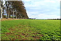
A pit defined cursus monument. Part of a huge Neolithic/Bronze Age complex discovered by aerial photography in 1992. Excavations of the site were carried out by a team from Manchester University, directed by Julian Thomas between 1999-2002.
This Neolithic cursus is recorded as Canmore ID 78925, which contains a number of aerial photographs.
NMR No. NX15NW 76 .04
Note: Earliest houses, Bronze Age cremations and tools found by archaeologists in Scotland. See comment below.
You may be viewing yesterday's version of this page. To see the most up to date information please register for a free account.
")
Do not use the above information on other web sites or publications without permission of the contributor.
Nearby Images from Geograph Britain and Ireland:
©2010(licence)
©2012(licence)
©2019(licence)
©2010(licence)
©2014(licence)
The above images may not be of the site on this page, they are loaded from Geograph.
Please Submit an Image of this site or go out and take one for us!
Click here to see more info for this site
Nearby sites
Key: Red: member's photo, Blue: 3rd party photo, Yellow: other image, Green: no photo - please go there and take one, Grey: site destroyed
Download sites to:
KML (Google Earth)
GPX (GPS waypoints)
CSV (Garmin/Navman)
CSV (Excel)
To unlock full downloads you need to sign up as a Contributory Member. Otherwise downloads are limited to 50 sites.
Turn off the page maps and other distractions
Nearby sites listing. In the following links * = Image available
519m NNW 342° Round Dounan* Hillfort (NX14835795)
598m SSW 192° Droughduil Mote* Timber Circle (NX14825687)
2.8km NE 45° Airyhemming W* Cairn (NX17055938)
3.0km NE 47° Airyhemming E* Cairn (NX17265943)
3.4km W 263° Inch Cursus Cursus (NX11555716)
3.5km W 262° Inch Cursus Cursus (NX11505710)
3.7km NE 36° Craig Fell N* Cairn (NX17296039)
3.8km ENE 68° St Katherine's Well (Glenluce)* Holy Well or Sacred Spring (NX18605873)
4.2km NW 314° Cults Loch* Crannog (NX12066047)
4.6km N 349° Glenterrow White Cairn (Destroyed)* Cairn (NX14286199)
4.7km E 87° St John's Well (Glenluce) Holy Well or Sacred Spring (NX19705752)
5.0km NE 46° Mid Gleniron Stony Mounds* Cairn (NX1869460787)
5.1km N 353° Glentirrow* Stone Circle (NX14536251)
5.1km NE 45° Mid Gleniron 5* Cairn (NX1871460929)
5.1km NE 44° Mid Gleniron 1* Chambered Cairn (NX18676100)
5.1km N 352° Glenterrow Cairn* Cairn (NX14506256)
5.1km NE 45° Mid Gleniron 3* Cairn (NX18766092)
5.1km NE 45° Mid Gleniron 2* Chambered Cairn (NX18776093)
5.2km NW 314° Black Loch Crannog* Crannog (NX11396118)
5.2km NE 45° Mid Gleniron 4* Cairn (NX18856100)
5.6km NNE 30° Cruise Back Fell* Hillfort (NX17946219)
5.7km NNE 21° Cairn McNeilie* Cairn (NX17246266)
5.7km NE 54° Camrie Fell* Cairn (NX19736060)
5.8km NNE 27° Littlepark* Cairn (NX17836250)
5.9km E 85° Lady Well (Glenluce) Holy Well or Sacred Spring (NX20845768)
View more nearby sites and additional images


 We would like to know more about this location. Please feel free to add a brief description and any relevant information in your own language.
 Wir möchten mehr über diese Stätte erfahren. Bitte zögern Sie nicht, eine kurze Beschreibung und relevante Informationen in Deutsch hinzuzufügen.
 Nous aimerions en savoir encore un peu sur les lieux. S'il vous plaît n'hesitez pas à ajouter une courte description et tous les renseignements pertinents dans votre propre langue.
 Quisieramos informarnos un poco más de las lugares. No dude en añadir una breve descripción y otros datos relevantes en su propio idioma.