 with our Megalithic Portal iPhone app")

, Aubrey Burl")
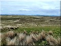
<< Our Photo Pages >> Drumacissock North Cairn - Cairn in Scotland in Dumfries and Galloway
Submitted by markj99 on Wednesday, 07 October 2020 Page Views: 450
Neolithic and Bronze AgeSite Name: Drumacissock North CairnCountry: Scotland County: Dumfries and Galloway Type: Cairn
Nearest Town: Stranraer Nearest Village: New Luce
Map Ref: NX11706827
Latitude: 54.973358N Longitude: 4.943572W
Condition:
| 5 | Perfect |
| 4 | Almost Perfect |
| 3 | Reasonable but with some damage |
| 2 | Ruined but still recognisable as an ancient site |
| 1 | Pretty much destroyed, possibly visible as crop marks |
| 0 | No data. |
| -1 | Completely destroyed |
| 5 | Superb |
| 4 | Good |
| 3 | Ordinary |
| 2 | Not Good |
| 1 | Awful |
| 0 | No data. |
| 5 | Can be driven to, probably with disabled access |
| 4 | Short walk on a footpath |
| 3 | Requiring a bit more of a walk |
| 2 | A long walk |
| 1 | In the middle of nowhere, a nightmare to find |
| 0 | No data. |
| 5 | co-ordinates taken by GPS or official recorded co-ordinates |
| 4 | co-ordinates scaled from a detailed map |
| 3 | co-ordinates scaled from a bad map |
| 2 | co-ordinates of the nearest village |
| 1 | co-ordinates of the nearest town |
| 0 | no data |
Internal Links:
External Links:
")
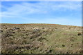
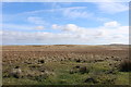
Canmore ID 61510 gives further information on Drumacissock North Cairn. As the name implies there is a Drumacissock South Cairn. It is 100 yards S of Drumacissock North Cairn parallel to the road.
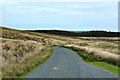
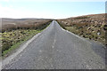
Directions: From Stranraer follow the A77 Ayr road. After passing the A751 Innermessan junction take the next R 500 yards later into an unsigned single track road. Follow this road for 3.5 miles to reach the bombed factory site. Cross the cattle grid, proceed for 0.33 miles to a passing place and look R into the moorland to locate Drumacissock North Cairn 50 yards E of the road.
You may be viewing yesterday's version of this page. To see the most up to date information please register for a free account.
")
")
")
Do not use the above information on other web sites or publications without permission of the contributor.
Nearby Images from Geograph Britain and Ireland:
©2013(licence)
©2019(licence)
©2019(licence)
©2019(licence)
©2013(licence)
The above images may not be of the site on this page, they are loaded from Geograph.
Please Submit an Image of this site or go out and take one for us!
Click here to see more info for this site
Nearby sites
Key: Red: member's photo, Blue: 3rd party photo, Yellow: other image, Green: no photo - please go there and take one, Grey: site destroyed
Download sites to:
KML (Google Earth)
GPX (GPS waypoints)
CSV (Garmin/Navman)
CSV (Excel)
To unlock full downloads you need to sign up as a Contributory Member. Otherwise downloads are limited to 50 sites.
Turn off the page maps and other distractions
Nearby sites listing. In the following links * = Image available
95m SSW 196° Drumacissock South Cairn* Cairn (NX11676818)
1.0km NE 45° Diddles Hill Cairn* Cairn (NX12446896)
2.5km SE 128° Cairnerzean Fell Summit* Cairn (NX13606668)
2.6km NNW 341° Brockloch Fell* Cairn (NX10947075)
2.7km SW 234° White Cairn, Beoch Hill* Cairn (NX09436677)
2.8km SE 129° Cairnerzean Fell N* Cairn (NX13836642)
2.9km SW 231° Beoch Hill Cairn* Cairn (NX09336654)
3.0km SE 131° Cairnerzean Fell Central* Cairn (NX13866620)
3.0km SE 138° Cairnerzean Fell South* Cairn (NX13616595)
3.2km ESE 121° Lingdowey Burn N* Cairn (NX14416649)
3.3km ESE 110° Lingdowey Burn E* Cairn (NX14806698)
3.4km N 349° Drumanwherran S Cairn Cemetery* Cairn (NX11207160)
3.4km ESE 101° Cairnerzean Farm SW* Cairn (NX14986747)
3.4km E 101° Cairnerzean Farm NE* Cairn (NX14996748)
3.5km ESE 121° Lingdowey Burn S* Cairn (NX14616635)
3.7km NNW 336° Claywarnies Cairn* Cairn (NX10347171)
3.8km SSE 149° Auld Wife's Grave* Chambered Cairn (NX13536498)
3.9km E 84° Kilfeddar Farm* Cairn (NX15626852)
3.9km NNW 347° Drumanwherran N* Cairn (NX10967212)
3.9km SSW 191° Balker Moor S Cairn (NX10766444)
4.0km NNE 21° Grey Hill (Shennas)* Cairn (NX13307198)
4.5km SSW 201° Teroy Fort* Broch or Nuraghe (NX0992364108)
4.5km E 89° Altigoukie Burn Cairn* Cairn (NX16266817)
4.6km E 90° Altigoukie Burn Burnt Mound* Misc. Earthwork (NX16336811)
4.6km NNE 14° Laganabeastie West* Cairn (NX13007271)
View more nearby sites and additional images


 We would like to know more about this location. Please feel free to add a brief description and any relevant information in your own language.
 Wir möchten mehr über diese Stätte erfahren. Bitte zögern Sie nicht, eine kurze Beschreibung und relevante Informationen in Deutsch hinzuzufügen.
 Nous aimerions en savoir encore un peu sur les lieux. S'il vous plaît n'hesitez pas à ajouter une courte description et tous les renseignements pertinents dans votre propre langue.
 Quisieramos informarnos un poco más de las lugares. No dude en añadir una breve descripción y otros datos relevantes en su propio idioma.