

<< Our Photo Pages >> Craigencroy - Cairn in Scotland in Dumfries and Galloway
Submitted by markj99 on Tuesday, 11 October 2022 Page Views: 277
Neolithic and Bronze AgeSite Name: Craigencroy Alternative Name: West RinguineaCountry: Scotland
NOTE: This site is 0.5 km away from the location you searched for.
County: Dumfries and Galloway Type: Cairn
Nearest Town: Stranraer Nearest Village: Sandhead
Map Ref: NX07064711
Latitude: 54.781695N Longitude: 5.001799W
Condition:
| 5 | Perfect |
| 4 | Almost Perfect |
| 3 | Reasonable but with some damage |
| 2 | Ruined but still recognisable as an ancient site |
| 1 | Pretty much destroyed, possibly visible as crop marks |
| 0 | No data. |
| -1 | Completely destroyed |
| 5 | Superb |
| 4 | Good |
| 3 | Ordinary |
| 2 | Not Good |
| 1 | Awful |
| 0 | No data. |
| 5 | Can be driven to, probably with disabled access |
| 4 | Short walk on a footpath |
| 3 | Requiring a bit more of a walk |
| 2 | A long walk |
| 1 | In the middle of nowhere, a nightmare to find |
| 0 | No data. |
| 5 | co-ordinates taken by GPS or official recorded co-ordinates |
| 4 | co-ordinates scaled from a detailed map |
| 3 | co-ordinates scaled from a bad map |
| 2 | co-ordinates of the nearest village |
| 1 | co-ordinates of the nearest town |
| 0 | no data |
Internal Links:
External Links:
I have visited· I would like to visit
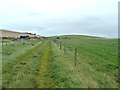
markj99 visited on 11th Oct 2022 - their rating: Cond: 2 Amb: 3 Access: 3 Craigencroy Cairn is accessed via Kilmuir farm track which extends NW into the SE corner of a field. Head N up the slope for 330 yards towards a gateway. The cairn is c. 25 yards NW of the gateway in the field boundary.
")
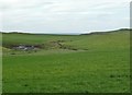
Craigencroy Cairn is a round cairn located c. 2 miles SW of Sandhead, a village in Dumfries and Galloway. It has been bisected by a field boundary on the NW-SE Axis. The NE half of the cairn has been ploughed out to ground level, leaving the SW half measuring c. 6 feet high, 16 yards long and 8 yards wide. The SW half of Craigencroy Cairn, covered by gorse bushes, has been incorporated into the field boundary. A full description of Craigencroy Cairn is available in Canmore ID 60474 .
You may be viewing yesterday's version of this page. To see the most up to date information please register for a free account.
")
")
")
Do not use the above information on other web sites or publications without permission of the contributor.
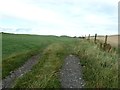
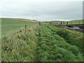
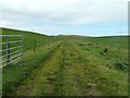
Nearby Images from Geograph Britain and Ireland:
©2011(licence)
©2011(licence)
©2011(licence)
©2011(licence)
©2011(licence)
The above images may not be of the site on this page, they are loaded from Geograph.
Please Submit an Image of this site or go out and take one for us!
Click here to see more info for this site
Nearby sites
Key: Red: member's photo, Blue: 3rd party photo, Yellow: other image, Green: no photo - please go there and take one, Grey: site destroyed
Download sites to:
KML (Google Earth)
GPX (GPS waypoints)
CSV (Garmin/Navman)
CSV (Excel)
To unlock full downloads you need to sign up as a Contributory Member. Otherwise downloads are limited to 50 sites.
Turn off the page maps and other distractions
Nearby sites listing. In the following links * = Image available
1.4km NNW 338° Mid Float W* Natural Stone / Erratic / Other Natural Feature (NX06584844)
1.4km NNW 347° Mid Float E* Standing Stone (Menhir) (NX06804851)
1.6km NE 34° Kirkmadrine Church Stones* Early Christian Sculptured Stone (NX0801448389)
1.9km NNW 344° Whirlpool* Standing Stone (Menhir) (NX06624898)
2.1km NE 45° Cairnweil standing stone* Standing Stone (Menhir) (NX0863748556)
2.5km S 186° Doon Castle (Broch)* Broch or Nuraghe (NX0670244683)
3.4km SSE 168° Grennan Point* Promontory Fort / Cliff Castle (NX07604377)
4.8km SE 136° Logan House* Standing Stone (Menhir) (NX10224354)
5.0km SSE 147° St Mary's Well (Logan) Holy Well or Sacred Spring (NX096428)
6.9km NW 318° Knockinaam Standing Stone* Standing Stone (Menhir) (NX02695242)
7.1km SE 135° Chipperdingan Well (New England Bay) Holy Well or Sacred Spring (NX11904190)
7.4km N 350° St Catherine's Well (Eldrickhill) Holy Well or Sacred Spring (NX06125442)
7.8km SE 136° Terally Bay* Standing Stone (Menhir) (NX12284127)
8.6km SE 143° St Bride's Well (Kirkmaiden Parish) Holy Well or Sacred Spring (NX1240)
8.7km SSE 150° Inchmulloch Hill* Standing Stone (Menhir) (NX1113739421)
9.6km NNW 342° Cairn Pat* Hillfort (NX04425632)
9.8km NW 313° St Patrick's Well (Portpatrick) Holy Well or Sacred Spring (NX00105411)
10.7km SE 145° Kilstay* Standing Stone (Menhir) (NX1273738072)
10.9km NNE 21° Inch Cursus Cursus (NX11505710)
11.0km NNE 22° Inch Cursus Cursus (NX11555716)
11.1km NNW 333° Craigenlee Fell E* Cairn (NX02495728)
11.2km NNW 332° Craigenlee Fell W* Cairn (NX02155717)
11.4km NW 317° St Kain's Well (Dunskey Glen) Holy Well or Sacred Spring (NW997558)
11.5km SSE 161° Cairn Fell* Cairn (NX10333612)
11.6km SSE 150° Core Hill* Hillfort (NX12433686)
View more nearby sites and additional images


 We would like to know more about this location. Please feel free to add a brief description and any relevant information in your own language.
 Wir möchten mehr über diese Stätte erfahren. Bitte zögern Sie nicht, eine kurze Beschreibung und relevante Informationen in Deutsch hinzuzufügen.
 Nous aimerions en savoir encore un peu sur les lieux. S'il vous plaît n'hesitez pas à ajouter une courte description et tous les renseignements pertinents dans votre propre langue.
 Quisieramos informarnos un poco más de las lugares. No dude en añadir una breve descripción y otros datos relevantes en su propio idioma.