


<< Our Photo Pages >> Pencarrow Rounds - Hillfort in England in Cornwall
Submitted by SolarMegalith on Saturday, 14 April 2012 Page Views: 4622
Iron Age and Later PrehistorySite Name: Pencarrow RoundsCountry: England County: Cornwall Type: Hillfort
Nearest Village: Washaway
Map Ref: SX03987001
Latitude: 50.497011N Longitude: 4.765224W
Condition:
| 5 | Perfect |
| 4 | Almost Perfect |
| 3 | Reasonable but with some damage |
| 2 | Ruined but still recognisable as an ancient site |
| 1 | Pretty much destroyed, possibly visible as crop marks |
| 0 | No data. |
| -1 | Completely destroyed |
| 5 | Superb |
| 4 | Good |
| 3 | Ordinary |
| 2 | Not Good |
| 1 | Awful |
| 0 | No data. |
| 5 | Can be driven to, probably with disabled access |
| 4 | Short walk on a footpath |
| 3 | Requiring a bit more of a walk |
| 2 | A long walk |
| 1 | In the middle of nowhere, a nightmare to find |
| 0 | No data. |
| 5 | co-ordinates taken by GPS or official recorded co-ordinates |
| 4 | co-ordinates scaled from a detailed map |
| 3 | co-ordinates scaled from a bad map |
| 2 | co-ordinates of the nearest village |
| 1 | co-ordinates of the nearest town |
| 0 | no data |
Internal Links:
External Links:
I have visited· I would like to visit
lucasn visited - their rating: Cond: 3 Amb: 4 Access: 4
")
Well-preserved Iron Age hillfort with an entrance at the west. The ramparts reach 2.5 m of height, the ditch is 1 m deep. The site has never been excavated.
Read More at Pastscape.
You may be viewing yesterday's version of this page. To see the most up to date information please register for a free account.
")
")
")
")
Do not use the above information on other web sites or publications without permission of the contributor.
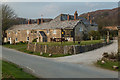
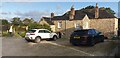
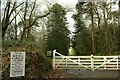
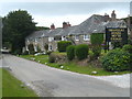
Nearby Images from Geograph Britain and Ireland:
©2019(licence)
©2023(licence)
©2020(licence)
©2011(licence)

©2019(licence)
The above images may not be of the site on this page, they are loaded from Geograph.
Please Submit an Image of this site or go out and take one for us!
Click here to see more info for this site
Nearby sites
Key: Red: member's photo, Blue: 3rd party photo, Yellow: other image, Green: no photo - please go there and take one, Grey: site destroyed
Download sites to:
KML (Google Earth)
GPX (GPS waypoints)
CSV (Garmin/Navman)
CSV (Excel)
To unlock full downloads you need to sign up as a Contributory Member. Otherwise downloads are limited to 50 sites.
Turn off the page maps and other distractions
Nearby sites listing. In the following links * = Image available
276m SW 218° Prior's Cross* Ancient Cross (SX038698)
890m N 359° Pencarrow Cross* Ancient Cross (SX040709)
3.0km SE 144° Scarlett's Well* Holy Well or Sacred Spring (SX0566767503)
3.7km SE 133° Berrycombe Cross* Ancient Cross (SX0661067414)
3.8km SE 133° Cocks Well* Holy Well or Sacred Spring (SX067673)
3.9km NNE 30° Longstone (St Mabyn)* Standing Stone (Menhir) (SX06067337)
4.0km NNE 30° Penwine Cross* Ancient Cross (SX0606473375)
4.0km NNE 30° Longstone Cross* Ancient Cross (SX06077338)
4.1km SE 126° Berry Tower Cross* Sculptured Stone (SX07236746)
4.2km SE 132° Eye Well* Holy Well or Sacred Spring (SX070671)
4.2km NNW 328° Killibury Camp* Hillfort (SX01857365)
4.4km ESE 102° Lancarffe Inscribed Stone Early Christian Sculptured Stone (SX08266894)
4.5km NE 40° Tregony Cross Early Christian Sculptured Stone (SX06997333)
4.6km ESE 120° Castle Hill Cross* Early Christian Sculptured Stone (SX0785567542)
4.6km NW 320° Three Hole Cross* Ancient Cross (SX01177367)
4.6km SE 128° St Guron's Well House* Holy Well or Sacred Spring (SX075670)
4.9km SE 131° St Petroc's Holy Well* Holy Well or Sacred Spring (SX07566671)
5.0km ESE 112° Callywith Cross Early Christian Sculptured Stone (SX08566794)
5.8km S 179° The Annicu Stone* Sculptured Stone (SX039642)
6.2km SE 131° Castle Canyke* Ancient Village or Settlement (SX085658)
6.3km NE 53° Fairies' Well Holy Well or Sacred Spring (SX09107363)
6.5km ENE 59° Holy Well (Blisland)* Holy Well or Sacred Spring (SX097731)
6.5km SE 130° Carminow Cross Ancient Cross (SX08846569)
6.6km WSW 252° St Breock Downs Barrow* Round Barrow(s) (SW97606821)
6.7km ENE 61° Blisland Holy Well* Holy Well or Sacred Spring (SX1073)
View more nearby sites and additional images


 We would like to know more about this location. Please feel free to add a brief description and any relevant information in your own language.
 Wir möchten mehr über diese Stätte erfahren. Bitte zögern Sie nicht, eine kurze Beschreibung und relevante Informationen in Deutsch hinzuzufügen.
 Nous aimerions en savoir encore un peu sur les lieux. S'il vous plaît n'hesitez pas à ajouter une courte description et tous les renseignements pertinents dans votre propre langue.
 Quisieramos informarnos un poco más de las lugares. No dude en añadir una breve descripción y otros datos relevantes en su propio idioma.