
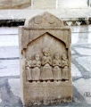

<< Our Photo Pages >> Standing Stone near Tyconel Farm - Standing Stone (Menhir) in Wales in Pembrokeshire
Submitted by bishop_pam on Friday, 01 December 2023 Page Views: 1416
Neolithic and Bronze AgeSite Name: Standing Stone near Tyconel FarmCountry: Wales County: Pembrokeshire Type: Standing Stone (Menhir)
Nearest Town: Newport
Map Ref: SN038393
Latitude: 52.017342N Longitude: 4.860672W
Condition:
| 5 | Perfect |
| 4 | Almost Perfect |
| 3 | Reasonable but with some damage |
| 2 | Ruined but still recognisable as an ancient site |
| 1 | Pretty much destroyed, possibly visible as crop marks |
| 0 | No data. |
| -1 | Completely destroyed |
| 5 | Superb |
| 4 | Good |
| 3 | Ordinary |
| 2 | Not Good |
| 1 | Awful |
| 0 | No data. |
| 5 | Can be driven to, probably with disabled access |
| 4 | Short walk on a footpath |
| 3 | Requiring a bit more of a walk |
| 2 | A long walk |
| 1 | In the middle of nowhere, a nightmare to find |
| 0 | No data. |
| 5 | co-ordinates taken by GPS or official recorded co-ordinates |
| 4 | co-ordinates scaled from a detailed map |
| 3 | co-ordinates scaled from a bad map |
| 2 | co-ordinates of the nearest village |
| 1 | co-ordinates of the nearest town |
| 0 | no data |
Internal Links:
External Links:
I have visited· I would like to visit
thurgojim visited on 29th May 2022 - their rating: Cond: 4 Amb: 4 Access: 4 Visited on family holiday while we were staying in a house a few hundred meters away. Weather was good all week and we avoided the jubilee celebrations. Got the feeling that lining the stone up with the peak on Dinas Head would indicate that when the sun sets in alignment, that would be a good time to plant crops. Went back a few days later to do a 3d scan (https://poly.cam/capture/404AA8FB-50D0-4790-8AAA-5B64A32649EC).
bishop_pam visited on 6th Feb 2020 - their rating: Cond: 5 Amb: 4 Access: 4
Average ratings for this site from all visit loggers: Condition: 4.5 Ambience: 4 Access: 4
")
You may be viewing yesterday's version of this page. To see the most up to date information please register for a free account.
")
")
")
")
Do not use the above information on other web sites or publications without permission of the contributor.
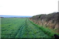
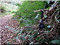
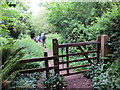
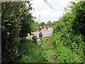
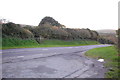
Nearby Images from Geograph Britain and Ireland:
©2015(licence)
©2007(licence)
©2017(licence)
©2017(licence)
©2015(licence)
The above images may not be of the site on this page, they are loaded from Geograph.
Please Submit an Image of this site or go out and take one for us!
Click here to see more info for this site
Nearby sites
Key: Red: member's photo, Blue: 3rd party photo, Yellow: other image, Green: no photo - please go there and take one, Grey: site destroyed
Download sites to:
KML (Google Earth)
GPX (GPS waypoints)
CSV (Garmin/Navman)
CSV (Excel)
To unlock full downloads you need to sign up as a Contributory Member. Otherwise downloads are limited to 50 sites.
Turn off the page maps and other distractions
Nearby sites listing. In the following links * = Image available
360m SSW 211° Cerrig y Gof Stone* Rock Art (SN036390)
426m SSW 198° Cerrig y Gof* Chambered Tomb (SN0364938901)
1.7km SE 142° Carn Ffoi* Hillfort (SN048379)
2.0km E 93° Golden Lion stone* Standing Stone (Menhir) (SN058391)
2.0km E 99° Inscribed cross stones St. Mary's church* Early Christian Sculptured Stone (SN058389)
2.1km SSE 146° Waun Fawr Ancient Village or Settlement (SN049375)
2.2km E 86° Carreg Coetan Arthur* Burial Chamber or Dolmen (SN06033935)
2.3km S 188° Mynydd Melyn Settlement 2 Ancient Village or Settlement (SN034370)
2.6km SE 142° Carn Ingli Mountain IA Settlement Ancient Village or Settlement (SN053372)
2.6km WNW 288° Castell Cwm y Eglwys Hillfort (SN013402)
2.7km ESE 112° Carn Llwyd Open Settlement Ancient Village or Settlement (SN0623038205)
2.8km ESE 120° Crn Llwyd Stone* Standing Stone (Menhir) (SN0613537828)
2.8km S 177° Bedd Morris* Standing Stone (Menhir) (SN0381836502)
2.8km S 170° Mynydd Caregog Ancient Village or Settlement (SN042365)
2.9km SE 144° Carn Llwyd* Ancient Village or Settlement (SN054369)
2.9km SE 138° Carn Briw* Cairn (SN0563537067)
2.9km ESE 119° Carn Ingli Mountain Neolithic Settlement Ancient Village or Settlement (SN063378)
2.9km ESE 119° Carn Ingli Settlement Hillfort (SN063378)
3.0km SSE 148° Carn Ingli Kerb Cairn Cairn (SN053367)
3.0km ESE 122° Mynydd Carn Ingli* Standing Stone (Menhir) (SN063376)
3.0km ESE 122° Carn Ingli Barrows Round Barrow(s) (SN063376)
3.0km SE 144° Carn Edward Ancient Village or Settlement (SN055368)
3.0km WSW 257° Dinas Cross Stone* Standing Stone (Menhir) (SN00813875)
3.0km SSW 195° Mynydd Melyn Stone* Standing Stone (Menhir) (SN029364)
3.0km SSW 195° Mynydd Melyn Cairn Cairn (SN029364)
View more nearby sites and additional images


 We would like to know more about this location. Please feel free to add a brief description and any relevant information in your own language.
 Wir möchten mehr über diese Stätte erfahren. Bitte zögern Sie nicht, eine kurze Beschreibung und relevante Informationen in Deutsch hinzuzufügen.
 Nous aimerions en savoir encore un peu sur les lieux. S'il vous plaît n'hesitez pas à ajouter une courte description et tous les renseignements pertinents dans votre propre langue.
 Quisieramos informarnos un poco más de las lugares. No dude en añadir una breve descripción y otros datos relevantes en su propio idioma.