

<< Our Photo Pages >> Cill Fhearchair - Standing Stone (Menhir) in Scotland in Highlands
Submitted by uisdean on Thursday, 08 February 2007 Page Views: 7704
Neolithic and Bronze AgeSite Name: Cill FhearchairCountry: Scotland County: Highlands Type: Standing Stone (Menhir)
Nearest Village: Sheil Bridge
Map Ref: NG93871879
Latitude: 57.213339N Longitude: 5.415131W
Condition:
| 5 | Perfect |
| 4 | Almost Perfect |
| 3 | Reasonable but with some damage |
| 2 | Ruined but still recognisable as an ancient site |
| 1 | Pretty much destroyed, possibly visible as crop marks |
| 0 | No data. |
| -1 | Completely destroyed |
| 5 | Superb |
| 4 | Good |
| 3 | Ordinary |
| 2 | Not Good |
| 1 | Awful |
| 0 | No data. |
| 5 | Can be driven to, probably with disabled access |
| 4 | Short walk on a footpath |
| 3 | Requiring a bit more of a walk |
| 2 | A long walk |
| 1 | In the middle of nowhere, a nightmare to find |
| 0 | No data. |
| 5 | co-ordinates taken by GPS or official recorded co-ordinates |
| 4 | co-ordinates scaled from a detailed map |
| 3 | co-ordinates scaled from a bad map |
| 2 | co-ordinates of the nearest village |
| 1 | co-ordinates of the nearest town |
| 0 | no data |
Internal Links:
External Links:
Cill Fhearchair - Farquhar's Cell or Church - refers to a probably mediaeval graveyard consisting of two circular enclosures, one partly destroyed by road works. The standing stone stands in the complete enclosure. It is c 5 feet 9 inches in height.
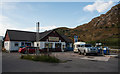
Access is easy - the stone is close to the main road from Inverness to Kyle of Lochalsh and easily visible from the road. Regrettably, this does nothing for the ambience.
You may be viewing yesterday's version of this page. To see the most up to date information please register for a free account.
")
Do not use the above information on other web sites or publications without permission of the contributor.
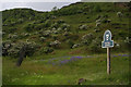
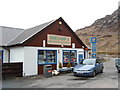
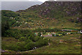
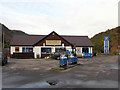
Nearby Images from Geograph Britain and Ireland:
©2010(licence)
©2007(licence)
©2010(licence)
©2008(licence)
©2013(licence)
The above images may not be of the site on this page, they are loaded from Geograph.
Please Submit an Image of this site or go out and take one for us!
Click here to see more info for this site
Nearby sites
Key: Red: member's photo, Blue: 3rd party photo, Yellow: other image, Green: no photo - please go there and take one, Grey: site destroyed
Download sites to:
KML (Google Earth)
GPX (GPS waypoints)
CSV (Garmin/Navman)
CSV (Excel)
To unlock full downloads you need to sign up as a Contributory Member. Otherwise downloads are limited to 50 sites.
Turn off the page maps and other distractions
Nearby sites listing. In the following links * = Image available
795m W 259° Sheil Henge* Henge (NG93081868)
1.9km N 360° Dunan Diarmaid* Hillfort (NG93952071)
2.1km N 0° Diarmaid's Grave* Standing Stones (NG93992085)
2.5km N 11° Tigh Geal* Rock Art (NG94452120)
2.9km NNE 23° Croe Bridge* Rock Art (NG95162141)
3.8km S 169° Sheil Bridge* Ancient Village or Settlement (NG9438215035)
4.1km NE 42° Lienassie* Rock Art (NG968217)
6.5km NW 307° Allt an Inbhir Souterrain* Souterrain (Fogou, Earth House) (NG88882296)
6.9km NW 304° Torran a'Bharraich* Hillfort (NG88312296)
7.0km NW 322° Carr Brae* Rock Art (NG89782451)
9.1km WSW 250° Grugaig Hut Circle* Ancient Village or Settlement (NG8517616131)
9.1km W 277° Serpent Mound (Scallasaig) Cairn (NG8484020288)
9.2km WSW 249° Dun Grugaig (Glenelg)* Broch or Nuraghe (NG85151591)
9.2km NW 313° Totaig Cup Markings* Rock Art (NG87432536)
9.2km WSW 252° Balvraid Cup Marked Stone* Rock Art (NG84961635)
9.5km NW 308° Caisteal Grugaig* Broch or Nuraghe (NG86692508)
9.6km WSW 254° Balvraid Chambered Cairn* Chambered Cairn (NG8452416627)
9.6km NW 310° Dun Totaig (Loch Duich) Broch or Nuraghe (NG868253)
9.9km NNW 333° Bard's Castle* Hillfort (NG89822790)
9.9km N 6° Faddoch* Rock Art (NG95452863)
10.0km WSW 255° Balvraid Farm Cup Marked Stone* Rock Art (NG84081667)
10.3km N 1° Camas Luinie* Rock Art (NG94492909)
10.6km WSW 258° Dun Troddan* Broch or Nuraghe (NG834172)
10.8km W 259° Corrary Prehistoric Site* Cairn (NG83121725)
11.0km W 259° Dun Telve* Broch or Nuraghe (NG829172)
View more nearby sites and additional images


 We would like to know more about this location. Please feel free to add a brief description and any relevant information in your own language.
 Wir möchten mehr über diese Stätte erfahren. Bitte zögern Sie nicht, eine kurze Beschreibung und relevante Informationen in Deutsch hinzuzufügen.
 Nous aimerions en savoir encore un peu sur les lieux. S'il vous plaît n'hesitez pas à ajouter une courte description et tous les renseignements pertinents dans votre propre langue.
 Quisieramos informarnos un poco más de las lugares. No dude en añadir una breve descripción y otros datos relevantes en su propio idioma.