 with our Megalithic Portal iPhone app")


<< Our Photo Pages >> Corston Beacon - Round Barrow(s) in Wales in Pembrokeshire
Submitted by moonastona on Monday, 12 December 2022 Page Views: 4985
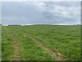
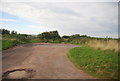
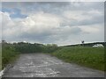
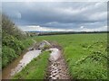
Neolithic and Bronze AgeSite Name: Corston BeaconCountry: Wales County: Pembrokeshire Type: Round Barrow(s)
Nearest Village: Hundleton
Map Ref: SR933999 Landranger Map Number: 158
Latitude: 51.659773N Longitude: 4.989922W
Condition:
| 5 | Perfect |
| 4 | Almost Perfect |
| 3 | Reasonable but with some damage |
| 2 | Ruined but still recognisable as an ancient site |
| 1 | Pretty much destroyed, possibly visible as crop marks |
| 0 | No data. |
| -1 | Completely destroyed |
| 5 | Superb |
| 4 | Good |
| 3 | Ordinary |
| 2 | Not Good |
| 1 | Awful |
| 0 | No data. |
| 5 | Can be driven to, probably with disabled access |
| 4 | Short walk on a footpath |
| 3 | Requiring a bit more of a walk |
| 2 | A long walk |
| 1 | In the middle of nowhere, a nightmare to find |
| 0 | No data. |
| 5 | co-ordinates taken by GPS or official recorded co-ordinates |
| 4 | co-ordinates scaled from a detailed map |
| 3 | co-ordinates scaled from a bad map |
| 2 | co-ordinates of the nearest village |
| 1 | co-ordinates of the nearest town |
| 0 | no data |
Internal Links:
External Links:
")
Parking was easy in a layby directly opposite, a short distance east of the drive for Sommerton farm.
Page originally by Vicky.
You may be viewing yesterday's version of this page. To see the most up to date information please register for a free account.
Do not use the above information on other web sites or publications without permission of the contributor.
Nearby Images from Geograph Britain and Ireland:
©2023(licence)
©2014(licence)
©2023(licence)
©2022(licence)
©2023(licence)
The above images may not be of the site on this page, they are loaded from Geograph.
Please Submit an Image of this site or go out and take one for us!
Click here to see more info for this site
Nearby sites
Key: Red: member's photo, Blue: 3rd party photo, Yellow: other image, Green: no photo - please go there and take one, Grey: site destroyed
Download sites to:
KML (Google Earth)
GPX (GPS waypoints)
CSV (Garmin/Navman)
CSV (Excel)
To unlock full downloads you need to sign up as a Contributory Member. Otherwise downloads are limited to 50 sites.
Turn off the page maps and other distractions
Nearby sites listing. In the following links * = Image available
858m WNW 303° Wallaston Green* Barrow Cemetery (SM926004)
1.5km E 95° Dry Burrows* Barrow Cemetery (SR948997)
2.0km E 82° Pennybridge Stone Circle (SM953001)
2.5km SSE 161° Merrion Court* Hillfort (SR940975)
3.5km NNW 339° Pwllcrochan Hillfort (SM922032)
3.8km ENE 73° Quoits Wood Ancient Village or Settlement (SM9696000845)
3.8km SW 225° Brownslade Farm Round Barrow(s) (SR905973)
3.9km ENE 76° Bowett Wood Camp Ancient Village or Settlement (SM9713500678)
4.4km W 278° Kilpaison Burrows Round Barrow(s) (SM890007)
4.4km ENE 74° St Nicholas' Well (Pembroke) Holy Well or Sacred Spring (SM9762800951)
4.5km SW 220° Castle Lady Valley Hillfort (SR903966)
4.6km SE 138° Devil's Quoit (St Twynnells)* Standing Stone (Menhir) (SR96239638)
4.6km SW 227° Linney Round Barrow(s) (SR898969)
4.6km NW 325° Oil Refinery Hillfort (SM908038)
4.7km W 279° The Devil's Quoit* Burial Chamber or Dolmen (SM88650084)
5.0km ENE 65° Priory Farm Cave* Cave or Rock Shelter (SM9789201832)
5.0km WSW 239° Linney Burrows Round Barrow(s) (SR889975)
5.3km S 181° Flimston Castle* Promontory Fort / Cliff Castle (SR930946)
5.3km SE 137° Harold Stone (Bosherton)* Standing Stone (Menhir) (SR96769586)
5.5km ENE 72° Main Street Well* Holy Well or Sacred Spring (SM9858001416)
5.6km S 175° Crocksydam Camp Hillfort (SR936943)
5.7km E 94° Kingston Cottage Tomb* Chambered Tomb (SR99039924)
6.1km SW 225° Hobbyhorse Bay* Promontory Fort / Cliff Castle (SR888957)
6.3km ESE 119° Stackpole enclosure* Ancient Village or Settlement (SR98679665)
6.3km SE 141° Bosherston* Hillfort (SR971948)
View more nearby sites and additional images


 We would like to know more about this location. Please feel free to add a brief description and any relevant information in your own language.
 Wir möchten mehr über diese Stätte erfahren. Bitte zögern Sie nicht, eine kurze Beschreibung und relevante Informationen in Deutsch hinzuzufügen.
 Nous aimerions en savoir encore un peu sur les lieux. S'il vous plaît n'hesitez pas à ajouter une courte description et tous les renseignements pertinents dans votre propre langue.
 Quisieramos informarnos un poco más de las lugares. No dude en añadir una breve descripción y otros datos relevantes en su propio idioma.