


<< Text Pages >> Dun Toiseach (Kilmartin) - Stone Fort or Dun in Scotland in Argyll
Submitted by Anne T on Thursday, 17 August 2017 Page Views: 1071
Iron Age and Later PrehistorySite Name: Dun Toiseach (Kilmartin) Alternative Name: Torran Farm; Loch AweCountry: Scotland County: Argyll Type: Stone Fort or Dun
Nearest Town: Kilmartin Nearest Village: Torran
Map Ref: NM88080475
Latitude: 56.188074N Longitude: 5.416764W
Condition:
| 5 | Perfect |
| 4 | Almost Perfect |
| 3 | Reasonable but with some damage |
| 2 | Ruined but still recognisable as an ancient site |
| 1 | Pretty much destroyed, possibly visible as crop marks |
| 0 | No data. |
| -1 | Completely destroyed |
| 5 | Superb |
| 4 | Good |
| 3 | Ordinary |
| 2 | Not Good |
| 1 | Awful |
| 0 | No data. |
| 5 | Can be driven to, probably with disabled access |
| 4 | Short walk on a footpath |
| 3 | Requiring a bit more of a walk |
| 2 | A long walk |
| 1 | In the middle of nowhere, a nightmare to find |
| 0 | No data. |
| 5 | co-ordinates taken by GPS or official recorded co-ordinates |
| 4 | co-ordinates scaled from a detailed map |
| 3 | co-ordinates scaled from a bad map |
| 2 | co-ordinates of the nearest village |
| 1 | co-ordinates of the nearest town |
| 0 | no data |
Internal Links:
External Links:
Hillfort in Argyll
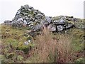
This dun is recorded as Canmore ID 22771, an extract of which reads: "Situated on a prominent rocky knoll overlooking the S end of Loch Awe 250 m ESE of Torran farmsteading, there is a severely ruined dun measuring about 16m by 13m within a wall which has been some 4m thick. Two stretches of outer facing-stones are visible, as well as a few possible stones of the inner face, but, particularly on the NE, the wall has been severely robbed and the core material scattered. The entrance lies on the NE, the innermost portion of the SE passage-wall and what may be a door-jamb on the opposite side still being visible. The knoll has acted as the focus for recent field-walls, but there is no indication that it was additionally defended by outworks. A small modern cairn surmounts the dun wall on the SE."
The Northern Antiquarian (TNA) also features a page for this site - see their entry for Dun Toiseach, Ford, Kilmartin, Argyll, which contains directions for finding the site together with a brief archaeology & history and a 1988 plan of this "rather ramshackled" dun.
Note: Have you visited this site? Do you have any photographs or further information you can add?
You may be viewing yesterday's version of this page. To see the most up to date information please register for a free account.
Do not use the above information on other web sites or publications without permission of the contributor.
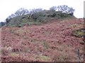
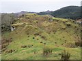
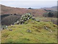
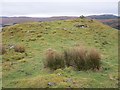
Nearby Images from Geograph Britain and Ireland:
©2013(licence)
©2013(licence)
©2013(licence)
©2013(licence)
©2013(licence)
The above images may not be of the site on this page, they are loaded from Geograph.
Please Submit an Image of this site or go out and take one for us!
Click here to see more info for this site
Nearby sites
Key: Red: member's photo, Blue: 3rd party photo, Yellow: other image, Green: no photo - please go there and take one, Grey: site destroyed
Download sites to:
KML (Google Earth)
GPX (GPS waypoints)
CSV (Garmin/Navman)
CSV (Excel)
To unlock full downloads you need to sign up as a Contributory Member. Otherwise downloads are limited to 50 sites.
Turn off the page maps and other distractions
Nearby sites listing. In the following links * = Image available
184m SW 218° Torran Cup-marked rock* Rock Art (NM87960461)
219m WNW 303° Torran Standing Stone* Standing Stone (Menhir) (NM8790104877)
819m E 84° Loch Awe (South) Crannog (NM889048)
933m ENE 58° Inverliever Cairn (NM889052)
1.7km W 269° Dun Dubh Stone Fort or Dun (NM864048)
1.7km SW 222° Ford Cist* Cist (NM86890356)
2.0km SW 221° Ford Stone (Kilmartin)* Standing Stone (Menhir) (NM8668103317)
2.6km SSW 209° Loch Ederline* Crannog (NM867025)
2.9km WSW 244° Dun Chonallaich* Stone Fort or Dun (NM85440365)
2.9km WNW 290° Tur A' Bhodaich Stone Fort or Dun (NM854059)
3.5km SW 225° Creag A Chapuill* Stone Fort or Dun (NM855024)
3.7km SW 236° Dun Na Nighinn Stone Fort or Dun (NM84910282)
3.8km SSW 211° Creagantairbh Beag* Standing Stone (Menhir) (NM85950156)
4.1km WSW 257° Salachary* Stone Row / Alignment (NM8405604024)
4.3km SSW 210° Glennan Standing Stone* Standing Stone (Menhir) (NM85730112)
4.4km W 269° Dun Na Ban-Oige* Stone Fort or Dun (NM837049)
4.4km SSW 210° Creagantairbh Beag Cairns* Cairn (NM85670108)
4.4km SSW 211° Glennan Cairn* Cairn (NM856011)
4.9km W 268° Kintraw (Argyll) Stone Fort or Dun (NM832048)
4.9km W 271° The Watch Stone (Kintraw)* Standing Stone (Menhir) (NM83200509)
4.9km W 271° Kintraw hill platform* Cairn (NM83170507)
4.9km WNW 302° Sluggan Standing Stone* Standing Stone (Menhir) (NM8404207571)
5.0km W 270° Kintraw (Kilmartin)* Standing Stone (Menhir) (NM83050497)
5.1km WNW 303° Sluggan Cairn* Cairn (NM83940768)
5.1km SW 224° Carnasserie Farm* Rock Art (NM84390125)
View more nearby sites and additional images


 We would like to know more about this location. Please feel free to add a brief description and any relevant information in your own language.
 Wir möchten mehr über diese Stätte erfahren. Bitte zögern Sie nicht, eine kurze Beschreibung und relevante Informationen in Deutsch hinzuzufügen.
 Nous aimerions en savoir encore un peu sur les lieux. S'il vous plaît n'hesitez pas à ajouter une courte description et tous les renseignements pertinents dans votre propre langue.
 Quisieramos informarnos un poco más de las lugares. No dude en añadir una breve descripción y otros datos relevantes en su propio idioma.