

<< Our Photo Pages >> Carnasserie, Kist - Cist in Scotland in Argyll
Submitted by caradoc68 on Sunday, 19 February 2012 Page Views: 2954
Neolithic and Bronze AgeSite Name: Carnasserie, KistCountry: Scotland County: Argyll Type: Cist
Nearest Village: Kilmartin
Map Ref: NM83910051
Latitude: 56.148177N Longitude: 5.480382W
Condition:
| 5 | Perfect |
| 4 | Almost Perfect |
| 3 | Reasonable but with some damage |
| 2 | Ruined but still recognisable as an ancient site |
| 1 | Pretty much destroyed, possibly visible as crop marks |
| 0 | No data. |
| -1 | Completely destroyed |
| 5 | Superb |
| 4 | Good |
| 3 | Ordinary |
| 2 | Not Good |
| 1 | Awful |
| 0 | No data. |
| 5 | Can be driven to, probably with disabled access |
| 4 | Short walk on a footpath |
| 3 | Requiring a bit more of a walk |
| 2 | A long walk |
| 1 | In the middle of nowhere, a nightmare to find |
| 0 | No data. |
| 5 | co-ordinates taken by GPS or official recorded co-ordinates |
| 4 | co-ordinates scaled from a detailed map |
| 3 | co-ordinates scaled from a bad map |
| 2 | co-ordinates of the nearest village |
| 1 | co-ordinates of the nearest town |
| 0 | no data |
Internal Links:
External Links:
I have visited· I would like to visit
SandyG visited on 15th Apr 2015 - their rating: Cond: 3 Amb: 4 Access: 4
")
? NM 838 005. Cist reported on edge of terrace, just buried. Found by farmer 50 years ago, but not opened.
M Campbell and M Sandeman 1964.�
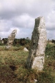
NM 8391 0052. The two side slabs of this earthfilled short cist measure 1.2m long and 0.6m apart and are oriented E-W. Nothing has been found in the cist which was opened several years ago.
Surveyed at 1:2500.
Visited by OS (R D) 12 October 1971.
Two side-slabs of an earth-filled cist are visible to the N of the track leading to Carnassarie Castle (NM80SW 2) and some 90m WNW of Carnassarie Cottage; aligned E and W, the cist has measured about l.2m by 0.6m (Campbell and Sandeman 1964). When it was discovered in the early part of this century it was not opened, but in 1971 it was reported to have been examined several years earlier, when it was found to be empty. The N side-slab is about l.3m long and 0.07m thick with a groove (50mm broad and 10mm deep) some 0.24m from the W end; the S side-slab is 1.44m long and about 0.lm thick with slight traces of a groove 0.24m from the W end corresponding to that on the N side.
You may be viewing yesterday's version of this page. To see the most up to date information please register for a free account.
")
")
Do not use the above information on other web sites or publications without permission of the contributor.
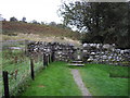
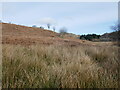
Nearby Images from Geograph Britain and Ireland:
©2008(licence)
©2013(licence)
©2024(licence)
©2009(licence)
©2024(licence)
The above images may not be of the site on this page, they are loaded from Geograph.
Please Submit an Image of this site or go out and take one for us!
Click here to see more info for this site
Nearby sites
Key: Red: member's photo, Blue: 3rd party photo, Yellow: other image, Green: no photo - please go there and take one, Grey: site destroyed
Download sites to:
KML (Google Earth)
GPX (GPS waypoints)
CSV (Garmin/Navman)
CSV (Excel)
To unlock full downloads you need to sign up as a Contributory Member. Otherwise downloads are limited to 50 sites.
Turn off the page maps and other distractions
Nearby sites listing. In the following links * = Image available
346m N 354° Carnasserie Rock Art* Rock Art (NM8389100856)
537m WNW 299° Carnasserie Stones* Standing Stones (NM8345400796)
546m WNW 285° Carnasserie Cairn* Cairn (NM8338900679)
880m NNE 30° Carnasserie Farm* Rock Art (NM84390125)
1.0km N 9° Carn Ban (Carnasserie)* Cairn (NM8411101503)
1.3km WSW 258° Dun Mac Samhainn Cairn (NM826003)
1.5km SSW 211° Upper Largie Burial Chamber or Dolmen (NR831993)
1.7km SSW 194° Kilmartin House* Museum (NR8343298890)
1.7km SSW 198° Glebe Cairn* Cairn (NR8330098930)
1.7km SSW 192° Kilmartin Churchyard* Sculptured Stone (NR8345998859)
1.7km SSW 192° Kilmartin Churchyard (Poltalloch Enclosure)* Sculptured Stone (NR8346798842)
1.7km SSW 193° Kilmartin Churchyard (Lapidarium)* Sculptured Stone (NR8344898839)
1.8km ENE 68° Glennan Cairn* Cairn (NM856011)
1.8km ENE 69° Creagantairbh Beag Cairns* Cairn (NM85670108)
1.9km ENE 69° Glennan Standing Stone* Standing Stone (Menhir) (NM85730112)
2.2km SSW 199° Nether Largie North* Cairn (NR8309098470)
2.2km SSW 200° Nether Largie Cup Marks North Rock Art (NR83059847)
2.3km ENE 60° Creagantairbh Beag* Standing Stone (Menhir) (NM85950156)
2.4km SSW 199° Nether Largie Mid* Cairn (NR8303798309)
2.5km NE 37° Creag A Chapuill* Stone Fort or Dun (NM855024)
2.5km NNE 20° Dun Na Nighinn Stone Fort or Dun (NM84910282)
2.5km SSW 199° Nether Largie Lost Cairn* Cairn (NR82979815)
2.7km NW 319° Ormaig* Rock Art (NM82220267)
2.8km SSW 199° Nether Largie South* Chambered Cairn (NR8286097920)
2.8km SE 138° Upper Rhudil Chambered Tomb (NR85739831)
View more nearby sites and additional images


 We would like to know more about this location. Please feel free to add a brief description and any relevant information in your own language.
 Wir möchten mehr über diese Stätte erfahren. Bitte zögern Sie nicht, eine kurze Beschreibung und relevante Informationen in Deutsch hinzuzufügen.
 Nous aimerions en savoir encore un peu sur les lieux. S'il vous plaît n'hesitez pas à ajouter une courte description et tous les renseignements pertinents dans votre propre langue.
 Quisieramos informarnos un poco más de las lugares. No dude en añadir una breve descripción y otros datos relevantes en su propio idioma.