


<< Text Pages >> Nether Largie Cup Marks North - Rock Art in Scotland in Argyll
Submitted by davidmorgan on Wednesday, 05 December 2012 Page Views: 2509
Rock ArtSite Name: Nether Largie Cup Marks NorthCountry: Scotland County: Argyll Type: Rock Art
Nearest Town: Kilmartin
Map Ref: NR83059847
Latitude: 56.129492N Longitude: 5.492537W
Condition:
| 5 | Perfect |
| 4 | Almost Perfect |
| 3 | Reasonable but with some damage |
| 2 | Ruined but still recognisable as an ancient site |
| 1 | Pretty much destroyed, possibly visible as crop marks |
| 0 | No data. |
| -1 | Completely destroyed |
| 5 | Superb |
| 4 | Good |
| 3 | Ordinary |
| 2 | Not Good |
| 1 | Awful |
| 0 | No data. |
| 5 | Can be driven to, probably with disabled access |
| 4 | Short walk on a footpath |
| 3 | Requiring a bit more of a walk |
| 2 | A long walk |
| 1 | In the middle of nowhere, a nightmare to find |
| 0 | No data. |
| 5 | co-ordinates taken by GPS or official recorded co-ordinates |
| 4 | co-ordinates scaled from a detailed map |
| 3 | co-ordinates scaled from a bad map |
| 2 | co-ordinates of the nearest village |
| 1 | co-ordinates of the nearest town |
| 0 | no data |
Internal Links:
External Links:
I have visited· I would like to visit
coin visited - their rating: Cond: 2 Amb: 4 Access: 4
"This group of thirteen plain cupmarks is situated on a gently sloping rock outcrop, which lies immediately W of a field wall opposite the entrance pathway to Nether Largie North cairn" - Canmore site no. 39472.
You may be viewing yesterday's version of this page. To see the most up to date information please register for a free account.
Do not use the above information on other web sites or publications without permission of the contributor.
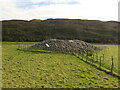
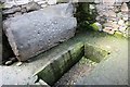
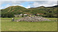
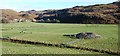
Nearby Images from Geograph Britain and Ireland:
©2023(licence)
©2011(licence)
©2011(licence)
©2013(licence)
©2020(licence)
The above images may not be of the site on this page, they are loaded from Geograph.
Please Submit an Image of this site or go out and take one for us!
Click here to see more info for this site
Nearby sites
Key: Red: member's photo, Blue: 3rd party photo, Yellow: other image, Green: no photo - please go there and take one, Grey: site destroyed
Download sites to:
KML (Google Earth)
GPX (GPS waypoints)
CSV (Garmin/Navman)
CSV (Excel)
To unlock full downloads you need to sign up as a Contributory Member. Otherwise downloads are limited to 50 sites.
Turn off the page maps and other distractions
Nearby sites listing. In the following links * = Image available
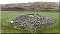
40m E 87° Nether Largie North* Cairn (NR8309098470)
161m S 182° Nether Largie Mid* Cairn (NR8303798309)
329m S 191° Nether Largie Lost Cairn* Cairn (NR82979815)
523m NNE 26° Glebe Cairn* Cairn (NR8330098930)
541m NE 44° Kilmartin Churchyard (Lapidarium)* Sculptured Stone (NR8344898839)
557m NE 45° Kilmartin Churchyard (Poltalloch Enclosure)* Sculptured Stone (NR8346798842)
563m NE 43° Kilmartin Churchyard* Sculptured Stone (NR8345998859)
566m NE 39° Kilmartin House* Museum (NR8343298890)
581m SSW 196° Nether Largie South* Chambered Cairn (NR8286097920)
726m SSW 210° Temple Wood N* Stone Circle (NR8265997856)
763m SSW 210° Temple Wood S* Stone Circle (NR8263197830)
783m SSW 196° Nether Largie standing stone* Standing Stone (Menhir) (NR82799773)
830m N 1° Upper Largie Burial Chamber or Dolmen (NR831993)
886m SSW 191° Nether Largie Stone Row* Stone Row / Alignment (NR8283197610)
1.1km SW 218° Bruach-na-cuirte* Cist (NR82309760)
1.4km SSW 197° Ri Cruin* Cairn (NR8254897119)
1.5km SW 217° Cnoc-an-teallaidh* Cist (NR82129735)
1.5km SSW 199° Ri Cruin* Rock Art (NR825971)
1.5km S 174° Baluachraig Rock Art* Rock Art (NR8312696966)
1.6km WSW 241° Ballygowan Rock Art* Rock Art (NR8162097782)
1.6km SE 138° Dun Mor, Dunchraigaig Stone Fort or Dun (NR841972)
1.7km SW 214° Poltalloch Cist* Cist (NR82049714)
1.7km SSE 168° Dunchraigaig Cairn* Cairn (NR8330796811)
1.7km WSW 251° Dun Ballygowan Stone Fort or Dun (NR814980)
1.9km NNW 343° Dun Mac Samhainn Cairn (NM826003)
View more nearby sites and additional images


 We would like to know more about this location. Please feel free to add a brief description and any relevant information in your own language.
 Wir möchten mehr über diese Stätte erfahren. Bitte zögern Sie nicht, eine kurze Beschreibung und relevante Informationen in Deutsch hinzuzufügen.
 Nous aimerions en savoir encore un peu sur les lieux. S'il vous plaît n'hesitez pas à ajouter une courte description et tous les renseignements pertinents dans votre propre langue.
 Quisieramos informarnos un poco más de las lugares. No dude en añadir una breve descripción y otros datos relevantes en su propio idioma.