 with our Megalithic Portal iPhone app")

<< Our Photo Pages >> Lowland Point - Ancient Village or Settlement in England in Cornwall
Submitted by Bladup on Friday, 24 July 2020 Page Views: 1128
Multi-periodSite Name: Lowland PointCountry: England County: Cornwall Type: Ancient Village or Settlement
Map Ref: SW80251952
Latitude: 50.035171N Longitude: 5.070008W
Condition:
| 5 | Perfect |
| 4 | Almost Perfect |
| 3 | Reasonable but with some damage |
| 2 | Ruined but still recognisable as an ancient site |
| 1 | Pretty much destroyed, possibly visible as crop marks |
| 0 | No data. |
| -1 | Completely destroyed |
| 5 | Superb |
| 4 | Good |
| 3 | Ordinary |
| 2 | Not Good |
| 1 | Awful |
| 0 | No data. |
| 5 | Can be driven to, probably with disabled access |
| 4 | Short walk on a footpath |
| 3 | Requiring a bit more of a walk |
| 2 | A long walk |
| 1 | In the middle of nowhere, a nightmare to find |
| 0 | No data. |
| 5 | co-ordinates taken by GPS or official recorded co-ordinates |
| 4 | co-ordinates scaled from a detailed map |
| 3 | co-ordinates scaled from a bad map |
| 2 | co-ordinates of the nearest village |
| 1 | co-ordinates of the nearest town |
| 0 | no data |
Internal Links:
External Links:
")
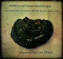
Sites include a Mesolithic flint working site on a platform on the SW side of Carrick Crane rocks at SW79751962 and SW79761964, which was excavated in 1933 when 600-650 worked flints were found. A probably intrusive fragment of an Iron Age bowl with double bead rim was found at SW79741962, Another trench produced only one core of flint, one flint flake and a few beach pebbles. Other flint flakes were found at SW80291976, Bronze Age hut circles at SW79931958, SW803196 and SW79691965, and a possible round barrow known as The Barn at SW80251952, as well as a 2nd century AD Romano-British field system and salt works at SW79591930. Pottery of the Bronze Age (Trevisker Ware) and Romano-British periods have also been found here.
You may be viewing yesterday's version of this page. To see the most up to date information please register for a free account.
")
")
")
")
")
")
")
")
")
Do not use the above information on other web sites or publications without permission of the contributor.
Click here to see more info for this site
Nearby sites
Key: Red: member's photo, Blue: 3rd party photo, Yellow: other image, Green: no photo - please go there and take one, Grey: site destroyed
Download sites to:
KML (Google Earth)
GPX (GPS waypoints)
CSV (Garmin/Navman)
CSV (Excel)
To unlock full downloads you need to sign up as a Contributory Member. Otherwise downloads are limited to 50 sites.
Turn off the page maps and other distractions
Nearby sites listing. In the following links * = Image available
1.9km N 4° Giant's Quoits* Rock Outcrop (SW80452145)
2.7km SW 217° Chynhalls Point Fort* Promontory Fort / Cliff Castle (SW785174)
2.8km W 278° Crousa Common* Standing Stones (SW775200)
2.8km W 269° Little Kistles Kerb Cairn* Cairn (SW77411959)
2.9km WNW 299° Tremenhere Menhir* Standing Stone (Menhir) (SW778210)
2.9km W 260° Crousa Downs Settlement* Ancient Village or Settlement (SW77401916)
2.9km W 275° St Keverne Beacon Tumulus* Chambered Cairn (SW77361987)
3.3km W 263° Tide Rock* Rock Outcrop (SW76921923)
4.1km W 271° Three Brothers of Grugith* Burial Chamber or Dolmen (SW76161978)
4.2km NW 325° Roskruge Beacon* Round Barrow(s) (SW7796623106)
4.4km SW 218° Dynas Cove* Promontory Fort / Cliff Castle (SW774162)
5.6km SW 235° Carrick Luz* Promontory Fort / Cliff Castle (SW755165)
5.7km NW 321° Boden Fogou* Souterrain (Fogou, Earth House) (SW768241)
6.0km WSW 241° Poldowrian Round House* Ancient Village or Settlement (SW749168)
6.3km NNW 343° Little Dennis* Promontory Fort / Cliff Castle (SW7864425648)
6.4km NNW 339° St Anthony in Meneage Cross* Ancient Cross (SW782256)
6.5km NNW 340° St Anthony's Well (St Anthony-in-Meneag)* Holy Well or Sacred Spring (SW783257)
6.6km WNW 281° Traboe Barrow Cemetery* Barrow Cemetery (SW7378321099)
6.7km NW 321° Manaccan Well* Holy Well or Sacred Spring (SW763249)
7.2km WSW 254° Goonhilly Downs Barrows* Barrow Cemetery (SW73261786)
7.5km W 267° Croft Pascoe Forrest Barrows* Barrow Cemetery (SW7273819434)
7.8km W 280° Dry Tree Menhir* Standing Stone (Menhir) (SW72562116)
8.0km WNW 282° Goonhilly tumuli* Round Barrow(s) (SW725215)
8.0km NNW 346° St Mawnan's Well* Holy Well or Sacred Spring (SW7868527385)
8.4km N 354° Rosemullion Head* Promontory Fort / Cliff Castle (SW79682788)
View more nearby sites and additional images


 We would like to know more about this location. Please feel free to add a brief description and any relevant information in your own language.
 Wir möchten mehr über diese Stätte erfahren. Bitte zögern Sie nicht, eine kurze Beschreibung und relevante Informationen in Deutsch hinzuzufügen.
 Nous aimerions en savoir encore un peu sur les lieux. S'il vous plaît n'hesitez pas à ajouter une courte description et tous les renseignements pertinents dans votre propre langue.
 Quisieramos informarnos un poco más de las lugares. No dude en añadir una breve descripción y otros datos relevantes en su propio idioma.