

<< Our Photo Pages >> Holy Well (Kilmory Oib) - Holy Well or Sacred Spring in Scotland in Argyll
Submitted by KiwiBetsy on Friday, 08 September 2006 Page Views: 9913
Springs and Holy WellsSite Name: Holy Well (Kilmory Oib)Country: Scotland
NOTE: This site is 1.1 km away from the location you searched for.
County: Argyll Type: Holy Well or Sacred Spring
Nearest Town: Lochgilphead Nearest Village: Tayvallich
Map Ref: NR780902
Latitude: 56.053012N Longitude: 5.566751W
Condition:
| 5 | Perfect |
| 4 | Almost Perfect |
| 3 | Reasonable but with some damage |
| 2 | Ruined but still recognisable as an ancient site |
| 1 | Pretty much destroyed, possibly visible as crop marks |
| 0 | No data. |
| -1 | Completely destroyed |
| 5 | Superb |
| 4 | Good |
| 3 | Ordinary |
| 2 | Not Good |
| 1 | Awful |
| 0 | No data. |
| 5 | Can be driven to, probably with disabled access |
| 4 | Short walk on a footpath |
| 3 | Requiring a bit more of a walk |
| 2 | A long walk |
| 1 | In the middle of nowhere, a nightmare to find |
| 0 | No data. |
| 5 | co-ordinates taken by GPS or official recorded co-ordinates |
| 4 | co-ordinates scaled from a detailed map |
| 3 | co-ordinates scaled from a bad map |
| 2 | co-ordinates of the nearest village |
| 1 | co-ordinates of the nearest town |
| 0 | no data |
Internal Links:
External Links:
I have visited· I would like to visit
coin has visited here
 (PID:23978)")
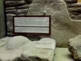
The site is best accessed by parking in the Forestry Commission carpark on the B8025 where there are 2 carparks both of which access the Loch Collie-Bharr walking track & cycleway … use the second carpark when heading for Tayvallich and take the forestry road/track until a clearing opens up on your right. A trackside sign indicates the easiest access to the well.
You may be viewing yesterday's version of this page. To see the most up to date information please register for a free account.
 (PID:23981)")
 (PID:23979)")
 (PID:124596)")
 (PID:124595)")
 (PID:23980)")
Do not use the above information on other web sites or publications without permission of the contributor.
Click here to see more info for this site
Nearby sites
Key: Red: member's photo, Blue: 3rd party photo, Yellow: other image, Green: no photo - please go there and take one, Grey: site destroyed
Download sites to:
KML (Google Earth)
GPX (GPS waypoints)
CSV (Garmin/Navman)
CSV (Excel)
To unlock full downloads you need to sign up as a Contributory Member. Otherwise downloads are limited to 50 sites.
Turn off the page maps and other distractions
Nearby sites listing. In the following links * = Image available
572m NNE 26° Kilmory Oib Enclosure* Standing Stones (NR78289070)
902m E 81° Gartnagreanoch* Chambered Cairn (NR789903)
3.8km NNE 13° Crinan Woods Cup Stone* Rock Art (NR79019382)
4.4km ENE 69° Barnakill Rock Art (NR82199154)
4.8km NNE 33° Crinan Moss Stones* Standing Stones (NR80839409)
4.8km NE 34° Crinan Moss Cairn Cairn (NR80909408)
5.9km ENE 79° Cairnbaan 2* Rock Art (NR8387791056)
6.0km E 82° Carn Ban (Lochgilphead)* Cairn (NR840907)
6.0km E 79° Cairnbaan 1* Rock Art (NR8398891027)
6.1km NNE 18° Duntroon Stone Fort or Dun (NR802959)
6.1km E 80° Dun Chuain* Stone Fort or Dun (NR841910)
6.3km SW 230° Barnashaig* Standing Stone (Menhir) (NR72988640)
6.3km NNE 28° Barsloisnoch* Cist (NR813956)
6.6km ENE 56° Dunadd Fort* Hillfort (NR8367693573)
6.6km SW 229° Upper Fernoch* Standing Stone (Menhir) (NR72808613)
6.7km ENE 68° Dun Mor, Dunamuck* Stone Fort or Dun (NR8435792420)
6.7km N 5° Dun Ardifuir 1 Stone Fort or Dun (NR789969)
6.8km ENE 59° Dunadd Recumbent Stone* Standing Stone (Menhir) (NR83979343)
6.8km ENE 72° Dunamuck Cairn* Cairn (NR84579192)
6.8km ENE 57° Dunadd Standing Stone* Standing Stone (Menhir) (NR8386993612)
6.9km NNE 21° Kilchoan* Chambered Cairn (NR8083596488)
6.9km NNE 33° Rowanfield Cottage* Standing Stone (Menhir) (NR82059585)
7.0km NNE 25° Poltalloch House Rock Art* Rock Art (NR813964)
7.1km ENE 70° Leacaichluaine* Standing Stones (NR84839232)
7.2km N 6° Dun Ardifuir 2 Stone Fort or Dun (NR791973)
View more nearby sites and additional images


 We would like to know more about this location. Please feel free to add a brief description and any relevant information in your own language.
 Wir möchten mehr über diese Stätte erfahren. Bitte zögern Sie nicht, eine kurze Beschreibung und relevante Informationen in Deutsch hinzuzufügen.
 Nous aimerions en savoir encore un peu sur les lieux. S'il vous plaît n'hesitez pas à ajouter une courte description et tous les renseignements pertinents dans votre propre langue.
 Quisieramos informarnos un poco más de las lugares. No dude en añadir una breve descripción y otros datos relevantes en su propio idioma.