Featured: Friendly specialist tours to ancient, mystical and historical sites in the UK and beyond

Friendly specialist tours to ancient, mystical and historical sites in the UK and beyond

The Modern Antiquarian Reissued

The Modern Antiquarian Reissued

Who's Online

There are currently, 357 guests and 3 members online.

You are a guest. To join in, please register for free by clicking here

Sponsors

<< Our Photo Pages >> Mabe Church - Standing Stone (Menhir) in England in Cornwall

Submitted by TimPrevett on Tuesday, 31 December 2002  Page Views: 11008

Neolithic and Bronze AgeSite Name: Mabe Church
Country: England County: Cornwall Type: Standing Stone (Menhir)

Map Ref: SW757325  Landranger Map Number: 204
Latitude: 50.150036N  Longitude: 5.141065W
Condition:
5Perfect
4Almost Perfect
3Reasonable but with some damage
2Ruined but still recognisable as an ancient site
1Pretty much destroyed, possibly visible as crop marks
0No data.
-1Completely destroyed
4 Ambience:
5Superb
4Good
3Ordinary
2Not Good
1Awful
0No data.
no data Access:
5Can be driven to, probably with disabled access
4Short walk on a footpath
3Requiring a bit more of a walk
2A long walk
1In the middle of nowhere, a nightmare to find
0No data.
5 Accuracy:
5co-ordinates taken by GPS or official recorded co-ordinates
4co-ordinates scaled from a detailed map
3co-ordinates scaled from a bad map
2co-ordinates of the nearest village
1co-ordinates of the nearest town
0no data
3

Internal Links:
External Links:

I have visited· I would like to visit

hallsifer visited on 16th May 2022 - their rating: Cond: 4 Amb: 4 Access: 4 Quite lovely stone, easy to find right by the church!

lucasn visited - their rating: Cond: 5 Amb: 4 Access: 5

Bladup hamish cazzyjane have visited here

Average ratings for this site from all visit loggers: Condition: 4.5 Ambience: 4 Access: 4.5

Mabe Church
Mabe Church submitted by TimPrevett : Mabe Church Standing Stone SW757325 Visited Wednesday 19th June 2002 Take the road south through Mabe Burnthouse (SW of A39, W of Penryn & Falmouth). When the church becomes clearly visible, take the junction to the right on a sharp bend. The church is on the left and convenient parking adjacent the cemetery. There is a narrow squeeze through a hole in the wall, into a very old-feeling gra... (Vote or comment on this photo)
Standing Stone in Cornwall

Take the road south through Mabe Burnthouse (SW of A39, W of Penryn & Falmouth). When the church becomes clearly visible, take the junction to the right on a sharp bend. The church is on the left and convenient parking adjacent the cemetery. There is a narrow squeeze through a hole in the wall, into a very old-feeling graveyard; the midsummer canopy of the trees giving it a very dark entry.

Following the tarmac path, the standing stone becomes visible, under the shadow of a yew tree. It is 6 feet + tall, healthily encrusted with lichens, and had a couple loose pieces of rock placed on top. (I could not ascertain if they were part of the stone & though I am doubtful).

Near the south entrance to the church, a few feet away, is a knee-high stone with a cross engraved upon it. I feel there is an intended relationship with the two stones. Given the standing stone's place, overlooking the valley and hills to the east, I feel the site would have been of some local significance; therefore the church, and crossed-stone is almost certainly a Christianisation of the location. Even without the standing stone, this is a pleasant location birds, trees, and many old graves. A place to spend time in reflection.
You may be viewing yesterday's version of this page. To see the most up to date information please register for a free account.

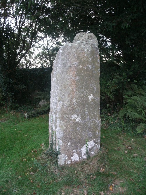
Mabe Church
Mabe Church submitted by Bladup : Made church standing stone. (Vote or comment on this photo)

Mabe Church
Mabe Church submitted by Bladup : Mabe church standing stone. (Vote or comment on this photo)

Mabe Church
Mabe Church submitted by TimPrevett : Mabe Church Standing Stone (1 comment - Vote or comment on this photo)

Mabe Church
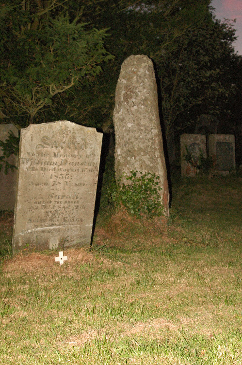
Mabe Church submitted by knap : Just though I'd include another image of Mabe church menhir with a rather dramatic Victorian-era gravestone in shot. Hope this helps lend perspective as to the dimensions of this fascinating menhir. (Vote or comment on this photo)

Mabe Church
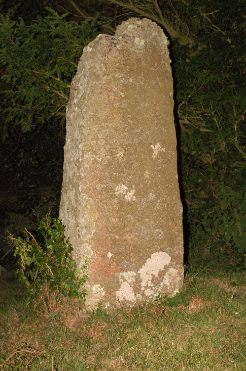
Mabe Church submitted by knap : The menhir in Mabe church yard by night, July 2006. Recently had the pleasure of meeting Mabe's Reverend, a very nice man who pointed out that you can see over to St Dennis parish (just South West of St Austell, quite a distance) on a clear day. Up close, in the region of 5' 8" from the ground, you can make out a very small cross carved into this menhir. (Vote or comment on this photo)

Mabe Church
Mabe Church submitted by hamish : The Mabe church stone sharing the peace with the church.

Mabe Church
Mabe Church submitted by hallsifer : Standing stone on a bright but overcast day - can't miss it amongst the headstones!

Mabe Church
Mabe Church submitted by lucasn : The Bronze Age standing stone in Mabe Churchyard

Mabe Church
Mabe Church submitted by hamish : This remarkable stone is in Mabe church yard. It looks from this angle to be an old monk hunched up. This is a lovely peaceful place overlooking the valley.

Do not use the above information on other web sites or publications without permission of the contributor.
Click here to see more info for this site

Nearby sites

Click here to view sites on an interactive OS map

Key: Red: member's photo, Blue: 3rd party photo, Yellow: other image, Green: no photo - please go there and take one, Grey: site destroyed

Download sites to:
KML (Google Earth)
GPX (GPS waypoints)
CSV (Garmin/Navman)
CSV (Excel)

To unlock full downloads you need to sign up as a Contributory Member. Otherwise downloads are limited to 50 sites.


Turn off the page maps and other distractions

Nearby sites listing. In the following links * = Image available
 565m SW 223° Lower Spargo* Standing Stone (Menhir) (SW753321)
 1.2km SSW 202° Helland House Ancient Cornish Cross* Ancient Cross (SW752314)
 1.6km SW 220° Eathorne Menhir* Standing Stone (Menhir) (SW746313)
 2.4km WSW 243° The Maen rock (Constantine)* Natural Stone / Erratic / Other Natural Feature (SW735315)
 2.9km E 90° Budock Church Crosses* Ancient Cross (SW78603239)
 3.5km NNW 337° Trevales House Cross* Ancient Cross (SW74443582)
 3.7km WSW 252° Trevease Cross* Ancient Cross (SW7208631514)
 3.8km SW 227° Piskey’s Hall – The Fairy’s Fogou* Souterrain (Fogou, Earth House) (SW72803003)
 4.0km NNW 334° Trevales Farm Wayside Cross* Ancient Cross (SW74073614)
 4.2km SSW 213° Tolmen Stone (Constantine) Burial Chamber or Dolmen (SW7326429059)
 4.3km NNW 346° Laity Moor (Tremenheere)* Standing Stone (Menhir) (SW7485136749)
 4.6km NW 320° Tretheague Ancient Cross* Ancient Cross (SW729361)
 4.9km WNW 303° Stithians Cupmarked Stones* Rock Art (SW71713536)
 5.1km N 349° Lady Holy Well* Holy Well or Sacred Spring (SW7492937503)
 5.3km NNW 329° St Stithians Churchyard Cross* Ancient Cross (SW73123713)
 5.3km NNW 328° Stithians Vicarage Garden Cross* Ancient Cross (SW73083716)
 5.5km WNW 297° Mt Wise Farm* Standing Stone (Menhir) (SW7092535175)
 5.6km NNW 337° Seaureaugh standing Stone* Standing Stone (Menhir) (SW73723776)
 5.7km E 88° National Maritime Museum, Cornwall* Museum (SW81383242)
 5.9km NW 306° Colvennor Standing Stone* Modern Stone Circle etc (SW71073610)
 5.9km SSE 147° St Mawnan's Well* Holy Well or Sacred Spring (SW7868527385)
 6.1km SE 137° Rosemullion Head* Promontory Fort / Cliff Castle (SW79682788)
 6.1km WSW 237° Merther Euny* Holy Well or Sacred Spring (SW70422939)
 6.2km NNW 330° Trewithen Round Ancient Village or Settlement (SW72833802)
 6.3km WNW 298° Carnmenellis Crosses* Ancient Cross (SW70233567)
View more nearby sites and additional images

<< Castell Coch Stone

Burras >>

Please add your thoughts on this site

Cornwall in Prehistory

Cornwall in Prehistory

Sponsors

Auto-Translation (Google)

Translate from English into:

"Mabe Church" | Login/Create an Account | 3 News and Comments
  
Go back to top of page    Comments are owned by the poster. We aren't responsible for their content.
Settlement and Metalworking in the Middle Bronze Age and Beyond by Andy B on Tuesday, 20 November 2018
(User Info | Send a Message)
Settlement and Metalworking in the Middle Bronze Age and Beyond
New evidence from Tremough, Cornwall
Edited by Andy M. Jones, James Gossip and Henrietta Quinnell

Between 2008 and 2011 excavations were undertaken by the Cornwall Archaeological Unit at Tremough, near Penryn, Cornwall. The site is situated on a plateau overlooking the Carrick Roads, historically one of the busiest waterways in Cornwall.

The excavations led to a large number of significant archaeological features being uncovered ranging from Neolithic pits to Bronze Age structures and late prehistoric enclosures. Foremost of these sites were a Middle Bronze roundhouse (circa 1500-1300 cal BC) and a large circular Late Bronze Age enclosure (circa 1000-800 cal BC).

Importantly, the roundhouse was found to contain stone moulds associated with the production of socketed tools and pins, and traces of metalworking were found inside the building. As such, the excavations have provided the first evidence for metalworking inside a Middle Bronze Age roundhouse in southern England, as well as radiocarbon dating for a range of metalwork forms. As part of the project finds of metalwork from other roundhouses in the South West region have been reassessed.

The Late Bronze Age enclosure is the first of its type to found in the South West of Britain. It encircled a large number of pits and postholes, some of which were associated with rectangular post-built structures. A carefully made cairn of burnt stone beside a large pit and a second large pit containing burnt stone and pottery were also investigated. These may have been associated with cooking or perhaps with a small-scale episode of metalworking, as the tip of a sword mould was found in one of the pits.

The significance of the investigated sites is fully discussed with regard to their relationships with other prehistoric sites on the plateau and in terms of their wider context with other sites in the South West and beyond.
Publication Date: 2015

https://www.sidestone.com/books/settlement-and-metalworking-in-the-middle-bronze-age-and-beyond

https://www.academia.edu/10808245/Settlement_and_Metalworking_in_the_Middle_Bronze_Age_and_Beyond
[ Reply to This ]

Re: Archaeological investigations of the ancient landscape at Tremough, Penryn by Anonymous on Tuesday, 07 March 2017
IS the stone pictured the one with the cross? I do not understand.
[ Reply to This ]

Archaeological investigations of the ancient landscape at Tremough, Penryn by Andy B on Friday, 10 February 2017
(User Info | Send a Message)
Archaeological investigations of a later prehistoric and a Romano British landscape at Tremough, Penryn, Cornwall. BAR (British Series) 443. Oxford: BAR. 2007, Andy M Jones and others

[Not at this location but within a couple of km]

Following an archaeological assessment and three geophysical surveys, a succession of archaeological excavations, test pitting and monitoring was carried out by Historic Environment Service, Cornwall County Council Council at the site of the Combined Universities in Cornwall’s campus at Tremough, Penryn between 2000 and 2004. Excavations were focused upon the investigation of a Neolithic flint scatter and pit groups, including some containing Late Neolithic Grooved Ware, together with Early to Middle Bronze Age timber post-rings and a small enclosed Romano-British settlement, situated upon a plateau overlooking the Fal estuary. Subsequent smaller-scale monitoring and test pitting was carried out at the east end of the plateau and on its slopes. This work confirmed the results from geophysical survey, which had indicated that there was a marked decline in significant archaeological features beyond the plateau.

Twenty-two radiocarbon determinations ranging between 3950 BC and AD 1160 were obtained. These dates fell into four major groups; the Early Neolithic, the Late Neolithic, the Early to Middle Bronze Age and the Later Iron Age to Romano-British period. A single earlier medieval date was also obtained from a field ditch.

https://www.academia.edu/681763/
[ Reply to This ]

Your Name: Anonymous [ Register Now ]
Subject:


Add your comment or contribution to this page. Spam or offensive posts are deleted immediately, don't even bother

<<< What is five plus one as a number? (Please type the answer to this question in the little box on the left)
You can also embed videos and other things. For Youtube please copy and paste the 'embed code'.
For Google Street View please include Street View in the text.
Create a web link like this: <a href="https://www.megalithic.co.uk">This is a link</a>  

Allowed HTML is:
<p> <b> <i> <a> <img> <em> <br> <strong> <blockquote> <tt> <li> <ol> <ul> <object> <param> <embed> <iframe>

We would like to know more about this location. Please feel free to add a brief description and any relevant information in your own language.
Wir möchten mehr über diese Stätte erfahren. Bitte zögern Sie nicht, eine kurze Beschreibung und relevante Informationen in Deutsch hinzuzufügen.
Nous aimerions en savoir encore un peu sur les lieux. S'il vous plaît n'hesitez pas à ajouter une courte description et tous les renseignements pertinents dans votre propre langue.
Quisieramos informarnos un poco más de las lugares. No dude en añadir una breve descripción y otros datos relevantes en su propio idioma.