 with our Megalithic Portal iPhone app")


<< Our Photo Pages >> Killichronan - Standing Stone (Menhir) in Scotland in Isle of Mull
Submitted by Anonymous on Thursday, 15 February 2001 Page Views: 4231
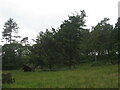
Neolithic and Bronze AgeSite Name: KillichronanCountry: Scotland County: Isle of Mull Type: Standing Stone (Menhir)
Map Ref: NM540419 Landranger Map Number: 47
Latitude: 56.504654N Longitude: 5.999331W
Condition:
| 5 | Perfect |
| 4 | Almost Perfect |
| 3 | Reasonable but with some damage |
| 2 | Ruined but still recognisable as an ancient site |
| 1 | Pretty much destroyed, possibly visible as crop marks |
| 0 | No data. |
| -1 | Completely destroyed |
| 5 | Superb |
| 4 | Good |
| 3 | Ordinary |
| 2 | Not Good |
| 1 | Awful |
| 0 | No data. |
| 5 | Can be driven to, probably with disabled access |
| 4 | Short walk on a footpath |
| 3 | Requiring a bit more of a walk |
| 2 | A long walk |
| 1 | In the middle of nowhere, a nightmare to find |
| 0 | No data. |
| 5 | co-ordinates taken by GPS or official recorded co-ordinates |
| 4 | co-ordinates scaled from a detailed map |
| 3 | co-ordinates scaled from a bad map |
| 2 | co-ordinates of the nearest village |
| 1 | co-ordinates of the nearest town |
| 0 | no data |
Be the first person to rate this site - see the 'Contribute!' box in the right hand menu.
Internal Links:
External Links:
")
Have you visited this site? Please contribute a description or any thoughts by adding a comment.
You may be viewing yesterday's version of this page. To see the most up to date information please register for a free account.
")
")
Do not use the above information on other web sites or publications without permission of the contributor.
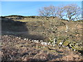
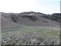
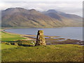
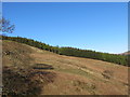
Nearby Images from Geograph Britain and Ireland:
©2017(licence)
©2017(licence)
©2009(licence)
©2017(licence)
©2021(licence)
The above images may not be of the site on this page, they are loaded from Geograph.
Please Submit an Image of this site or go out and take one for us!
Click here to see more info for this site
Nearby sites
Key: Red: member's photo, Blue: 3rd party photo, Yellow: other image, Green: no photo - please go there and take one, Grey: site destroyed
Download sites to:
KML (Google Earth)
GPX (GPS waypoints)
CSV (Garmin/Navman)
CSV (Excel)
To unlock full downloads you need to sign up as a Contributory Member. Otherwise downloads are limited to 50 sites.
![]()
Turn off the page maps and other distractions
Nearby sites listing. In the following links * = Image available
344m SSW 193° Torr Nam Fiann* Stone Fort or Dun (NM53904157)
1.1km WSW 253° Kellan Wood Stone Fort or Dun (NM52914163)
2.1km NE 44° Cnoc Na Sroine* Stone Fort or Dun (NM55534330)
2.2km S 169° Gruline 2* Standing Stone (Menhir) (NM543397)
2.4km SSE 163° Gruline 1* Standing Stone (Menhir) (NM54553959)
2.6km SSE 162° Carn Ban (Mull)* Cairn (NM54653934)
5.6km NNW 331° Ledmore Crannog (NM51514696)
5.7km NW 317° Tenga (Mull)* Stone Circle (NM50394631)
7.2km N 358° Ardnacross South* Stone Row / Alignment (NM5419049135)
7.2km N 358° Ardnacross Cairns* Cairn (NM54184914)
7.3km N 358° Ardnacross North* Stone Row / Alignment (NM5417949181)
7.5km SSW 212° Dishig* Standing Stone (Menhir) (NM49693574)
8.0km N 5° An Sean Chaisteal* Broch or Nuraghe (NM55104988)
8.3km N 4° Ardnacross Cairn* Cairn (NM55025014)
9.8km WSW 248° Meall Min Rock Art (NM447387)
9.9km W 274° Dun Choinichean Stone Fort or Dun (NM44094312)
10.7km W 274° Dun nan Gall* Broch or Nuraghe (NM43344331)
11.7km WSW 254° Ulva Standing Stone Standing Stone (Menhir) (NM42563926)
11.9km S 174° Uluvalt Standing Stones* Standing Stones (NM54633002)
11.9km S 173° Uluvalt Standing Stone* Standing Stone (Menhir) (NM54692997)
12.0km SW 234° Inch Kenneth Stone Standing Stone (Menhir) (NM4385835492)
12.7km NW 307° Torr Aint* Hillfort (NM44265005)
12.9km NNW 338° Balliscate* Stone Row / Alignment (NM49965413)
13.7km WNW 303° Torr A'chlachain, Mull Hillfort (NM42945000)
13.7km S 175° Rossal* Standing Stone (Menhir) (NM543282)
View more nearby sites and additional images


 We would like to know more about this location. Please feel free to add a brief description and any relevant information in your own language.
 Wir möchten mehr über diese Stätte erfahren. Bitte zögern Sie nicht, eine kurze Beschreibung und relevante Informationen in Deutsch hinzuzufügen.
 Nous aimerions en savoir encore un peu sur les lieux. S'il vous plaît n'hesitez pas à ajouter une courte description et tous les renseignements pertinents dans votre propre langue.
 Quisieramos informarnos un poco más de las lugares. No dude en añadir una breve descripción y otros datos relevantes en su propio idioma.