

<< Text Pages >> Vynyeck - Ancient Village or Settlement in England in Cornwall
Submitted by coldrum on Tuesday, 13 October 2009 Page Views: 6407
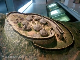
Multi-periodSite Name: VynyeckCountry: England County: Cornwall Type: Ancient Village or Settlement
Map Ref: SW412274
Latitude: 50.090207N Longitude: 5.619578W
Condition:
| 5 | Perfect |
| 4 | Almost Perfect |
| 3 | Reasonable but with some damage |
| 2 | Ruined but still recognisable as an ancient site |
| 1 | Pretty much destroyed, possibly visible as crop marks |
| 0 | No data. |
| -1 | Completely destroyed |
| 5 | Superb |
| 4 | Good |
| 3 | Ordinary |
| 2 | Not Good |
| 1 | Awful |
| 0 | No data. |
| 5 | Can be driven to, probably with disabled access |
| 4 | Short walk on a footpath |
| 3 | Requiring a bit more of a walk |
| 2 | A long walk |
| 1 | In the middle of nowhere, a nightmare to find |
| 0 | No data. |
| 5 | co-ordinates taken by GPS or official recorded co-ordinates |
| 4 | co-ordinates scaled from a detailed map |
| 3 | co-ordinates scaled from a bad map |
| 2 | co-ordinates of the nearest village |
| 1 | co-ordinates of the nearest town |
| 0 | no data |
Be the first person to rate this site - see the 'Contribute!' box in the right hand menu.
Internal Links:
External Links:
Ancient Village or Settlement in Cornwall
From Pastscape:
"An Iron Age and Roman occupation site with finds of spindle whorls, querns, whetstones and pottery and the alleged site of a fogou."
http://www.pastscape.org.uk/hob.aspx?hob_id=422441
You may be viewing yesterday's version of this page. To see the most up to date information please register for a free account.
Do not use the above information on other web sites or publications without permission of the contributor.
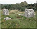
Nearby Images from Geograph Britain and Ireland:
©2024(licence)

©2008(licence)

©2024(licence)

©2013(licence)

©2016(licence)
The above images may not be of the site on this page, they are loaded from Geograph.
Please Submit an Image of this site or go out and take one for us!
Click here to see more info for this site
Nearby sites
Key: Red: member's photo, Blue: 3rd party photo, Yellow: other image, Green: no photo - please go there and take one, Grey: site destroyed
Download sites to:
KML (Google Earth)
GPX (GPS waypoints)
CSV (Garmin/Navman)
CSV (Excel)
To unlock full downloads you need to sign up as a Contributory Member. Otherwise downloads are limited to 50 sites.
Turn off the page maps and other distractions
Nearby sites listing. In the following links * = Image available
45m SSE 151° Boscawen Un* Stone Circle (SW41222736)
51m E 99° Boscawen-Un Stones* Standing Stones (SW41252739)
80m SSE 148° Boscawen-un barrows* Round Barrow(s) (SW41242733)
100m SW 214° The Money Rock* Standing Stone (Menhir) (SW41142732)
219m NW 310° Creeg Tol* Rock Outcrop (SW41042755)
223m SSE 151° Boscawen Outcrops* Rock Outcrop (SW413272)
362m NE 48° Boscawen-Un Field* Standing Stone (Menhir) (SW41482763)
500m NNW 331° Goldherring stone* Rock Outcrop (SW40982785)
549m WNW 286° Leah Well Holy Well or Sacred Spring (SW4067927578)
563m NNE 14° Goldherring 2 Burial Chamber or Dolmen (SW41362794)
617m NE 56° Boscawen-Un Hedge* Standing Stone (Menhir) (SW41732772)
705m W 275° Lower Leah Souterrain (Fogou, Earth House) (SW405275)
727m ESE 112° Chyangwens* Standing Stone (Menhir) (SW41862709)
812m NNW 344° Goldherring hut circle* Ancient Village or Settlement (SW41012819)
812m NNE 28° Trengonebris menhir* Standing Stone (Menhir) (SW4162228095)
833m N 352° Goldherring 1* Ancient Village or Settlement (SW41122823)
912m SSE 148° Pridden Standing Stone* Standing Stone (Menhir) (SW41642660)
935m SE 127° Trelew Farm Standing Stone (Menhir) (SW41922680)
992m SSE 158° Higher Trevenian Cross* Ancient Cross (SW41522646)
1.1km ESE 113° Trelew* Standing Stone (Menhir) (SW42172693)
1.2km WNW 298° Brane Longbarrow* Artificial Mound (SW402280)
1.2km W 274° Trevorgans Cross* Ancient Cross (SW39982755)
1.2km SSE 154° Higher Trevorian* Stone Circle (SW41682626)
1.3km WNW 304° Brane Entrance Grave* Chambered Tomb (SW40132819)
1.3km NNW 344° Brane Cross* Ancient Cross (SW409287)
View more nearby sites and additional images


 We would like to know more about this location. Please feel free to add a brief description and any relevant information in your own language.
 Wir möchten mehr über diese Stätte erfahren. Bitte zögern Sie nicht, eine kurze Beschreibung und relevante Informationen in Deutsch hinzuzufügen.
 Nous aimerions en savoir encore un peu sur les lieux. S'il vous plaît n'hesitez pas à ajouter une courte description et tous les renseignements pertinents dans votre propre langue.
 Quisieramos informarnos un poco más de las lugares. No dude en añadir una breve descripción y otros datos relevantes en su propio idioma.