 with our Megalithic Portal iPhone app")

<< Our Photo Pages >> Bartine Castle - Ancient Village or Settlement in England in Cornwall
Submitted by JimChampion on Thursday, 25 August 2005 Page Views: 26132
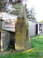
Multi-periodSite Name: Bartine Castle Alternative Name: Bartinney CastleCountry: England County: Cornwall Type: Ancient Village or Settlement
Nearest Town: St Just
Map Ref: SW39442933
Latitude: 50.106761N Longitude: 5.645448W
Condition:
| 5 | Perfect |
| 4 | Almost Perfect |
| 3 | Reasonable but with some damage |
| 2 | Ruined but still recognisable as an ancient site |
| 1 | Pretty much destroyed, possibly visible as crop marks |
| 0 | No data. |
| -1 | Completely destroyed |
| 5 | Superb |
| 4 | Good |
| 3 | Ordinary |
| 2 | Not Good |
| 1 | Awful |
| 0 | No data. |
| 5 | Can be driven to, probably with disabled access |
| 4 | Short walk on a footpath |
| 3 | Requiring a bit more of a walk |
| 2 | A long walk |
| 1 | In the middle of nowhere, a nightmare to find |
| 0 | No data. |
| 5 | co-ordinates taken by GPS or official recorded co-ordinates |
| 4 | co-ordinates scaled from a detailed map |
| 3 | co-ordinates scaled from a bad map |
| 2 | co-ordinates of the nearest village |
| 1 | co-ordinates of the nearest town |
| 0 | no data |
Internal Links:
External Links:
I have visited· I would like to visit
JimChampion has visited here
")
Access: Much of the hill is "access land", although the thick covering of gorse and the presence of old mine shafts may encourage you to stick to the pathways. The nearest convenient parking is at Chapel Carn Brea, from which a footpath runs west across Tredinney Common towards Carn Euny.
If you have any thoughts or information about this site, please leave a comment below.
You may be viewing yesterday's version of this page. To see the most up to date information please register for a free account.
")
")
")
")
")
")
")
")
")
")
")
")
")
")
")
")
")
")
")
")
")
")
")
")
")
These are just the first 25 photos of Bartine Castle. If you log in with a free user account you will be able to see our entire collection.
Do not use the above information on other web sites or publications without permission of the contributor.
Click here to see more info for this site
Nearby sites
Key: Red: member's photo, Blue: 3rd party photo, Yellow: other image, Green: no photo - please go there and take one, Grey: site destroyed
Download sites to:
KML (Google Earth)
GPX (GPS waypoints)
CSV (Garmin/Navman)
CSV (Excel)
To unlock full downloads you need to sign up as a Contributory Member. Otherwise downloads are limited to 50 sites.
Turn off the page maps and other distractions
Nearby sites listing. In the following links * = Image available
545m SSE 149° Bartine boulder cairn* Cairn (SW39702885)
628m SE 130° St Euny's Well Way Ancient Trackway (SW399289)
681m SE 126° St Euny's Well (Carn Euny)* Holy Well or Sacred Spring (SW39972890)
778m NNE 13° Leswidden stone* Ancient Cross (SW39653008)
897m SSW 191° Tredinney Cairn* Cairn (SW39222846)
905m ESE 119° Chapel Euny Well 2* Holy Well or Sacred Spring (SW40212885)
920m ESE 117° Carn Euny Fogou* Souterrain (Fogou, Earth House) (SW40242887)
941m ESE 119° Carn Euny Village* Ancient Village or Settlement (SW40242883)
1.1km E 79° Grumbla* Chambered Cairn (SW40532948)
1.2km SW 219° Chapel Carn Brea Stones* Standing Stone (Menhir) (SW38672847)
1.3km SW 221° Carn Brea Hut circles and Tumulus* Round Barrow(s) (SW3853428372)
1.3km E 100° Caer Bran Hillfort* Hillfort (SW40742903)
1.3km SE 146° Brane Entrance Grave* Chambered Tomb (SW40132819)
1.5km SW 215° Chapel Carn Brea Cairns* Barrow Cemetery (SW38522815)
1.5km W 279° Lower Numphra Tumulus* Round Barrow(s) (SW3796529644)
1.5km E 100° Caer Bran Enclosure* Ancient Village or Settlement (SW40922900)
1.5km SSW 211° Chapel Carn Brea Tomb* Chambered Tomb (SW38582807)
1.5km SSE 148° Brane Longbarrow* Artificial Mound (SW402280)
1.5km NNE 33° Botrea menhir* Modern Stone Circle etc (SW40343057)
1.6km ESE 111° Brane Cross* Ancient Cross (SW409287)
1.6km SSW 210° Chapel Carn Brea Long Cairn* Long Barrow (SW38572798)
1.7km S 174° Crows-an-Wra Cross* Ancient Cross (SW39532762)
1.8km NNE 30° Botrea Tumuli, Homstead and Hut Circle* Barrow Cemetery (SW404308)
1.9km SSE 160° Trevorgans Cross* Ancient Cross (SW39982755)
1.9km ENE 77° Sancreed Beacon homestead* Ancient Village or Settlement (SW41282965)
View more nearby sites and additional images


 We would like to know more about this location. Please feel free to add a brief description and any relevant information in your own language.
 Wir möchten mehr über diese Stätte erfahren. Bitte zögern Sie nicht, eine kurze Beschreibung und relevante Informationen in Deutsch hinzuzufügen.
 Nous aimerions en savoir encore un peu sur les lieux. S'il vous plaît n'hesitez pas à ajouter une courte description et tous les renseignements pertinents dans votre propre langue.
 Quisieramos informarnos un poco más de las lugares. No dude en añadir una breve descripción y otros datos relevantes en su propio idioma.