


<< Our Photo Pages >> Suie - Standing Stones in Scotland in Isle of Mull
Submitted by vicky on Sunday, 22 December 2002 Page Views: 5395
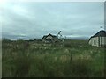
Neolithic and Bronze AgeSite Name: Suie Alternative Name: SuidheCountry: Scotland County: Isle of Mull Type: Standing Stones
Map Ref: NM37062185 Landranger Map Number: 48
Latitude: 56.315867N Longitude: 6.253663W
Condition:
| 5 | Perfect |
| 4 | Almost Perfect |
| 3 | Reasonable but with some damage |
| 2 | Ruined but still recognisable as an ancient site |
| 1 | Pretty much destroyed, possibly visible as crop marks |
| 0 | No data. |
| -1 | Completely destroyed |
| 5 | Superb |
| 4 | Good |
| 3 | Ordinary |
| 2 | Not Good |
| 1 | Awful |
| 0 | No data. |
| 5 | Can be driven to, probably with disabled access |
| 4 | Short walk on a footpath |
| 3 | Requiring a bit more of a walk |
| 2 | A long walk |
| 1 | In the middle of nowhere, a nightmare to find |
| 0 | No data. |
| 5 | co-ordinates taken by GPS or official recorded co-ordinates |
| 4 | co-ordinates scaled from a detailed map |
| 3 | co-ordinates scaled from a bad map |
| 2 | co-ordinates of the nearest village |
| 1 | co-ordinates of the nearest town |
| 0 | no data |
Internal Links:
External Links:
")
Canmore site no. 21762.
You may be viewing yesterday's version of this page. To see the most up to date information please register for a free account.
")
")
")
Do not use the above information on other web sites or publications without permission of the contributor.
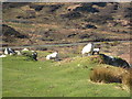
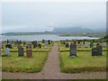
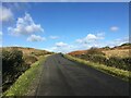
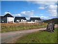
Nearby Images from Geograph Britain and Ireland:
©2015(licence)
©2006(licence)
©2023(licence)
©2015(licence)
©2021(licence)
The above images may not be of the site on this page, they are loaded from Geograph.
Please Submit an Image of this site or go out and take one for us!
Click here to see more info for this site
Nearby sites
Key: Red: member's photo, Blue: 3rd party photo, Yellow: other image, Green: no photo - please go there and take one, Grey: site destroyed
Download sites to:
KML (Google Earth)
GPX (GPS waypoints)
CSV (Garmin/Navman)
CSV (Excel)
To unlock full downloads you need to sign up as a Contributory Member. Otherwise downloads are limited to 50 sites.
Turn off the page maps and other distractions
Nearby sites listing. In the following links * = Image available
1.8km WNW 285° Tirghoil* Standing Stone (Menhir) (NM35322242)
2.7km ENE 75° Taoslin* Standing Stone (Menhir) (NM3973122388)
3.1km SE 133° Uisken.* Standing Stone (Menhir) (NM3919119632)
3.1km SSE 162° Ardalanish* Standing Stones (NM37841887)
4.5km W 271° Poit Na H-i Stone* Standing Stone (Menhir) (NM3251022174)
5.8km W 279° Loch Poit Na H-I* Crannog (NM31432313)
5.9km W 281° Achaban House* Standing Stone (Menhir) (NM31332331)
8.7km WNW 286° Cladh an Diseirt* Cairn (NM28842475)
8.8km WNW 283° Clach Braith (Iona) Natural Stone / Erratic / Other Natural Feature (NM286244)
8.8km WNW 281° St Mary's Nunnery (Iona) Ancient Cross (NM2850424110)
8.8km WNW 284° Iona Cross* Ancient Cross (NM286245)
9.3km WNW 287° Tobar nah Aois* Holy Well or Sacred Spring (NM283252)
10.1km WNW 286° Tobar na Gaoithe Tuath (Iona) Holy Well or Sacred Spring (NM275252)
10.9km W 281° Dun Cul Bhuirg (Iona)* Hillfort (NM26492462)
11.8km ENE 69° An Dun (Mull)* Stone Fort or Dun (NM484254)
15.2km NNE 23° Inch Kenneth Stone Standing Stone (Menhir) (NM4385835492)
17.4km N 7° Cragaig* Standing Stones (NM40283901)
18.2km NNE 14° Ulva Standing Stone Standing Stone (Menhir) (NM42563926)
18.2km N 356° Tigh An Duine Stone Fort or Dun (NM36944013)
18.3km ENE 66° Rossal* Standing Stone (Menhir) (NM543282)
18.5km NNE 21° Meall Min Rock Art (NM447387)
18.7km NE 39° Dishig* Standing Stone (Menhir) (NM49693574)
19.3km ENE 61° Uluvalt Standing Stones* Standing Stones (NM54633002)
19.3km ENE 62° Uluvalt Standing Stone* Standing Stone (Menhir) (NM54692997)
22.1km E 80° Tobar Chaluim Chille (Mull)* Holy Well or Sacred Spring (NM591244)
View more nearby sites and additional images


 We would like to know more about this location. Please feel free to add a brief description and any relevant information in your own language.
 Wir möchten mehr über diese Stätte erfahren. Bitte zögern Sie nicht, eine kurze Beschreibung und relevante Informationen in Deutsch hinzuzufügen.
 Nous aimerions en savoir encore un peu sur les lieux. S'il vous plaît n'hesitez pas à ajouter une courte description et tous les renseignements pertinents dans votre propre langue.
 Quisieramos informarnos un poco más de las lugares. No dude en añadir una breve descripción y otros datos relevantes en su propio idioma.