 with our Megalithic Portal iPhone app")

<< Our Photo Pages >> Sennen Hedge - Standing Stone (Menhir) in England in Cornwall
Submitted by ocifant on Wednesday, 21 April 2004 Page Views: 9731
Neolithic and Bronze AgeSite Name: Sennen HedgeCountry: England County: Cornwall Type: Standing Stone (Menhir)
Nearest Village: Sennen
Map Ref: SW355256 Landranger Map Number: 203
Latitude: 50.071543N Longitude: 5.69785W
Condition:
| 5 | Perfect |
| 4 | Almost Perfect |
| 3 | Reasonable but with some damage |
| 2 | Ruined but still recognisable as an ancient site |
| 1 | Pretty much destroyed, possibly visible as crop marks |
| 0 | No data. |
| -1 | Completely destroyed |
| 5 | Superb |
| 4 | Good |
| 3 | Ordinary |
| 2 | Not Good |
| 1 | Awful |
| 0 | No data. |
| 5 | Can be driven to, probably with disabled access |
| 4 | Short walk on a footpath |
| 3 | Requiring a bit more of a walk |
| 2 | A long walk |
| 1 | In the middle of nowhere, a nightmare to find |
| 0 | No data. |
| 5 | co-ordinates taken by GPS or official recorded co-ordinates |
| 4 | co-ordinates scaled from a detailed map |
| 3 | co-ordinates scaled from a bad map |
| 2 | co-ordinates of the nearest village |
| 1 | co-ordinates of the nearest town |
| 0 | no data |
Internal Links:
External Links:
I have visited· I would like to visit
lucasn visited on 18th Aug 2018 - their rating: Cond: 4 Amb: 4 Access: 4
Bladup AngieLake ocifant have visited here
")
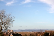
Access is via a private (unmade) road, then a farm track opposite Sennen Church (note the old cross in the churchyard). This gets you to within 100 yards or so, but the stone is best viewed from the far side of the hedge. This entails trespassing round the back of a barn to get to the far side of the hedge. The stone is built into, but rises above the level of the hedge.
Mind the foxes - I startled one when there last year!
You may be viewing yesterday's version of this page. To see the most up to date information please register for a free account.
")
")
")
")
")
")
")
")
")
")
")
")
")
")
")
")
")
Do not use the above information on other web sites or publications without permission of the contributor.
Click here to see more info for this site
Nearby sites
Key: Red: member's photo, Blue: 3rd party photo, Yellow: other image, Green: no photo - please go there and take one, Grey: site destroyed
Download sites to:
KML (Google Earth)
GPX (GPS waypoints)
CSV (Garmin/Navman)
CSV (Excel)
To unlock full downloads you need to sign up as a Contributory Member. Otherwise downloads are limited to 50 sites.
Turn off the page maps and other distractions
Nearby sites listing. In the following links * = Image available
223m ESE 114° Sennen Church* Ancient Cross (SW357255)
442m SSE 160° Trevescan Cross* Early Christian Sculptured Stone (SW3563425178)
446m ENE 61° Table Maen* Natural Stone / Erratic / Other Natural Feature (SW359258)
450m NE 37° Mayon menhir* Standing Stone (Menhir) (SW3578625948)
576m E 82° Mayon Farm Cross* Early Christian Sculptured Stone (SW3607625653)
639m NW 306° Whitesand Bay Stone Circle (SW350260)
754m W 279° Maen Castle* Promontory Fort / Cliff Castle (SW34762576)
805m WNW 299° Mayon Cliff cairn* Cairn (SW34812602)
957m E 90° Brew Cross Ancient Cross (SW36462556)
971m SSE 166° Trevilley Cross* Early Christian Sculptured Stone (SW3569524648)
1.2km NNE 27° Carn Towan Cross* Ancient Cross (SW3612626668)
1.3km WSW 249° Land’s End Iron Age Settlement* Hillfort (SW343252)
1.5km ENE 71° Trevear Sennen* Standing Stone (Menhir) (SW369260)
1.5km SSW 209° Pordenack Point* Promontory Fort / Cliff Castle (SW347243)
1.5km SSW 198° Mushroom Rock* Rock Outcrop (SW34952415)
1.6km SSW 207° Trevilley Cliff Tumuli* Barrow Cemetery (SW34682417)
1.7km NNE 21° Escalls Cliff Cairn* Cairn (SW362272)
1.9km S 171° Lower Bosistow Cliff Cave Cave or Rock Shelter (SW357237)
2.3km S 170° Higher Bosistow Cliff Tumulus* Round Barrow(s) (SW35792330)
2.4km S 174° Carn Lês Boel* Promontory Fort / Cliff Castle (SW35642323)
2.4km SSE 152° Higher Bosistow Menhir* Standing Stone (Menhir) (SW36532338)
2.5km ESE 118° Trebehor Cross* Early Christian Sculptured Stone (SW3763824319)
2.6km NE 40° Trevedra Common Tumuli Barrow Cemetery (SW37292752)
2.8km NE 36° Tregiffian Vean* Chambered Tomb (SW37252773)
3.3km N 8° Nanjulian courtyard house settlement* Ancient Village or Settlement (SW36152888)
View more nearby sites and additional images


 We would like to know more about this location. Please feel free to add a brief description and any relevant information in your own language.
 Wir möchten mehr über diese Stätte erfahren. Bitte zögern Sie nicht, eine kurze Beschreibung und relevante Informationen in Deutsch hinzuzufügen.
 Nous aimerions en savoir encore un peu sur les lieux. S'il vous plaît n'hesitez pas à ajouter une courte description et tous les renseignements pertinents dans votre propre langue.
 Quisieramos informarnos un poco más de las lugares. No dude en añadir una breve descripción y otros datos relevantes en su propio idioma.