

<< Our Photo Pages >> Port Charlotte - Chambered Cairn in Scotland in Isle of Islay
Submitted by nicoladidsbury on Sunday, 22 August 2004 Page Views: 11278
Neolithic and Bronze AgeSite Name: Port CharlotteCountry: Scotland
NOTE: This site is 6.6 km away from the location you searched for.
County: Isle of Islay Type: Chambered Cairn
Nearest Town: Bridgend Nearest Village: Port Charlotte
Map Ref: NR2482957613 Landranger Map Number: 60
Latitude: 55.733497N Longitude: 6.384965W
Condition:
| 5 | Perfect |
| 4 | Almost Perfect |
| 3 | Reasonable but with some damage |
| 2 | Ruined but still recognisable as an ancient site |
| 1 | Pretty much destroyed, possibly visible as crop marks |
| 0 | No data. |
| -1 | Completely destroyed |
| 5 | Superb |
| 4 | Good |
| 3 | Ordinary |
| 2 | Not Good |
| 1 | Awful |
| 0 | No data. |
| 5 | Can be driven to, probably with disabled access |
| 4 | Short walk on a footpath |
| 3 | Requiring a bit more of a walk |
| 2 | A long walk |
| 1 | In the middle of nowhere, a nightmare to find |
| 0 | No data. |
| 5 | co-ordinates taken by GPS or official recorded co-ordinates |
| 4 | co-ordinates scaled from a detailed map |
| 3 | co-ordinates scaled from a bad map |
| 2 | co-ordinates of the nearest village |
| 1 | co-ordinates of the nearest town |
| 0 | no data |
Internal Links:
External Links:
I have visited· I would like to visit
hidebasket visited on 13th Aug 2023 - their rating: Cond: 4 Amb: 2 Access: 3
kelpie nicoladidsbury have visited here
")
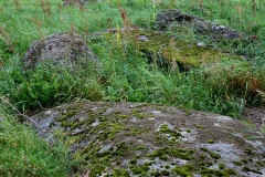
The info board reads:
Neolithic Chambered Cairn
The first people living on this site were Mesolithic hunter-gatherers who arrived soon after the ice age, 10,000 years ago. They lived by hunting deer, otters and wildfowl, by fishing and by gathering an assortment of shellfish and plant foods. Many of their temporary campsites and discarded stone tools have been discovered on Islay.
About five thousand years ago Neolithic people arrived. They herded animals and may have cultivated crops, but their settlements have not yet been discovered on Islay. We know they lived here though because they built elaborate and sophisticated monuments such as this chambered cairn in which they buried their dead.
Canmore: https://canmore.org.uk/site/37313/islay-port-charlotte
You may be viewing yesterday's version of this page. To see the most up to date information please register for a free account.
")
")
")
Do not use the above information on other web sites or publications without permission of the contributor.
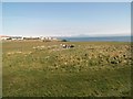
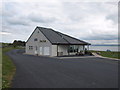
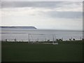
Nearby Images from Geograph Britain and Ireland:
©2011(licence)
©2010(licence)
©2008(licence)
©2013(licence)
©2013(licence)
The above images may not be of the site on this page, they are loaded from Geograph.
Please Submit an Image of this site or go out and take one for us!
Click here to see more info for this site
Nearby sites
Key: Red: member's photo, Blue: 3rd party photo, Yellow: other image, Green: no photo - please go there and take one, Grey: site destroyed
Download sites to:
KML (Google Earth)
GPX (GPS waypoints)
CSV (Garmin/Navman)
CSV (Excel)
To unlock full downloads you need to sign up as a Contributory Member. Otherwise downloads are limited to 50 sites.
Turn off the page maps and other distractions
Nearby sites listing. In the following links * = Image available
2.8km NNW 343° Cnoc Thornasaig Standing Stone (Menhir) (NR242603)
3.7km N 2° Gartacharra* Standing Stone (Menhir) (NR252613)
3.7km NW 316° Cnoc Nan Guaillean Standing Stone* Standing Stone (Menhir) (NR22406042)
3.9km WSW 248° Giant's Grave (Islay)* Chambered Cairn (NR211564)
4.2km WNW 291° Gleann Droighneach Standing Stone (Menhir) (NR21055938)
4.9km WSW 247° Lossit Burn Stone Circle (NR202560)
5.0km WNW 296° Kilchiaran cup marked stone* Rock Art (NR20436010)
5.3km W 259° Cultoon* Stone Circle (NR19565697)
7.0km NNE 14° Foreland House Standing Stone (Menhir) (NR269643)
7.3km NE 35° Uiskentuie* Standing Stone (Menhir) (NR29386336)
8.5km NE 43° Tayandock* Standing Stone (Menhir) (NR31016341)
9.2km N 5° Glacan Daraich Ancient Village or Settlement (NR262667)
9.6km N 351° Carnduncan* Cairn (NR2399867228)
10.0km NNW 340° Ballinaby* Stone Row / Alignment (NR2200167206)
11.0km NE 49° Knockdon Standing Stone (Menhir) (NR33616424)
11.5km ENE 72° Neriby (Bridgend) Standing Stone (Menhir) (NR35956053)
11.6km ENE 67° Gortanilivorrie Standing Stone (Menhir) (NR35816138)
11.6km SE 143° Dun A'chail* Stone Fort or Dun (NR31274796)
11.7km SE 139° Kintra (Islay) Standing Stone (Menhir) (NR319483)
11.7km SSE 157° Gleann Bun An Easa* Misc. Earthwork (NR2863146542)
12.1km SE 145° Coille A'chnoic Mhoir* Standing Stone (Menhir) (NR31094721)
12.3km SE 146° Frachdale* Chambered Cairn (NR31054693)
12.6km SE 137° Carragh Bhan* Standing Stone (Menhir) (NR32834781)
14.0km SE 143° Cornabus Standing Stone (Menhir) (NR32644600)
14.3km N 11° St Nem's Churchyard (Kilnave)* Ancient Cross (NR285715)
View more nearby sites and additional images


 We would like to know more about this location. Please feel free to add a brief description and any relevant information in your own language.
 Wir möchten mehr über diese Stätte erfahren. Bitte zögern Sie nicht, eine kurze Beschreibung und relevante Informationen in Deutsch hinzuzufügen.
 Nous aimerions en savoir encore un peu sur les lieux. S'il vous plaît n'hesitez pas à ajouter une courte description et tous les renseignements pertinents dans votre propre langue.
 Quisieramos informarnos un poco más de las lugares. No dude en añadir una breve descripción y otros datos relevantes en su propio idioma.