

, Aubrey Burl")
<< Text Pages >> Aird Sleitenish - Stone Circle in Scotland in Isle of Lewis
Submitted by Andy B on Monday, 11 November 2002 Page Views: 7879
Neolithic and Bronze AgeSite Name: Aird Sleitenish Alternative Name: Aird SleitinisCountry: Scotland County: Isle of Lewis Type: Stone Circle
Map Ref: NB031198 Landranger Map Number: 13
Latitude: 58.067457N Longitude: 7.036769W
Condition:
| 5 | Perfect |
| 4 | Almost Perfect |
| 3 | Reasonable but with some damage |
| 2 | Ruined but still recognisable as an ancient site |
| 1 | Pretty much destroyed, possibly visible as crop marks |
| 0 | No data. |
| -1 | Completely destroyed |
| 5 | Superb |
| 4 | Good |
| 3 | Ordinary |
| 2 | Not Good |
| 1 | Awful |
| 0 | No data. |
| 5 | Can be driven to, probably with disabled access |
| 4 | Short walk on a footpath |
| 3 | Requiring a bit more of a walk |
| 2 | A long walk |
| 1 | In the middle of nowhere, a nightmare to find |
| 0 | No data. |
| 5 | co-ordinates taken by GPS or official recorded co-ordinates |
| 4 | co-ordinates scaled from a detailed map |
| 3 | co-ordinates scaled from a bad map |
| 2 | co-ordinates of the nearest village |
| 1 | co-ordinates of the nearest town |
| 0 | no data |
Internal Links:
External Links:
Possible Stone Circle or burial cairn in Lewis
Canmore Record
Have you visited this site? Please contribute a description or any thoughts by adding a comment.
You may be viewing yesterday's version of this page. To see the most up to date information please register for a free account.
Do not use the above information on other web sites or publications without permission of the contributor.
Nearby Images from Geograph Britain and Ireland:
©2008(licence)
©2009(licence)
©2008(licence)
©2010(licence)
©2007(licence)
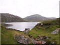
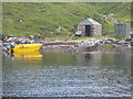
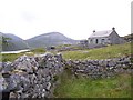
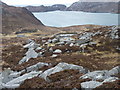
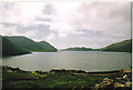
The above images may not be of the site on this page, they are loaded from Geograph.
Please Submit an Image of this site or go out and take one for us!
Click here to see more info for this site
Nearby sites
Key: Red: member's photo, Blue: 3rd party photo, Yellow: other image, Green: no photo - please go there and take one, Grey: site destroyed
Download sites to:
KML (Google Earth)
GPX (GPS waypoints)
CSV (Garmin/Navman)
CSV (Excel)
To unlock full downloads you need to sign up as a Contributory Member. Otherwise downloads are limited to 50 sites.
Turn off the page maps and other distractions
Nearby sites listing. In the following links * = Image available
6.7km S 190° Loch Crabhadail* Ancient Village or Settlement (NB01401333)
13.6km N 4° Dun Borranais* Stone Fort or Dun (NB05033326)
14.5km N 358° Loch Cleidir Crannog (NB03653437)
17.0km NNE 21° Traigh na Berie* Broch or Nuraghe (NB1035235177)
17.3km NNE 19° Traigh Na Berie Stone Row / Alignment (NB10073571)
19.1km S 181° Clach An Teampuill (Taransay)* Standing Stone (Menhir) (NB01280077)
19.5km NE 39° Callanish 8A* Standing Stone (Menhir) (NB165340)
19.6km NE 38° Callanish 8* Stone Circle (NB16423424)
19.8km NE 39° Barraglom Cup-Marked Rock Rock Art (NB167343)
19.9km NE 39° Dun Barraglom Broch or Nuraghe (NB16773435)
20.1km NE 34° Dun Baravat* Stone Fort or Dun (NB1559835563)
20.7km NE 40° Callanish 15* Standing Stone (Menhir) (NB177345)
21.9km NNE 24° Carnan Gibegeo Propped Stone CG1* Rock Outcrop (NB13653911)
22.0km NNE 24° Carnan Gibegeo Propped Stone CG2* Rock Outcrop (NB13653913)
22.2km NNE 24° Carnan Gibegeo Propped Stone CG3* Rock Outcrop (NB13833932)
22.2km NNE 24° Carnan Gibegeo Propped Stone CG4* Rock Outcrop (NB13843932)
22.3km NNE 24° Stiogha Chnap Propped Stone SC2* Rock Outcrop (NB13703947)
22.3km NNE 24° Stiogha Chnap Propped Stone SC1* Rock Outcrop (NB1371539472)
22.4km NE 50° Callanish I* Stone Circle (NB2128633009)
22.4km NE 50° Callanish* Stone Circle (NB2129833013)
22.4km ENE 60° Callanish 9* Standing Stones (NB233297)
22.5km ENE 58° Callanish 4* Stone Circle (NB2298830412)
22.5km ENE 58° Callanish 7* Ancient Mine, Quarry or other Industry (NB232302)
22.6km S 173° Clach Mhic Leoid* Standing Stone (Menhir) (NG04109718)
22.6km ENE 59° Callanish 5* Stone Row / Alignment (NB23432990)
View more nearby sites and additional images


 We would like to know more about this location. Please feel free to add a brief description and any relevant information in your own language.
 Wir möchten mehr über diese Stätte erfahren. Bitte zögern Sie nicht, eine kurze Beschreibung und relevante Informationen in Deutsch hinzuzufügen.
 Nous aimerions en savoir encore un peu sur les lieux. S'il vous plaît n'hesitez pas à ajouter une courte description et tous les renseignements pertinents dans votre propre langue.
 Quisieramos informarnos un poco más de las lugares. No dude en añadir una breve descripción y otros datos relevantes en su propio idioma.