

<< Text Pages >> Maari - Standing Stone (Menhir) in Scotland in North Uist
Submitted by vicky on Monday, 24 March 2003 Page Views: 5125
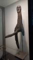
Neolithic and Bronze AgeSite Name: MaariCountry: Scotland County: North Uist Type: Standing Stone (Menhir)
Nearest Village: Trumaisgearraidh
Map Ref: NF864729 Landranger Map Number: 18
Latitude: 57.636507N Longitude: 7.256975W
Condition:
| 5 | Perfect |
| 4 | Almost Perfect |
| 3 | Reasonable but with some damage |
| 2 | Ruined but still recognisable as an ancient site |
| 1 | Pretty much destroyed, possibly visible as crop marks |
| 0 | No data. |
| -1 | Completely destroyed |
| 5 | Superb |
| 4 | Good |
| 3 | Ordinary |
| 2 | Not Good |
| 1 | Awful |
| 0 | No data. |
| 5 | Can be driven to, probably with disabled access |
| 4 | Short walk on a footpath |
| 3 | Requiring a bit more of a walk |
| 2 | A long walk |
| 1 | In the middle of nowhere, a nightmare to find |
| 0 | No data. |
| 5 | co-ordinates taken by GPS or official recorded co-ordinates |
| 4 | co-ordinates scaled from a detailed map |
| 3 | co-ordinates scaled from a bad map |
| 2 | co-ordinates of the nearest village |
| 1 | co-ordinates of the nearest town |
| 0 | no data |
Be the first person to rate this site - see the 'Contribute!' box in the right hand menu.
Internal Links:
External Links:
Rock Art in North Uist
Have you visited this site? Please add a comment below.
You may be viewing yesterday's version of this page. To see the most up to date information please register for a free account.
Do not use the above information on other web sites or publications without permission of the contributor.
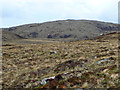
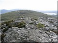
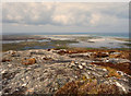
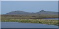
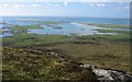
Nearby Images from Geograph Britain and Ireland:
©2012(licence)
©2008(licence)
©2012(licence)
©2008(licence)
©2005(licence)
The above images may not be of the site on this page, they are loaded from Geograph.
Please Submit an Image of this site or go out and take one for us!
Click here to see more info for this site
Nearby sites
Key: Red: member's photo, Blue: 3rd party photo, Yellow: other image, Green: no photo - please go there and take one, Grey: site destroyed
Download sites to:
KML (Google Earth)
GPX (GPS waypoints)
CSV (Garmin/Navman)
CSV (Excel)
To unlock full downloads you need to sign up as a Contributory Member. Otherwise downloads are limited to 50 sites.
Turn off the page maps and other distractions
Nearby sites listing. In the following links * = Image available
1.1km SW 215° Barpa nam Feannag* Chambered Cairn (NF85687204)
2.4km SSW 200° Skeal Traval* Stone Row / Alignment (NF8538370672)
2.6km N 357° Druim na h-Uamha earth house* Souterrain (Fogou, Earth House) (NF86457546)
2.6km ESE 112° Na Fir Bhreige* Standing Stones (NF8873671734)
2.6km ENE 67° Dun Torcuill Stone Fort or Dun (NF8888573730)
3.4km NNE 21° Dun Rosail Stone Fort or Dun (NF87837595)
4.8km WNW 291° Dun Toloman Stone Fort or Dun (NF82077492)
4.9km NNE 27° Baile Mhic' Phàil Stone Setting* Cairn (NF88937711)
5.4km NE 37° Beinn A Chaolais Stone Circle (NF900770)
5.7km NNE 31° Dun an Sticir* Broch or Nuraghe (NF897776)
6.0km WNW 287° Dun Skellor Broch or Nuraghe (NF80757507)
6.1km NNE 25° Crois Mhic Jamain* Stone Row / Alignment (NF89397820)
6.2km NNE 22° Port nan Long Souterrain (Fogou, Earth House) (NF892784)
6.4km SSW 210° Airigh Na Gaoithe Long Cairn* Long Barrow (NF82796763)
6.5km SSW 212° Airigh Na Gaoithe Stone Row* Stone Row / Alignment (NF82586767)
6.6km NW 319° Udal (Grenitote)* Ancient Village or Settlement (NF82387822)
6.7km WNW 287° Sollas, Machair Leathann Ancient Village or Settlement (NF80117533)
7.0km SE 132° Dun Leiravay Stone Fort or Dun (NF91266778)
7.3km SE 126° Taigh Chearsabhagh Museum and Arts Centre Museum (NF920681)
7.5km SSW 197° Loch 'a Bharpa Settlement Ancient Village or Settlement (NF837659)
7.6km SSW 196° Barpa Langais* Chambered Tomb (NF8376665729)
7.7km S 189° Beistean's Grave* Rock Art (NF8459865345)
7.7km S 189° Not-so-Standing Stone* Standing Stone (Menhir) (NF8459765344)
8.1km WNW 292° Leac nan Cailleacha Dubha Standing Stones (NF79087650)
8.1km S 191° Pobull Fhinn* Stone Circle (NF84286502)
View more nearby sites and additional images


 We would like to know more about this location. Please feel free to add a brief description and any relevant information in your own language.
 Wir möchten mehr über diese Stätte erfahren. Bitte zögern Sie nicht, eine kurze Beschreibung und relevante Informationen in Deutsch hinzuzufügen.
 Nous aimerions en savoir encore un peu sur les lieux. S'il vous plaît n'hesitez pas à ajouter une courte description et tous les renseignements pertinents dans votre propre langue.
 Quisieramos informarnos un poco más de las lugares. No dude en añadir una breve descripción y otros datos relevantes en su propio idioma.