 with our Megalithic Portal iPhone app")


<< Our Photo Pages >> La Roque menhir - Standing Stone (Menhir) in France in Languedoc:Hérault (34)
Submitted by TheCaptain on Thursday, 10 February 2005 Page Views: 2577
Neolithic and Bronze AgeSite Name: La Roque menhirCountry: France Département: Languedoc:Hérault (34) Type: Standing Stone (Menhir)
Nearest Town: Lodève Nearest Village: St-Pierre-de-la-Fage
Latitude: 43.790680N Longitude: 3.391100E
Condition:
| 5 | Perfect |
| 4 | Almost Perfect |
| 3 | Reasonable but with some damage |
| 2 | Ruined but still recognisable as an ancient site |
| 1 | Pretty much destroyed, possibly visible as crop marks |
| 0 | No data. |
| -1 | Completely destroyed |
| 5 | Superb |
| 4 | Good |
| 3 | Ordinary |
| 2 | Not Good |
| 1 | Awful |
| 0 | No data. |
| 5 | Can be driven to, probably with disabled access |
| 4 | Short walk on a footpath |
| 3 | Requiring a bit more of a walk |
| 2 | A long walk |
| 1 | In the middle of nowhere, a nightmare to find |
| 0 | No data. |
| 5 | co-ordinates taken by GPS or official recorded co-ordinates |
| 4 | co-ordinates scaled from a detailed map |
| 3 | co-ordinates scaled from a bad map |
| 2 | co-ordinates of the nearest village |
| 1 | co-ordinates of the nearest town |
| 0 | no data |
Be the first person to rate this site - see the 'Contribute!' box in the right hand menu.
Internal Links:
External Links:
I have visited· I would like to visit
regina has visited here
")
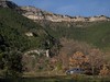
The menhir is only 1.10 metre high.
You may be viewing yesterday's version of this page. To see the most up to date information please register for a free account.
Do not use the above information on other web sites or publications without permission of the contributor.
Nearby Images from Flickr
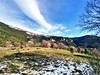
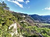

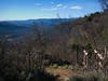
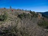
The above images may not be of the site on this page, but were taken nearby. They are loaded from Flickr so please click on them for image credits.
Click here to see more info for this site
Nearby sites
Click here to view sites on an interactive map of the areaKey: Red: member's photo, Blue: 3rd party photo, Yellow: other image, Green: no photo - please go there and take one, Grey: site destroyed
Download sites to:
KML (Google Earth)
GPX (GPS waypoints)
CSV (Garmin/Navman)
CSV (Excel)
To unlock full downloads you need to sign up as a Contributory Member. Otherwise downloads are limited to 50 sites.
Turn off the page maps and other distractions
Nearby sites listing. In the following links * = Image available
214m NNW 345° Dolmen de la Roque (17)* Burial Chamber or Dolmen
217m S 173° La Roque Dolmens* Barrow Cemetery
221m WNW 301° Dolmen de la Roque (14)* Burial Chamber or Dolmen
255m WNW 287° Dolmen de la Roque (13)* Burial Chamber or Dolmen
279m WNW 297° Dolmen de la Roque (12)* Burial Chamber or Dolmen
313m N 350° Menhir de la Roque 1* Standing Stone (Menhir)
315m NNW 341° Dolmen de la Roque (03)* Burial Chamber or Dolmen
333m NW 321° Dolmen de la Roque (16)* Burial Chamber or Dolmen
340m NW 322° Dolmen de la Roque (15)* Burial Chamber or Dolmen
355m N 354° Dolmen de la Roque (04)* Burial Chamber or Dolmen
356m WNW 284° Dolmen de la Roque (11)* Burial Chamber or Dolmen
368m N 358° Dolmen de la Roque (05)* Burial Chamber or Dolmen
401m WNW 284° Dolmen de la Roque (10)* Burial Chamber or Dolmen
454m WNW 286° Dolmen de la Roque (09)* Burial Chamber or Dolmen
488m WNW 289° Dolmen de la Roque (08)* Burial Chamber or Dolmen
508m N 2° Dolmen de la Roque (06)* Burial Chamber or Dolmen
584m NNW 339° Dolmen de la Roque (02)* Burial Chamber or Dolmen
666m NNW 336° Dolmen de la Roque (01)* Burial Chamber or Dolmen
734m NNE 19° Dolmen du Signal de la Roque 6* Burial Chamber or Dolmen
896m NNE 33° Dolmen du Signal de la Roque 7* Burial Chamber or Dolmen
914m NNE 31° Dolmen du Signal de la Roque 9* Burial Chamber or Dolmen
923m NE 45° Necropole du Signal de la Roque* Barrow Cemetery
948m NNE 33° Dolmen du Signal de la Roque 8* Burial Chamber or Dolmen
955m NNE 15° Dolmen du Signal de la Roque 3* Burial Chamber or Dolmen
1.1km NNE 18° Dolmen du Signal de la Roque 5* Burial Chamber or Dolmen
View more nearby sites and additional images


 We would like to know more about this location. Please feel free to add a brief description and any relevant information in your own language.
 Wir möchten mehr über diese Stätte erfahren. Bitte zögern Sie nicht, eine kurze Beschreibung und relevante Informationen in Deutsch hinzuzufügen.
 Nous aimerions en savoir encore un peu sur les lieux. S'il vous plaît n'hesitez pas à ajouter une courte description et tous les renseignements pertinents dans votre propre langue.
 Quisieramos informarnos un poco más de las lugares. No dude en añadir una breve descripción y otros datos relevantes en su propio idioma.