


<< Other Photo Pages >> Estaque tumulus - Chambered Cairn in France in Midi:Hautes-Pyrénées (65)
Submitted by thecaptain on Thursday, 10 February 2005 Page Views: 2866
Neolithic and Bronze AgeSite Name: Estaque tumulusCountry: France Département: Midi:Hautes-Pyrénées (65) Type: Chambered Cairn
Nearest Town: Lannemezan Nearest Village: Tilhouse
Latitude: 43.083300N Longitude: 0.352900E
Condition:
| 5 | Perfect |
| 4 | Almost Perfect |
| 3 | Reasonable but with some damage |
| 2 | Ruined but still recognisable as an ancient site |
| 1 | Pretty much destroyed, possibly visible as crop marks |
| 0 | No data. |
| -1 | Completely destroyed |
| 5 | Superb |
| 4 | Good |
| 3 | Ordinary |
| 2 | Not Good |
| 1 | Awful |
| 0 | No data. |
| 5 | Can be driven to, probably with disabled access |
| 4 | Short walk on a footpath |
| 3 | Requiring a bit more of a walk |
| 2 | A long walk |
| 1 | In the middle of nowhere, a nightmare to find |
| 0 | No data. |
| 5 | co-ordinates taken by GPS or official recorded co-ordinates |
| 4 | co-ordinates scaled from a detailed map |
| 3 | co-ordinates scaled from a bad map |
| 2 | co-ordinates of the nearest village |
| 1 | co-ordinates of the nearest town |
| 0 | no data |
Be the first person to rate this site - see the 'Contribute!' box in the right hand menu.
Internal Links:
External Links:
I have visited· I would like to visit
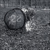
TheCaptain saw from a distance on 5th Sep 2005 To the west of the village of La Barthe-sur-Neste, and northeast of the row of tumuli along the ridgetop road, can be found the remains of the Estaque tumulus. This is a very large mound, now contained beyond the confines of a rubbish facility, and not easy to access, although it can just about be seen from the road.
There are many other Tumuli in the area.
You may be viewing yesterday's version of this page. To see the most up to date information please register for a free account.
Do not use the above information on other web sites or publications without permission of the contributor.
TheCaptain has found this location on Google Street View:
Nearby Images from Flickr
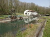


The above images may not be of the site on this page, but were taken nearby. They are loaded from Flickr so please click on them for image credits.
Click here to see more info for this site
Nearby sites
Click here to view sites on an interactive map of the areaKey: Red: member's photo, Blue: 3rd party photo, Yellow: other image, Green: no photo - please go there and take one, Grey: site destroyed
Download sites to:
KML (Google Earth)
GPX (GPS waypoints)
CSV (Garmin/Navman)
CSV (Excel)
To unlock full downloads you need to sign up as a Contributory Member. Otherwise downloads are limited to 50 sites.
Turn off the page maps and other distractions
Nearby sites listing. In the following links * = Image available
706m ESE 116° La Gare tumulus* Chambered Tomb
1.1km WNW 286° Estaque d'Avezac cinq tumuli* Chambered Tomb
1.4km WNW 289° La Croix-La Botte* Chambered Tomb
2.3km SW 214° Puyo de l'Ardoun Chambered Tomb
4.9km SSE 153° Lortet* Cave or Rock Shelter
5.0km NNE 18° Arioulès de Chourrine tumuli Chambered Tomb
5.5km S 184° Grotte de Labastide Cave or Rock Shelter
5.8km ENE 64° Puzo Pelat tumulus T1 et T2 Chambered Tomb
7.8km NNE 15° Tres Puyos tumuli Chambered Tomb
10.7km ESE 114° Dolmen de Bize Burial Chamber or Dolmen
12.0km N 349° Oppidum de Burg Hillfort
15.2km ESE 102° Grotte de Gargas* Cave or Rock Shelter
15.4km NNW 345° Oppidum Bernadets-Dessus Hillfort
15.9km ESE 104° Grotte Tibiran-Jaunac Cave or Rock Shelter
17.0km S 175° Grotte de Pereyre Cave or Rock Shelter
17.0km NE 47° Chourtigade tumulus Chambered Tomb
17.0km NE 47° Glotte tumulus Chambered Tomb
17.1km SSW 203° Le menhir de Campan Standing Stone (Menhir)
17.1km E 94° Grotte de l' Eléphant* Cave or Rock Shelter
18.8km SSW 195° Peyre Hicade de Payolle* Standing Stone (Menhir)
18.9km ESE 108° La Boudette Roman Ruins Ancient Village or Settlement
19.3km N 10° Oppidum de Libaros Hillfort
20.3km WNW 283° Oppidum Las Puyolles Hillfort
21.4km WNW 294° Le Turon de Bernac Dessus Hillfort
22.5km NW 305° Oppidum de Barbazan-Debat-Tambouré Hillfort
View more nearby sites and additional images


 We would like to know more about this location. Please feel free to add a brief description and any relevant information in your own language.
 Wir möchten mehr über diese Stätte erfahren. Bitte zögern Sie nicht, eine kurze Beschreibung und relevante Informationen in Deutsch hinzuzufügen.
 Nous aimerions en savoir encore un peu sur les lieux. S'il vous plaît n'hesitez pas à ajouter une courte description et tous les renseignements pertinents dans votre propre langue.
 Quisieramos informarnos un poco más de las lugares. No dude en añadir una breve descripción y otros datos relevantes en su propio idioma.