


<< Text Pages >> Dolmens de Kerroyal - Burial Chamber or Dolmen in France in Bretagne:Morbihan (56)
Submitted by TheCaptain on Monday, 03 January 2005 Page Views: 2571
Neolithic and Bronze AgeSite Name: Dolmens de KerroyalCountry: France Département: Bretagne:Morbihan (56) Type: Burial Chamber or Dolmen
Nearest Town: Auray Nearest Village: Plougoumelen
Latitude: 47.664908N Longitude: 2.926649W
Condition:
| 5 | Perfect |
| 4 | Almost Perfect |
| 3 | Reasonable but with some damage |
| 2 | Ruined but still recognisable as an ancient site |
| 1 | Pretty much destroyed, possibly visible as crop marks |
| 0 | No data. |
| -1 | Completely destroyed |
| 5 | Superb |
| 4 | Good |
| 3 | Ordinary |
| 2 | Not Good |
| 1 | Awful |
| 0 | No data. |
| 5 | Can be driven to, probably with disabled access |
| 4 | Short walk on a footpath |
| 3 | Requiring a bit more of a walk |
| 2 | A long walk |
| 1 | In the middle of nowhere, a nightmare to find |
| 0 | No data. |
| 5 | co-ordinates taken by GPS or official recorded co-ordinates |
| 4 | co-ordinates scaled from a detailed map |
| 3 | co-ordinates scaled from a bad map |
| 2 | co-ordinates of the nearest village |
| 1 | co-ordinates of the nearest town |
| 0 | no data |
Be the first person to rate this site - see the 'Contribute!' box in the right hand menu.
Internal Links:
External Links:
Dolmen in Morbihan
"Dolmens with corridors now partly submerged by the rising waters, but accessible at low tide. They are separated 80 meters, and one of the two has a side cabinet."
Google Translation
Location Source: T4T35.fr
You may be viewing yesterday's version of this page. To see the most up to date information please register for a free account.
Do not use the above information on other web sites or publications without permission of the contributor.
Nearby Images from Flickr
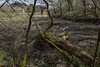
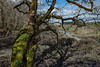
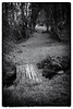
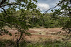
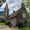
The above images may not be of the site on this page, but were taken nearby. They are loaded from Flickr so please click on them for image credits.
Click here to see more info for this site
Nearby sites
Click here to view sites on an interactive map of the areaKey: Red: member's photo, Blue: 3rd party photo, Yellow: other image, Green: no photo - please go there and take one, Grey: site destroyed
Download sites to:
KML (Google Earth)
GPX (GPS waypoints)
CSV (Garmin/Navman)
CSV (Excel)
To unlock full downloads you need to sign up as a Contributory Member. Otherwise downloads are limited to 50 sites.
Turn off the page maps and other distractions
Nearby sites listing. In the following links * = Image available
530m ENE 76° Menhir de Keroyal* Standing Stone (Menhir)
1.6km WSW 245° Dolmen de Mané-Bransquel Burial Chamber or Dolmen
2.9km NNW 328° Kervengu Dolmen* Burial Chamber or Dolmen
3.2km SSW 209° Menhir du Bono Standing Stone (Menhir)
3.3km NE 53° Megalithe de Tremodec* Standing Stones
3.6km NE 53° Dolmen De Pont-Tiret* Burial Chamber or Dolmen
4.0km SW 214° Tombelles de Kernourz * Burial Chamber or Dolmen
4.0km NE 46° Allée Couverte de Coët-Sal Passage Grave
4.1km SW 214° Tumulus du Rocher* Chambered Tomb
4.2km SSW 213° Pierre à Sacrifice du Rocher* Natural Stone / Erratic / Other Natural Feature
4.2km SSW 205° Dolmen de Kerdrec'h Burial Chamber or Dolmen
4.4km SW 219° Dolmen du Vide Bouteilles* Burial Chamber or Dolmen
4.5km S 190° Dolmen de Lanester* Burial Chamber or Dolmen
4.6km SW 227° Dolmen du Château de Rosnarho Burial Chamber or Dolmen
4.7km W 278° Menhir d'Auray Standing Stone (Menhir)
4.7km NE 48° Allée Couverte dite de Coguer Neguinan* Passage Grave
4.8km SW 220° Dolmen Vide Bouteilles II* Burial Chamber or Dolmen
5.0km SW 218° Kerentreh tumulus Chambered Tomb
5.4km SSW 197° Dolmen de Rohello* Burial Chamber or Dolmen
6.2km SSW 206° Dolmen de Kercado Burial Chamber or Dolmen
6.5km WSW 254° Menhir de Kerive Standing Stone (Menhir)
6.5km S 178° Menhir de Mériadec* Standing Stone (Menhir)
6.9km WNW 301° Kerivalan Menhir* Standing Stones
7.3km S 178° Pointe de Toulvern Dolmen* Burial Chamber or Dolmen
7.4km WSW 258° Dolmen de Kervin-Brigitte* Burial Chamber or Dolmen
View more nearby sites and additional images

")
 We would like to know more about this location. Please feel free to add a brief description and any relevant information in your own language.
 Wir möchten mehr über diese Stätte erfahren. Bitte zögern Sie nicht, eine kurze Beschreibung und relevante Informationen in Deutsch hinzuzufügen.
 Nous aimerions en savoir encore un peu sur les lieux. S'il vous plaît n'hesitez pas à ajouter une courte description et tous les renseignements pertinents dans votre propre langue.
 Quisieramos informarnos un poco más de las lugares. No dude en añadir una breve descripción y otros datos relevantes en su propio idioma.