 with our Megalithic Portal iPhone app")


<< Our Photo Pages >> Dolmen de Berder - Burial Chamber or Dolmen in France in Bretagne:Morbihan (56)
Submitted by TheCaptain on Monday, 03 January 2005 Page Views: 3811
Neolithic and Bronze AgeSite Name: Dolmen de Berder Alternative Name: Etal-Berder tumulusCountry: France Département: Bretagne:Morbihan (56) Type: Burial Chamber or Dolmen
Nearest Town: Auray Nearest Village: Larmor-Baden
Latitude: 47.576528N Longitude: 2.890694W
Condition:
| 5 | Perfect |
| 4 | Almost Perfect |
| 3 | Reasonable but with some damage |
| 2 | Ruined but still recognisable as an ancient site |
| 1 | Pretty much destroyed, possibly visible as crop marks |
| 0 | No data. |
| -1 | Completely destroyed |
| 5 | Superb |
| 4 | Good |
| 3 | Ordinary |
| 2 | Not Good |
| 1 | Awful |
| 0 | No data. |
| 5 | Can be driven to, probably with disabled access |
| 4 | Short walk on a footpath |
| 3 | Requiring a bit more of a walk |
| 2 | A long walk |
| 1 | In the middle of nowhere, a nightmare to find |
| 0 | No data. |
| 5 | co-ordinates taken by GPS or official recorded co-ordinates |
| 4 | co-ordinates scaled from a detailed map |
| 3 | co-ordinates scaled from a bad map |
| 2 | co-ordinates of the nearest village |
| 1 | co-ordinates of the nearest town |
| 0 | no data |
Be the first person to rate this site - see the 'Contribute!' box in the right hand menu.
Internal Links:
External Links:
I have visited· I would like to visit
karolus visited - their rating: Cond: 2 Amb: 4 Access: 2 The whole island has been heavily Christianized, with a chapel and something like over 20 calvaries. While there was evidence of neolithic activity, strangely more near the chapel, the rest seems to have been converted into a motley collection of benches and a bizarre grotto.
")
You may be viewing yesterday's version of this page. To see the most up to date information please register for a free account.
")
")
Do not use the above information on other web sites or publications without permission of the contributor.
Nearby Images from Flickr
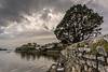
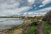
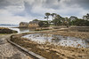
The above images may not be of the site on this page, but were taken nearby. They are loaded from Flickr so please click on them for image credits.
Click here to see more info for this site
Nearby sites
Click here to view sites on an interactive map of the areaKey: Red: member's photo, Blue: 3rd party photo, Yellow: other image, Green: no photo - please go there and take one, Grey: site destroyed
Download sites to:
KML (Google Earth)
GPX (GPS waypoints)
CSV (Garmin/Navman)
CSV (Excel)
To unlock full downloads you need to sign up as a Contributory Member. Otherwise downloads are limited to 50 sites.
Turn off the page maps and other distractions
Nearby sites listing. In the following links * = Image available
164m NNW 348° Hémicycle de Berder* Stone Circle
681m N 353° Tumulus d'Etal-Berder* Burial Chamber or Dolmen
766m NE 36° Dolmen de la Pointe de Berder* Burial Chamber or Dolmen
775m SW 228° Gavrinis Cairn* Cairn
1.0km SSW 205° Er Lannic* Stone Circle
1.6km SW 233° Île Longue tumulus* Chambered Tomb
2.4km SSW 211° Menhir de Monteno* Standing Stone (Menhir)
2.5km ESE 103° Dolmen de Pen-Hap* Burial Chamber or Dolmen
2.5km S 180° Dolmen du Grah-Niol* Burial Chamber or Dolmen
2.6km E 86° Menhir de Kerno (A) Standing Stone (Menhir)
2.7km WNW 296° Dolmens de la Presqu'île de Couédic Burial Chamber or Dolmen
2.7km E 79° Menhir de Kerno (B)* Standing Stone (Menhir)
2.7km ENE 76° Kerno Dolmen* Burial Chamber or Dolmen
2.8km SW 219° Bilgroix Point Menhir* Modern Stone Circle etc
2.8km ESE 123° Dolmens de Nioul Burial Chamber or Dolmen
2.8km E 88° Dolmen de Roh-Vras Burial Chamber or Dolmen
2.8km SW 217° Bilgroix allée couverte* Passage Grave
2.9km ENE 69° Dolmen De Kerno II* Burial Chamber or Dolmen
2.9km SSE 151° Pen Castel menhir Standing Stone (Menhir)
2.9km SE 128° Pointe de Nioul dolmen Burial Chamber or Dolmen
3.2km SW 234° Menhir de Goémorent Standing Stone (Menhir)
3.2km SSW 203° Menhir de Bourgneuf Standing Stone (Menhir)
3.3km ENE 62° Kergonan Cromlech* Stone Circle
3.4km NW 310° Dolmens de Mané-Ven-Guen* Burial Chamber or Dolmen
3.5km SW 234° Kerpenhir Menhir* Standing Stone (Menhir)
View more nearby sites and additional images


 We would like to know more about this location. Please feel free to add a brief description and any relevant information in your own language.
 Wir möchten mehr über diese Stätte erfahren. Bitte zögern Sie nicht, eine kurze Beschreibung und relevante Informationen in Deutsch hinzuzufügen.
 Nous aimerions en savoir encore un peu sur les lieux. S'il vous plaît n'hesitez pas à ajouter une courte description et tous les renseignements pertinents dans votre propre langue.
 Quisieramos informarnos un poco más de las lugares. No dude en añadir una breve descripción y otros datos relevantes en su propio idioma.