


<< Our Photo Pages >> Dolmen Jardin de la Mairie - Burial Chamber or Dolmen in France in Bretagne:Morbihan (56)
Submitted by TheCaptain on Monday, 03 January 2005 Page Views: 2507
Neolithic and Bronze AgeSite Name: Dolmen Jardin de la MairieCountry: France Département: Bretagne:Morbihan (56) Type: Burial Chamber or Dolmen
Nearest Town: Lorient Nearest Village: Guidel
Latitude: 47.789080N Longitude: 3.48911W
Condition:
| 5 | Perfect |
| 4 | Almost Perfect |
| 3 | Reasonable but with some damage |
| 2 | Ruined but still recognisable as an ancient site |
| 1 | Pretty much destroyed, possibly visible as crop marks |
| 0 | No data. |
| -1 | Completely destroyed |
| 5 | Superb |
| 4 | Good |
| 3 | Ordinary |
| 2 | Not Good |
| 1 | Awful |
| 0 | No data. |
| 5 | Can be driven to, probably with disabled access |
| 4 | Short walk on a footpath |
| 3 | Requiring a bit more of a walk |
| 2 | A long walk |
| 1 | In the middle of nowhere, a nightmare to find |
| 0 | No data. |
| 5 | co-ordinates taken by GPS or official recorded co-ordinates |
| 4 | co-ordinates scaled from a detailed map |
| 3 | co-ordinates scaled from a bad map |
| 2 | co-ordinates of the nearest village |
| 1 | co-ordinates of the nearest town |
| 0 | no data |
Internal Links:
External Links:
I have visited· I would like to visit
johnstone visited on 23rd Jun 2022 - their rating: Cond: 3 Amb: 3 Access: 5
")
Location Source: T4T35.fr
You may be viewing yesterday's version of this page. To see the most up to date information please register for a free account.
")
")
")
Do not use the above information on other web sites or publications without permission of the contributor.
Nearby Images from Flickr

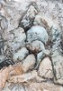


The above images may not be of the site on this page, but were taken nearby. They are loaded from Flickr so please click on them for image credits.
Click here to see more info for this site
Nearby sites
Click here to view sites on an interactive map of the areaKey: Red: member's photo, Blue: 3rd party photo, Yellow: other image, Green: no photo - please go there and take one, Grey: site destroyed
Download sites to:
KML (Google Earth)
GPX (GPS waypoints)
CSV (Garmin/Navman)
CSV (Excel)
To unlock full downloads you need to sign up as a Contributory Member. Otherwise downloads are limited to 50 sites.
Turn off the page maps and other distractions
Nearby sites listing. In the following links * = Image available
132m NE 39° Monument Commémoratif menhir Standing Stone (Menhir)
541m NE 40° Menhir de Mélézéven* Standing Stone (Menhir)
1.2km WSW 237° Menhir Saint-Fiacre Standing Stone (Menhir)
1.5km NNE 32° Menhir des Cinq Chemins* Standing Stone (Menhir)
2.2km ESE 121° Kerméné tumulus Chambered Tomb
2.5km E 83° Menhir de Kerdéhoret* Standing Stone (Menhir)
2.9km NE 34° Lesvariel Dolmen* Burial Chamber or Dolmen
3.2km SW 224° Menhir dit Er Herine* Standing Stone (Menhir)
3.4km E 80° Dolmen dit Pen Tri Mein* Burial Chamber or Dolmen
5.1km S 179° Dolmen de Locmiquel-Méné Burial Chamber or Dolmen
5.2km ENE 78° Menhir de Kerroc'h (Quéven) Standing Stone (Menhir)
5.4km W 281° Allée Couverte de Keroulic* Passage Grave
5.5km ENE 78° Le Trou des Chouans* Burial Chamber or Dolmen
5.5km S 183° Dolmen de Saint-Adrien Burial Chamber or Dolmen
5.9km S 177° Cruguellic dolmen* Burial Chamber or Dolmen
6.1km W 281° Menhir de Keroulic Standing Stone (Menhir)
6.5km ENE 78° Dolmen de Kerscant Burial Chamber or Dolmen
6.9km W 273° Menhir de Lann-Vein Standing Stone (Menhir)
7.0km E 94° Dolmen de Kerloës Burial Chamber or Dolmen
7.2km NW 309° Forêt de Carnoët 2 tumulus Chambered Tomb
7.2km NNW 328° Forêt de Carnoët 1 tumulus Chambered Tomb
7.4km NW 323° Dolmen de Toulfoën Burial Chamber or Dolmen
7.5km SE 143° Cupules de Saint-Jude Rock Art
7.8km NW 324° Pierre Redressée Standing Stone (Menhir)
7.9km S 174° Tuchenn Pol* Passage Grave
View more nearby sites and additional images


 We would like to know more about this location. Please feel free to add a brief description and any relevant information in your own language.
 Wir möchten mehr über diese Stätte erfahren. Bitte zögern Sie nicht, eine kurze Beschreibung und relevante Informationen in Deutsch hinzuzufügen.
 Nous aimerions en savoir encore un peu sur les lieux. S'il vous plaît n'hesitez pas à ajouter une courte description et tous les renseignements pertinents dans votre propre langue.
 Quisieramos informarnos un poco más de las lugares. No dude en añadir una breve descripción y otros datos relevantes en su propio idioma.