 with our Megalithic Portal iPhone app")


<< Text Pages >> Menhir de Kerhouant - Standing Stone (Menhir) in France in Bretagne:Morbihan (56)
Submitted by TheCaptain on Monday, 03 January 2005 Page Views: 2749
Neolithic and Bronze AgeSite Name: Menhir de Kerhouant Alternative Name: Kerlagad Menhir 2Country: France Département: Bretagne:Morbihan (56) Type: Standing Stone (Menhir)
Nearest Town: Carnac Nearest Village: Kerguéarec
Latitude: 47.617800N Longitude: 3.0365W
Condition:
| 5 | Perfect |
| 4 | Almost Perfect |
| 3 | Reasonable but with some damage |
| 2 | Ruined but still recognisable as an ancient site |
| 1 | Pretty much destroyed, possibly visible as crop marks |
| 0 | No data. |
| -1 | Completely destroyed |
| 5 | Superb |
| 4 | Good |
| 3 | Ordinary |
| 2 | Not Good |
| 1 | Awful |
| 0 | No data. |
| 5 | Can be driven to, probably with disabled access |
| 4 | Short walk on a footpath |
| 3 | Requiring a bit more of a walk |
| 2 | A long walk |
| 1 | In the middle of nowhere, a nightmare to find |
| 0 | No data. |
| 5 | co-ordinates taken by GPS or official recorded co-ordinates |
| 4 | co-ordinates scaled from a detailed map |
| 3 | co-ordinates scaled from a bad map |
| 2 | co-ordinates of the nearest village |
| 1 | co-ordinates of the nearest town |
| 0 | no data |
Internal Links:
External Links:
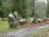
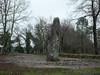
Less than 2 metre tall menhir at the edge of a wood.
Location Source: T4T35
Information and Pictures:
megalithes-breton.fr
You may be viewing yesterday's version of this page. To see the most up to date information please register for a free account.
Do not use the above information on other web sites or publications without permission of the contributor.
Nearby Images from Flickr
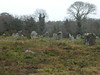
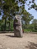
The above images may not be of the site on this page, but were taken nearby. They are loaded from Flickr so please click on them for image credits.
Click here to see more info for this site
Nearby sites
Click here to view sites on an interactive map of the areaKey: Red: member's photo, Blue: 3rd party photo, Yellow: other image, Green: no photo - please go there and take one, Grey: site destroyed
Download sites to:
KML (Google Earth)
GPX (GPS waypoints)
CSV (Garmin/Navman)
CSV (Excel)
To unlock full downloads you need to sign up as a Contributory Member. Otherwise downloads are limited to 50 sites.
Turn off the page maps and other distractions
Nearby sites listing. In the following links * = Image available
310m W 281° Menhir de Kerlagad (Carnac)* Standing Stone (Menhir)
485m SW 229° Dolmen de Mané-Roch 1* Burial Chamber or Dolmen
489m SW 229° Dolmen de Mané-Roch 2* Burial Chamber or Dolmen
534m WNW 284° Allée Couverte de Kerlagad* Passage Grave
660m SW 227° Mané-Roc'h 1* Standing Stone (Menhir)
679m E 83° Dolmen de Kerourang 3* Burial Chamber or Dolmen
688m N 9° Le Lizo Dolmen Burial Chamber or Dolmen
803m E 95° Dolmen dit Mane Roc'h en Ezel* Passage Grave
847m NNE 32° Dolmen de Mané Er Mour Burial Chamber or Dolmen
935m N 360° Dolmen de la Colline du Lizo Burial Chamber or Dolmen
952m WNW 290° Dolmen de La Madeleine (Carnac)* Burial Chamber or Dolmen
1.0km ESE 120° Luffang Allée Couverte* Passage Grave
1.1km W 269° Menhir dit Er-Roh 3* Standing Stone (Menhir)
1.1km W 265° Menhirs dits Er-Roh* Standing Stones
1.1km W 267° Dolmen dit Er-Roh* Burial Chamber or Dolmen
1.1km W 268° Dolmen du Clos Pernel* Burial Chamber or Dolmen
1.1km W 268° Menhir dit Er-Roh 2* Standing Stone (Menhir)
1.2km ENE 57° Dolmen de Kergouet* Burial Chamber or Dolmen
1.2km W 279° Dolmen de Er-Roc'h-Feutet* Burial Chamber or Dolmen
1.2km NW 315° Menhir de Gouyanzeur* Standing Stone (Menhir)
1.4km SW 216° Menhir de Kerlescan 1* Standing Stone (Menhir)
1.4km E 94° Dolmen de Kerourang 1* Burial Chamber or Dolmen
1.4km E 96° Dolmen de Kerourang 2* Burial Chamber or Dolmen
1.5km SW 218° Menhir de Kerlescan 2 Standing Stone (Menhir)
1.5km S 191° Le Petit Ménec* Multiple Stone Rows / Avenue
View more nearby sites and additional images


 We would like to know more about this location. Please feel free to add a brief description and any relevant information in your own language.
 Wir möchten mehr über diese Stätte erfahren. Bitte zögern Sie nicht, eine kurze Beschreibung und relevante Informationen in Deutsch hinzuzufügen.
 Nous aimerions en savoir encore un peu sur les lieux. S'il vous plaît n'hesitez pas à ajouter une courte description et tous les renseignements pertinents dans votre propre langue.
 Quisieramos informarnos un poco más de las lugares. No dude en añadir una breve descripción y otros datos relevantes en su propio idioma.