


<< Our Photo Pages >> Menhirs dits Er-Roh - Standing Stones in France in Bretagne:Morbihan (56)
Submitted by TheCaptain on Monday, 03 January 2005 Page Views: 4601
Neolithic and Bronze AgeSite Name: Menhirs dits Er-Roh Alternative Name: Er Roc'h Feutet menhirs, Clos Pernel (A)Country: France Département: Bretagne:Morbihan (56) Type: Standing Stones
Nearest Town: Auray Nearest Village: Carnac
Latitude: 47.616970N Longitude: 3.05171W
Condition:
| 5 | Perfect |
| 4 | Almost Perfect |
| 3 | Reasonable but with some damage |
| 2 | Ruined but still recognisable as an ancient site |
| 1 | Pretty much destroyed, possibly visible as crop marks |
| 0 | No data. |
| -1 | Completely destroyed |
| 5 | Superb |
| 4 | Good |
| 3 | Ordinary |
| 2 | Not Good |
| 1 | Awful |
| 0 | No data. |
| 5 | Can be driven to, probably with disabled access |
| 4 | Short walk on a footpath |
| 3 | Requiring a bit more of a walk |
| 2 | A long walk |
| 1 | In the middle of nowhere, a nightmare to find |
| 0 | No data. |
| 5 | co-ordinates taken by GPS or official recorded co-ordinates |
| 4 | co-ordinates scaled from a detailed map |
| 3 | co-ordinates scaled from a bad map |
| 2 | co-ordinates of the nearest village |
| 1 | co-ordinates of the nearest town |
| 0 | no data |
Internal Links:
External Links:
")
See Menhir dit Er-Roh 3, Menhir dit Er-Roh 2, Dolmen dit Er-Roh and Dolmen du Clos Pernel.
At this spot: 2 menhirs, the tall one with sharp top is about 2 m, the bulb-shaped one about 1.5 m.
You may be viewing yesterday's version of this page. To see the most up to date information please register for a free account.
")
Do not use the above information on other web sites or publications without permission of the contributor.
Nearby Images from Flickr
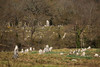
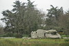
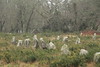
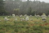
The above images may not be of the site on this page, but were taken nearby. They are loaded from Flickr so please click on them for image credits.
Click here to see more info for this site
Nearby sites
Click here to view sites on an interactive map of the areaKey: Red: member's photo, Blue: 3rd party photo, Yellow: other image, Green: no photo - please go there and take one, Grey: site destroyed
Download sites to:
KML (Google Earth)
GPX (GPS waypoints)
CSV (Garmin/Navman)
CSV (Excel)
To unlock full downloads you need to sign up as a Contributory Member. Otherwise downloads are limited to 50 sites.
Turn off the page maps and other distractions
Nearby sites listing. In the following links * = Image available
23m N 350° Dolmen dit Er-Roh* Burial Chamber or Dolmen
44m N 350° Dolmen du Clos Pernel* Burial Chamber or Dolmen
51m N 350° Menhir dit Er-Roh 2* Standing Stone (Menhir)
73m NNE 14° Menhir dit Er-Roh 3* Standing Stone (Menhir)
302m NNW 346° Dolmen de Er-Roc'h-Feutet* Burial Chamber or Dolmen
478m NNE 31° Dolmen de La Madeleine (Carnac)* Burial Chamber or Dolmen
660m ENE 70° Allée Couverte de Kerlagad* Passage Grave
753m ESE 119° Mané-Roc'h 1* Standing Stone (Menhir)
760m SSW 196° Moustoir Champ de Menhirs* Standing Stones
806m ESE 106° Dolmen de Mané-Roch 1* Burial Chamber or Dolmen
807m ESE 107° Dolmen de Mané-Roch 2* Burial Chamber or Dolmen
822m SW 231° Menhir du tumulus du Moustoir* Standing Stone (Menhir)
847m WSW 244° Moustoir-Rohec menhir* Standing Stone (Menhir)
849m E 80° Menhir de Kerlagad (Carnac)* Standing Stone (Menhir)
879m SW 230° Moustoir tumulus* Chambered Tomb
903m S 183° Menhirs de Parc er Manio Stone Row / Alignment
908m SW 232° Moustoir menhir* Standing Stone (Menhir)
1.0km W 275° Mané-Brizil Dolmen* Burial Chamber or Dolmen
1.0km NNE 15° Menhir de Gouyanzeur* Standing Stone (Menhir)
1.1km SSE 162° Menhir de Kerlescan 1* Standing Stone (Menhir)
1.1km SSE 167° Menhir de Kerlescan 2 Standing Stone (Menhir)
1.1km E 85° Menhir de Kerhouant Standing Stone (Menhir)
1.2km S 178° Kerlescan North Cromlech* Stone Circle
1.3km SSE 166° Kerlescan nord allée couverte* Passage Grave
1.3km S 178° Kerlescan Tertre and menhir* Standing Stone (Menhir)
View more nearby sites and additional images


 We would like to know more about this location. Please feel free to add a brief description and any relevant information in your own language.
 Wir möchten mehr über diese Stätte erfahren. Bitte zögern Sie nicht, eine kurze Beschreibung und relevante Informationen in Deutsch hinzuzufügen.
 Nous aimerions en savoir encore un peu sur les lieux. S'il vous plaît n'hesitez pas à ajouter une courte description et tous les renseignements pertinents dans votre propre langue.
 Quisieramos informarnos un poco más de las lugares. No dude en añadir una breve descripción y otros datos relevantes en su propio idioma.