 with our Megalithic Portal iPhone app")


<< Our Photo Pages >> Lann-er-Bein allée couverte - Passage Grave in France in Bretagne:Morbihan (56)
Submitted by TheCaptain on Monday, 03 January 2005 Page Views: 3456
Neolithic and Bronze AgeSite Name: Lann-er-Bein allée couverte Alternative Name: Lann-er-VeinnCountry: France Département: Bretagne:Morbihan (56) Type: Passage Grave
Nearest Town: Lorient Nearest Village: Camors
Latitude: 47.837970N Longitude: 2.99685W
Condition:
| 5 | Perfect |
| 4 | Almost Perfect |
| 3 | Reasonable but with some damage |
| 2 | Ruined but still recognisable as an ancient site |
| 1 | Pretty much destroyed, possibly visible as crop marks |
| 0 | No data. |
| -1 | Completely destroyed |
| 5 | Superb |
| 4 | Good |
| 3 | Ordinary |
| 2 | Not Good |
| 1 | Awful |
| 0 | No data. |
| 5 | Can be driven to, probably with disabled access |
| 4 | Short walk on a footpath |
| 3 | Requiring a bit more of a walk |
| 2 | A long walk |
| 1 | In the middle of nowhere, a nightmare to find |
| 0 | No data. |
| 5 | co-ordinates taken by GPS or official recorded co-ordinates |
| 4 | co-ordinates scaled from a detailed map |
| 3 | co-ordinates scaled from a bad map |
| 2 | co-ordinates of the nearest village |
| 1 | co-ordinates of the nearest town |
| 0 | no data |
Internal Links:
External Links:
I have visited· I would like to visit
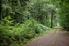
TheCaptain couldn't find on 13th Jul 2005 I had a quick look for this, now to be found somewhere in the outskirts and building land of Camors, but could see no signs or obvious place for it to be, so moved on.
Ozzie visited - their rating: Cond: 3 Amb: 3 Access: 5
Ogham have visited here
")
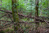
It is supposedly all much still in place, but much ruined and overgrown.
Further information from Ogham
"It can be found at the junction of the Rue des Sabotiers and Rue de l Allee Couverte. The alley is dilapidated: its supports have fallen or leaning on the inside. This monument is still engaged in his cairn. And a cover slab is still in place. Two panels from the monument are certainly leaning against the bank: they may have been displaced during the construction of the intersection where the monument lies."
You may be viewing yesterday's version of this page. To see the most up to date information please register for a free account.
")
")
")
")
Do not use the above information on other web sites or publications without permission of the contributor.
Nearby Images from Flickr
The above images may not be of the site on this page, but were taken nearby. They are loaded from Flickr so please click on them for image credits.
Click here to see more info for this site
Nearby sites
Click here to view sites on an interactive map of the areaKey: Red: member's photo, Blue: 3rd party photo, Yellow: other image, Green: no photo - please go there and take one, Grey: site destroyed
Download sites to:
KML (Google Earth)
GPX (GPS waypoints)
CSV (Garmin/Navman)
CSV (Excel)
To unlock full downloads you need to sign up as a Contributory Member. Otherwise downloads are limited to 50 sites.
Turn off the page maps and other distractions
Nearby sites listing. In the following links * = Image available
448m NNW 333° Toul Er Rest Dolmen* Burial Chamber or Dolmen
1.2km ESE 121° Pen Ganquis menhir couché Standing Stone (Menhir)
1.2km W 268° L'Etoile allée couverte* Passage Grave
1.8km NE 40° Roh-Hir Standing Stone (Menhir)
1.8km SE 141° Menhir de Kerpenru Standing Stone (Menhir)
1.9km WSW 251° Men Braz menhir* Standing Stone (Menhir)
2.0km WSW 243° Allée Couverte de Men Braz Passage Grave
2.1km W 261° Lambel Menhir* Standing Stone (Menhir)
2.2km ESE 118° L'Armoirie menhir* Standing Stone (Menhir)
2.3km WSW 249° Men-Bihan Allée Couverte* Passage Grave
2.3km WSW 248° Menhir de Men Bihan* Standing Stone (Menhir)
2.3km ENE 66° Menhir de Kergludan* Standing Stone (Menhir)
2.6km ESE 105° Kornevec Alignement* Stone Row / Alignment
3.3km E 88° Dolmen de Roh Du 3 Burial Chamber or Dolmen
3.4km ESE 114° Menhir dit la Croix Blanche (Morbihan) Standing Stone (Menhir)
3.5km WNW 289° Roh-Prioldi Allée Couverte* Passage Grave
3.8km E 88° Dolmen de Roh Du 1* Burial Chamber or Dolmen
3.9km E 85° Dolmen de Roh Du 2 Burial Chamber or Dolmen
4.5km ESE 118° Dolmen de Soucho Burial Chamber or Dolmen
4.7km NNW 339° Dolmen de Kerlatu Burial Chamber or Dolmen
6.2km W 276° Soldats-de-Saint-Cornély* Stone Row / Alignment
6.2km W 275° Dolmen de Kersolan Burial Chamber or Dolmen
6.3km W 281° Grand Resto Kersolan Alignements* Multiple Stone Rows / Avenue
6.4km WNW 289° Petit-Resto menhir* Standing Stone (Menhir)
6.9km S 189° Dolmen de Kermavon Burial Chamber or Dolmen
View more nearby sites and additional images


 We would like to know more about this location. Please feel free to add a brief description and any relevant information in your own language.
 Wir möchten mehr über diese Stätte erfahren. Bitte zögern Sie nicht, eine kurze Beschreibung und relevante Informationen in Deutsch hinzuzufügen.
 Nous aimerions en savoir encore un peu sur les lieux. S'il vous plaît n'hesitez pas à ajouter une courte description et tous les renseignements pertinents dans votre propre langue.
 Quisieramos informarnos un poco más de las lugares. No dude en añadir una breve descripción y otros datos relevantes en su propio idioma.