

, Aubrey Burl")
<< Text Pages >> Rosmeur tumulus - Chambered Tomb in France in Bretagne:Finistère (29)
Submitted by TheCaptain on Tuesday, 28 December 2004 Page Views: 2988
Neolithic and Bronze AgeSite Name: Rosmeur tumulus Alternative Name: La Grande ButteCountry: France Département: Bretagne:Finistère (29) Type: Chambered Tomb
Nearest Town: Quimper Nearest Village: Penmarc'h
Latitude: 47.824000N Longitude: 4.366W
Condition:
| 5 | Perfect |
| 4 | Almost Perfect |
| 3 | Reasonable but with some damage |
| 2 | Ruined but still recognisable as an ancient site |
| 1 | Pretty much destroyed, possibly visible as crop marks |
| 0 | No data. |
| -1 | Completely destroyed |
| 5 | Superb |
| 4 | Good |
| 3 | Ordinary |
| 2 | Not Good |
| 1 | Awful |
| 0 | No data. |
| 5 | Can be driven to, probably with disabled access |
| 4 | Short walk on a footpath |
| 3 | Requiring a bit more of a walk |
| 2 | A long walk |
| 1 | In the middle of nowhere, a nightmare to find |
| 0 | No data. |
| 5 | co-ordinates taken by GPS or official recorded co-ordinates |
| 4 | co-ordinates scaled from a detailed map |
| 3 | co-ordinates scaled from a bad map |
| 2 | co-ordinates of the nearest village |
| 1 | co-ordinates of the nearest town |
| 0 | no data |
Be the first person to rate this site - see the 'Contribute!' box in the right hand menu.
Internal Links:
External Links:
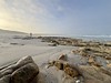
Remains of two tumulus mounds here, one which covered a single dolmen, the other which covered two complexes.
I believe that there is not much left to be seen of these monuments between the holiday homes.
IMPORTANT NOTE: Position coordinates of site unsure, believed to be near here.
You may be viewing yesterday's version of this page. To see the most up to date information please register for a free account.
Do not use the above information on other web sites or publications without permission of the contributor.
Nearby Images from Flickr
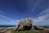
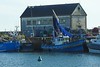

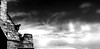
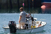
The above images may not be of the site on this page, but were taken nearby. They are loaded from Flickr so please click on them for image credits.
Click here to see more info for this site
Nearby sites
Click here to view sites on an interactive map of the areaKey: Red: member's photo, Blue: 3rd party photo, Yellow: other image, Green: no photo - please go there and take one, Grey: site destroyed
Download sites to:
KML (Google Earth)
GPX (GPS waypoints)
CSV (Garmin/Navman)
CSV (Excel)
To unlock full downloads you need to sign up as a Contributory Member. Otherwise downloads are limited to 50 sites.
Turn off the page maps and other distractions
Nearby sites listing. In the following links * = Image available
250m N 356° Dolmen de Rosmeur* Burial Chamber or Dolmen
285m NE 35° Musée Préhistorique Finistérien* Museum
301m NE 39° Run-Amor allée couverte* Passage Grave
624m ESE 114° Menhir de Kervedal* Standing Stone (Menhir)
1.0km ENE 72° Plage de Porz-Carn menhir* Standing Stone (Menhir)
1.7km NNE 33° Presqu'île de la Torche* Passage Grave
2.1km SSW 193° Chapelle Notre Dame de la Joie menhir Standing Stone (Menhir)
2.2km ENE 72° Dolmens de Kerboulen Burial Chamber or Dolmen
3.1km E 100° Menhir de Kerscaven 3 Standing Stone (Menhir)
3.2km ENE 72° Roz An Tremen Dolmen* Burial Chamber or Dolmen
3.3km ENE 67° Men Briz menhir* Standing Stone (Menhir)
3.3km E 100° Menhir de Kerscaven 1* Standing Stone (Menhir)
3.3km E 97° Menhir de Kerscaven 2* Standing Stone (Menhir)
3.4km NE 46° Carrière de Kerharo alignements* Stone Row / Alignment
3.4km E 82° Chapelle de la Madeleine alignement* Stone Row / Alignment
3.6km E 92° Gravures de Feuntenigou* Rock Art
3.7km E 101° Allée Couverte de Gouesnach Passage Grave
4.1km E 95° Menhir de Kervéen Standing Stone (Menhir)
4.1km E 88° Dolmen de Lestriguiou* Burial Chamber or Dolmen
4.6km NE 39° Chapelle Notre Dame de Tronoën Stèle* Standing Stone (Menhir)
4.6km NE 52° Lanvenaël menhir* Standing Stone (Menhir)
4.7km E 81° Allée Couverte de Menez Landu* Passage Grave
4.9km ENE 60° Kerugou dolmen* Burial Chamber or Dolmen
4.9km ESE 113° Dolmen du Poulguen* Burial Chamber or Dolmen
5.2km NE 43° Kermenhir mégalithe Standing Stone (Menhir)
View more nearby sites and additional images


 We would like to know more about this location. Please feel free to add a brief description and any relevant information in your own language.
 Wir möchten mehr über diese Stätte erfahren. Bitte zögern Sie nicht, eine kurze Beschreibung und relevante Informationen in Deutsch hinzuzufügen.
 Nous aimerions en savoir encore un peu sur les lieux. S'il vous plaît n'hesitez pas à ajouter une courte description et tous les renseignements pertinents dans votre propre langue.
 Quisieramos informarnos un poco más de las lugares. No dude en añadir una breve descripción y otros datos relevantes en su propio idioma.